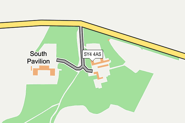
SY4 4AS is located in the Shawbury electoral ward, within the unitary authority of Shropshire and the English Parliamentary constituency of North Shropshire. The Sub Integrated Care Board (ICB) Location is NHS Shropshire, Telford and Wrekin ICB - M2L0M and the police force is West Mercia. This postcode has been in use since August 1993.


GetTheData
Source: OS OpenMap – Local (Ordnance Survey)
Source: OS VectorMap District (Ordnance Survey)
Licence: Open Government Licence (requires attribution)
| Easting | 351981 |
| Northing | 321617 |
| Latitude | 52.789990 |
| Longitude | -2.713494 |
GetTheData
Source: Open Postcode Geo
Licence: Open Government Licence
| Country | England |
| Postcode District | SY4 |
➜ See where SY4 is on a map | |
GetTheData
Source: Land Registry Price Paid Data
Licence: Open Government Licence
Elevation or altitude of SY4 4AS as distance above sea level:
| Metres | Feet | |
|---|---|---|
| Elevation | 80m | 262ft |
Elevation is measured from the approximate centre of the postcode, to the nearest point on an OS contour line from OS Terrain 50, which has contour spacing of ten vertical metres.
➜ How high above sea level am I? Find the elevation of your current position using your device's GPS.
GetTheData
Source: Open Postcode Elevation
Licence: Open Government Licence
| Ward | Shawbury |
| Constituency | North Shropshire |
GetTheData
Source: ONS Postcode Database
Licence: Open Government Licence
| Painsbrook Jct (A49) | Hadnall | 731m |
| Painsbrook Jct (A49) | Hadnall | 739m |
| Merry Lane Jct (Sansaw Road) | Sandsaw Heath | 1,037m |
| Merry Lane Jct (Sansaw Road) | Sandsaw Heath | 1,040m |
| Ladymas Road Jct (Shrewsbury Road) | Hadnall | 1,138m |
| Yorton Station | 2.6km |
GetTheData
Source: NaPTAN
Licence: Open Government Licence
GetTheData
Source: ONS Postcode Database
Licence: Open Government Licence


➜ Get more ratings from the Food Standards Agency
GetTheData
Source: Food Standards Agency
Licence: FSA terms & conditions
| Last Collection | |||
|---|---|---|---|
| Location | Mon-Fri | Sat | Distance |
| Hadnall North End | 16:00 | 10:30 | 979m |
| Hadnall Post Office | 17:15 | 11:00 | 1,712m |
| Grinshill | 16:45 | 08:15 | 1,831m |
GetTheData
Source: Dracos
Licence: Creative Commons Attribution-ShareAlike
The below table lists the International Territorial Level (ITL) codes (formerly Nomenclature of Territorial Units for Statistics (NUTS) codes) and Local Administrative Units (LAU) codes for SY4 4AS:
| ITL 1 Code | Name |
|---|---|
| TLG | West Midlands (England) |
| ITL 2 Code | Name |
| TLG2 | Shropshire and Staffordshire |
| ITL 3 Code | Name |
| TLG22 | Shropshire |
| LAU 1 Code | Name |
| E06000051 | Shropshire |
GetTheData
Source: ONS Postcode Directory
Licence: Open Government Licence
The below table lists the Census Output Area (OA), Lower Layer Super Output Area (LSOA), and Middle Layer Super Output Area (MSOA) for SY4 4AS:
| Code | Name | |
|---|---|---|
| OA | E00146995 | |
| LSOA | E01028861 | Shropshire 013A |
| MSOA | E02006022 | Shropshire 013 |
GetTheData
Source: ONS Postcode Directory
Licence: Open Government Licence
| SY4 4AT | Acton Bank | 814m |
| SY4 3JT | Sansaw Road | 932m |
| SY4 4AN | Shrewsbury Road | 978m |
| SY4 4AU | Sandy Lane | 993m |
| SY4 4BA | Painsbrook Lane | 1073m |
| SY4 3JX | Oakdene | 1257m |
| SY4 4EQ | Chapel Crescent | 1407m |
| SY4 4EH | Chapel Road | 1453m |
| SY4 3JY | Sandy Lane | 1482m |
| SY4 4AZ | Magdalene View | 1522m |
GetTheData
Source: Open Postcode Geo; Land Registry Price Paid Data
Licence: Open Government Licence