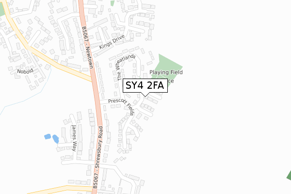
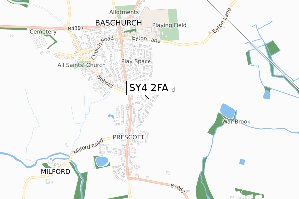
SY4 2FA is located in the Ruyton and Baschurch electoral ward, within the unitary authority of Shropshire and the English Parliamentary constituency of North Shropshire. The Sub Integrated Care Board (ICB) Location is NHS Shropshire, Telford and Wrekin ICB - M2L0M and the police force is West Mercia. This postcode has been in use since September 2017.


GetTheData
Source: OS Open Zoomstack (Ordnance Survey)
Licence: Open Government Licence (requires attribution)
Attribution: Contains OS data © Crown copyright and database right 2025
Source: Open Postcode Geo
Licence: Open Government Licence (requires attribution)
Attribution: Contains OS data © Crown copyright and database right 2025; Contains Royal Mail data © Royal Mail copyright and database right 2025; Source: Office for National Statistics licensed under the Open Government Licence v.3.0
| Easting | 342754 |
| Northing | 321581 |
| Latitude | 52.788764 |
| Longitude | -2.850297 |
GetTheData
Source: Open Postcode Geo
Licence: Open Government Licence
| Country | England |
| Postcode District | SY4 |
➜ See where SY4 is on a map | |
GetTheData
Source: Land Registry Price Paid Data
Licence: Open Government Licence
| Ward | Ruyton And Baschurch |
| Constituency | North Shropshire |
GetTheData
Source: ONS Postcode Database
Licence: Open Government Licence
| The Wheatlands Jct (Shrewsbury Road) | Baschurch | 159m |
| The Wheatlands Jct (Shrewsbury Road) | Baschurch | 174m |
| Admiral Duncan (Shrewsbury Road) | Baschurch | 444m |
| Admiral Duncan (Shrewsbury Road) | Baschurch | 487m |
| Corbet School (Eyton Lane) | Baschurch | 513m |
GetTheData
Source: NaPTAN
Licence: Open Government Licence
| Percentage of properties with Next Generation Access | 100.0% |
| Percentage of properties with Superfast Broadband | 100.0% |
| Percentage of properties with Ultrafast Broadband | 0.0% |
| Percentage of properties with Full Fibre Broadband | 0.0% |
Superfast Broadband is between 30Mbps and 300Mbps
Ultrafast Broadband is > 300Mbps
| Median download speed | 15.6Mbps |
| Average download speed | 18.3Mbps |
| Maximum download speed | 77.66Mbps |
| Median upload speed | 1.1Mbps |
| Average upload speed | 2.1Mbps |
| Maximum upload speed | 19.53Mbps |
| Percentage of properties unable to receive 2Mbps | 0.0% |
| Percentage of properties unable to receive 5Mbps | 0.0% |
| Percentage of properties unable to receive 10Mbps | 0.0% |
| Percentage of properties unable to receive 30Mbps | 0.0% |
GetTheData
Source: Ofcom
Licence: Ofcom Terms of Use (requires attribution)
GetTheData
Source: ONS Postcode Database
Licence: Open Government Licence


➜ Get more ratings from the Food Standards Agency
GetTheData
Source: Food Standards Agency
Licence: FSA terms & conditions
| Last Collection | |||
|---|---|---|---|
| Location | Mon-Fri | Sat | Distance |
| Baschurch Post Office | 16:45 | 11:45 | 622m |
| Old Woods | 11:00 | 11:00 | 2,910m |
| Walford Heath | 17:00 | 10:00 | 3,012m |
GetTheData
Source: Dracos
Licence: Creative Commons Attribution-ShareAlike
The below table lists the International Territorial Level (ITL) codes (formerly Nomenclature of Territorial Units for Statistics (NUTS) codes) and Local Administrative Units (LAU) codes for SY4 2FA:
| ITL 1 Code | Name |
|---|---|
| TLG | West Midlands (England) |
| ITL 2 Code | Name |
| TLG2 | Shropshire and Staffordshire |
| ITL 3 Code | Name |
| TLG22 | Shropshire |
| LAU 1 Code | Name |
| E06000051 | Shropshire |
GetTheData
Source: ONS Postcode Directory
Licence: Open Government Licence
The below table lists the Census Output Area (OA), Lower Layer Super Output Area (LSOA), and Middle Layer Super Output Area (MSOA) for SY4 2FA:
| Code | Name | |
|---|---|---|
| OA | E00146987 | |
| LSOA | E01028860 | Shropshire 010A |
| MSOA | E02006021 | Shropshire 010 |
GetTheData
Source: ONS Postcode Directory
Licence: Open Government Licence
| SY4 2DN | The Wheatlands | 119m |
| SY4 2DW | The Wheatlands | 119m |
| SY4 2EL | Prescott Fields | 139m |
| SY4 2DL | The Wheatlands | 166m |
| SY4 2DG | Kings Drive | 207m |
| SY4 2DP | Prescott Road | 224m |
| SY4 2DH | Jaras Drive | 251m |
| SY4 2DQ | Harefields Close | 273m |
| SY4 2DT | Badgers Way | 276m |
| SY4 2DJ | Loveridge Drive | 281m |
GetTheData
Source: Open Postcode Geo; Land Registry Price Paid Data
Licence: Open Government Licence