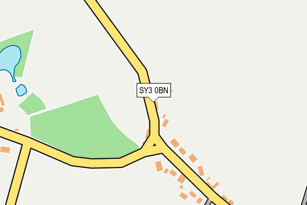
SY3 0BN lies on Yewtree Cottage in Lyth Bank, Shrewsbury. SY3 0BN is located in the Longden electoral ward, within the unitary authority of Shropshire and the English Parliamentary constituency of Shrewsbury and Atcham. The Sub Integrated Care Board (ICB) Location is NHS Shropshire, Telford and Wrekin ICB - M2L0M and the police force is West Mercia. This postcode has been in use since July 1990.


GetTheData
Source: OS OpenMap – Local (Ordnance Survey)
Source: OS VectorMap District (Ordnance Survey)
Licence: Open Government Licence (requires attribution)
| Easting | 346142 |
| Northing | 307231 |
| Latitude | 52.660125 |
| Longitude | -2.797708 |
GetTheData
Source: Open Postcode Geo
Licence: Open Government Licence
| Street | Yewtree Cottage |
| Locality | Lyth Bank |
| Town/City | Shrewsbury |
| Country | England |
| Postcode District | SY3 |
➜ See where SY3 is on a map ➜ Where is Lythbank? | |
GetTheData
Source: Land Registry Price Paid Data
Licence: Open Government Licence
Elevation or altitude of SY3 0BN as distance above sea level:
| Metres | Feet | |
|---|---|---|
| Elevation | 130m | 427ft |
Elevation is measured from the approximate centre of the postcode, to the nearest point on an OS contour line from OS Terrain 50, which has contour spacing of ten vertical metres.
➜ How high above sea level am I? Find the elevation of your current position using your device's GPS.
GetTheData
Source: Open Postcode Elevation
Licence: Open Government Licence
| Ward | Longden |
| Constituency | Shrewsbury And Atcham |
GetTheData
Source: ONS Postcode Database
Licence: Open Government Licence
| Orwell House (Main Road) | Lyth Bank | 141m |
| Green Lane Jct (Main Road) | Lyth Bank | 187m |
| Great Lyth Farm (Main Road) | Lyth Bank | 339m |
| Great Lyth Farm (Main Road) | Lyth Bank | 358m |
| Housing Estate (Main Road) | Old Coppice | 654m |
GetTheData
Source: NaPTAN
Licence: Open Government Licence
| Percentage of properties with Next Generation Access | 100.0% |
| Percentage of properties with Superfast Broadband | 0.0% |
| Percentage of properties with Ultrafast Broadband | 0.0% |
| Percentage of properties with Full Fibre Broadband | 0.0% |
Superfast Broadband is between 30Mbps and 300Mbps
Ultrafast Broadband is > 300Mbps
| Percentage of properties unable to receive 2Mbps | 0.0% |
| Percentage of properties unable to receive 5Mbps | 0.0% |
| Percentage of properties unable to receive 10Mbps | 0.0% |
| Percentage of properties unable to receive 30Mbps | 100.0% |
GetTheData
Source: Ofcom
Licence: Ofcom Terms of Use (requires attribution)
GetTheData
Source: ONS Postcode Database
Licence: Open Government Licence


➜ Get more ratings from the Food Standards Agency
GetTheData
Source: Food Standards Agency
Licence: FSA terms & conditions
| Last Collection | |||
|---|---|---|---|
| Location | Mon-Fri | Sat | Distance |
| Lyth Bank | 16:15 | 10:15 | 77m |
| Annscroft | 16:00 | 11:15 | 1,072m |
| Hemford | 16:45 | 08:45 | 1,111m |
GetTheData
Source: Dracos
Licence: Creative Commons Attribution-ShareAlike
The below table lists the International Territorial Level (ITL) codes (formerly Nomenclature of Territorial Units for Statistics (NUTS) codes) and Local Administrative Units (LAU) codes for SY3 0BN:
| ITL 1 Code | Name |
|---|---|
| TLG | West Midlands (England) |
| ITL 2 Code | Name |
| TLG2 | Shropshire and Staffordshire |
| ITL 3 Code | Name |
| TLG22 | Shropshire |
| LAU 1 Code | Name |
| E06000051 | Shropshire |
GetTheData
Source: ONS Postcode Directory
Licence: Open Government Licence
The below table lists the Census Output Area (OA), Lower Layer Super Output Area (LSOA), and Middle Layer Super Output Area (MSOA) for SY3 0BN:
| Code | Name | |
|---|---|---|
| OA | E00147448 | |
| LSOA | E01028954 | Shropshire 026A |
| MSOA | E02006039 | Shropshire 026 |
GetTheData
Source: ONS Postcode Directory
Licence: Open Government Licence
| SY3 0BE | 132m | |
| SY3 0BJ | Hawthorne Cottages | 156m |
| SY3 0BQ | Green Lane | 230m |
| SY3 0BA | 373m | |
| SY3 0BW | 392m | |
| SY3 0BP | Old Coppice | 659m |
| SY3 0BT | Lyth Hill | 855m |
| SY5 8HQ | 925m | |
| SY3 0BS | Lyth Hill | 950m |
| SY5 8AY | The Hazels | 1048m |
GetTheData
Source: Open Postcode Geo; Land Registry Price Paid Data
Licence: Open Government Licence