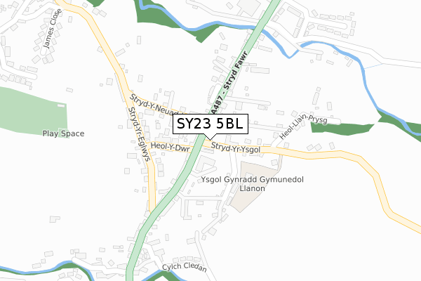
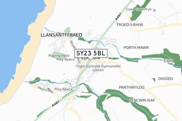
SY23 5BL is located in the Llansanffraid electoral ward, within the unitary authority of Ceredigion and the Welsh Parliamentary constituency of Ceredigion. The Local Health Board is Hywel Dda University and the police force is Dyfed-Powys. This postcode has been in use since April 2020.


GetTheData
Source: OS Open Zoomstack (Ordnance Survey)
Licence: Open Government Licence (requires attribution)
Attribution: Contains OS data © Crown copyright and database right 2024
Source: Open Postcode Geo
Licence: Open Government Licence (requires attribution)
Attribution: Contains OS data © Crown copyright and database right 2024; Contains Royal Mail data © Royal Mail copyright and database right 2024; Source: Office for National Statistics licensed under the Open Government Licence v.3.0
| Easting | 251608 |
| Northing | 267097 |
| Latitude | 52.281940 |
| Longitude | -4.176751 |
GetTheData
Source: Open Postcode Geo
Licence: Open Government Licence
| Country | Wales |
| Postcode District | SY23 |
➜ See where SY23 is on a map ➜ Where is Llanon? | |
GetTheData
Source: Land Registry Price Paid Data
Licence: Open Government Licence
| Ward | Llansanffraid |
| Constituency | Ceredigion |
GetTheData
Source: ONS Postcode Database
Licence: Open Government Licence
| Central Hotel (High Street) | Llanon | 34m |
| Central Hotel (High Street) | Llanon | 44m |
| Old Post Office (Bridge Street) | Llanon | 289m |
| Old Post Office (Bridge Street) | Llanon | 293m |
| Cylch Peris (High Street) | Llanon | 319m |
GetTheData
Source: NaPTAN
Licence: Open Government Licence
GetTheData
Source: ONS Postcode Database
Licence: Open Government Licence


➜ Get more ratings from the Food Standards Agency
GetTheData
Source: Food Standards Agency
Licence: FSA terms & conditions
| Last Collection | |||
|---|---|---|---|
| Location | Mon-Fri | Sat | Distance |
| Llanon Post Office | 16:00 | 11:00 | 41m |
| Llanon Village | 15:45 | 11:00 | 58m |
| Cylch Peris | 15:45 | 11:00 | 367m |
GetTheData
Source: Dracos
Licence: Creative Commons Attribution-ShareAlike
The below table lists the International Territorial Level (ITL) codes (formerly Nomenclature of Territorial Units for Statistics (NUTS) codes) and Local Administrative Units (LAU) codes for SY23 5BL:
| ITL 1 Code | Name |
|---|---|
| TLL | Wales |
| ITL 2 Code | Name |
| TLL1 | West Wales and The Valleys |
| ITL 3 Code | Name |
| TLL14 | South West Wales |
| LAU 1 Code | Name |
| W06000008 | Ceredigion |
GetTheData
Source: ONS Postcode Directory
Licence: Open Government Licence
The below table lists the Census Output Area (OA), Lower Layer Super Output Area (LSOA), and Middle Layer Super Output Area (MSOA) for SY23 5BL:
| Code | Name | |
|---|---|---|
| OA | W00002884 | |
| LSOA | W01000540 | Ceredigion 005E |
| MSOA | W02000120 | Ceredigion 005 |
GetTheData
Source: ONS Postcode Directory
Licence: Open Government Licence
| SY23 5HH | 14m | |
| SY23 5HG | 86m | |
| SY23 5HY | 88m | |
| SY23 5HQ | 97m | |
| SY23 5AU | Erw Non | 111m |
| SY23 5HT | 163m | |
| SY23 5HF | 168m | |
| SY23 5HE | 184m | |
| SY23 5HX | 192m | |
| SY23 5HJ | 197m |
GetTheData
Source: Open Postcode Geo; Land Registry Price Paid Data
Licence: Open Government Licence