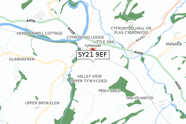
SY21 9EF is located in the Berriew and Castle Caereinion electoral ward, within the unitary authority of Powys and the Welsh Parliamentary constituency of Montgomeryshire. The Local Health Board is Powys Teaching and the police force is Dyfed-Powys. This postcode has been in use since November 2019.


GetTheData
Source: OS Open Zoomstack (Ordnance Survey)
Licence: Open Government Licence (requires attribution)
Attribution: Contains OS data © Crown copyright and database right 2025
Source: Open Postcode Geo
Licence: Open Government Licence (requires attribution)
Attribution: Contains OS data © Crown copyright and database right 2025; Contains Royal Mail data © Royal Mail copyright and database right 2025; Source: Office for National Statistics licensed under the Open Government Licence v.3.0
| Easting | 316152 |
| Northing | 305461 |
| Latitude | 52.640403 |
| Longitude | -3.240558 |
GetTheData
Source: Open Postcode Geo
Licence: Open Government Licence
| Country | Wales |
| Postcode District | SY21 |
➜ See where SY21 is on a map ➜ Where is Castle Caereinion? | |
GetTheData
Source: Land Registry Price Paid Data
Licence: Open Government Licence
| Ward | Berriew And Castle Caereinion |
| Constituency | Montgomeryshire |
GetTheData
Source: ONS Postcode Database
Licence: Open Government Licence
| Maesgarmon (The Row) | Castle Caereinion | 277m |
| Maesgarmon (The Row) | Castle Caereinion | 278m |
| Station (B4385) | Castle Caereinion | 440m |
| Castle Caereinion Station (W&llr) | Castle Caereinion | 440m |
| Sylfaen Station (W&llr) | Sylfaen | 1,751m |
GetTheData
Source: NaPTAN
Licence: Open Government Licence
| Percentage of properties with Next Generation Access | 100.0% |
| Percentage of properties with Superfast Broadband | 100.0% |
| Percentage of properties with Ultrafast Broadband | 0.0% |
| Percentage of properties with Full Fibre Broadband | 0.0% |
Superfast Broadband is between 30Mbps and 300Mbps
Ultrafast Broadband is > 300Mbps
| Percentage of properties unable to receive 2Mbps | 0.0% |
| Percentage of properties unable to receive 5Mbps | 0.0% |
| Percentage of properties unable to receive 10Mbps | 0.0% |
| Percentage of properties unable to receive 30Mbps | 0.0% |
GetTheData
Source: Ofcom
Licence: Ofcom Terms of Use (requires attribution)
GetTheData
Source: ONS Postcode Database
Licence: Open Government Licence


➜ Get more ratings from the Food Standards Agency
GetTheData
Source: Food Standards Agency
Licence: FSA terms & conditions
| Last Collection | |||
|---|---|---|---|
| Location | Mon-Fri | Sat | Distance |
| Bridge | 17:00 | 11:15 | 4,058m |
GetTheData
Source: Dracos
Licence: Creative Commons Attribution-ShareAlike
The below table lists the International Territorial Level (ITL) codes (formerly Nomenclature of Territorial Units for Statistics (NUTS) codes) and Local Administrative Units (LAU) codes for SY21 9EF:
| ITL 1 Code | Name |
|---|---|
| TLL | Wales |
| ITL 2 Code | Name |
| TLL2 | East Wales |
| ITL 3 Code | Name |
| TLL24 | Powys |
| LAU 1 Code | Name |
| W06000023 | Powys |
GetTheData
Source: ONS Postcode Directory
Licence: Open Government Licence
The below table lists the Census Output Area (OA), Lower Layer Super Output Area (LSOA), and Middle Layer Super Output Area (MSOA) for SY21 9EF:
| Code | Name | |
|---|---|---|
| OA | W00002365 | |
| LSOA | W01000444 | Powys 002A |
| MSOA | W02000098 | Powys 002 |
GetTheData
Source: ONS Postcode Directory
Licence: Open Government Licence
| SY21 9DZ | Swallows Meadow | 95m |
| SY21 9AJ | 100m | |
| SY21 9AL | 178m | |
| SY21 9BJ | Maes Castell | 269m |
| SY21 9DX | Tan Y Castell | 283m |
| SY21 9BH | Coppice Lane | 295m |
| SY21 9AN | Maesgarmon | 338m |
| SY21 9AS | 338m | |
| SY21 9BQ | Maesgarmon Close | 394m |
| SY21 9AR | Cwm Lane | 1083m |
GetTheData
Source: Open Postcode Geo; Land Registry Price Paid Data
Licence: Open Government Licence