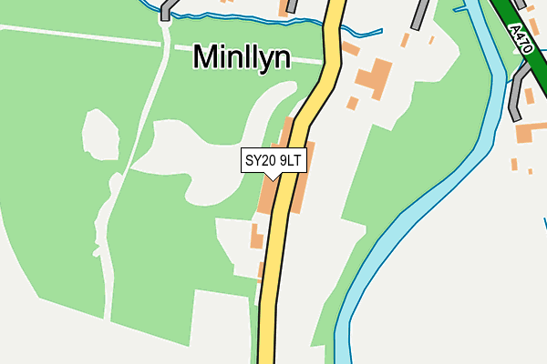
SY20 9LT is located in the Corris a Mawddwy electoral ward, within the unitary authority of Gwynedd and the Welsh Parliamentary constituency of Dwyfor Meirionnydd. The Local Health Board is Betsi Cadwaladr University and the police force is North Wales. This postcode has been in use since January 1980.


GetTheData
Source: OS OpenMap – Local (Ordnance Survey)
Source: OS VectorMap District (Ordnance Survey)
Licence: Open Government Licence (requires attribution)
| Easting | 285782 |
| Northing | 313660 |
| Latitude | 52.708514 |
| Longitude | -3.692032 |
GetTheData
Source: Open Postcode Geo
Licence: Open Government Licence
| Country | Wales |
| Postcode District | SY20 |
➜ See where SY20 is on a map ➜ Where is Minllyn? | |
GetTheData
Source: Land Registry Price Paid Data
Licence: Open Government Licence
Elevation or altitude of SY20 9LT as distance above sea level:
| Metres | Feet | |
|---|---|---|
| Elevation | 90m | 295ft |
Elevation is measured from the approximate centre of the postcode, to the nearest point on an OS contour line from OS Terrain 50, which has contour spacing of ten vertical metres.
➜ How high above sea level am I? Find the elevation of your current position using your device's GPS.
GetTheData
Source: Open Postcode Elevation
Licence: Open Government Licence
| Ward | Corris A Mawddwy |
| Constituency | Dwyfor Meirionnydd |
GetTheData
Source: ONS Postcode Database
Licence: Open Government Licence
| War Memorial (A470) | Minllyn | 422m |
| Swyddfa'r Post Office (Main Road) | Dinas Mawddwy | 1,182m |
| Post Office (Main Road) | Dinas Mawddwy | 1,186m |
| Wylecop Street (A470) | Dinas Mawddwy | 1,268m |
| Wylecop Street (A470) | Dinas Mawddwy | 1,275m |
GetTheData
Source: NaPTAN
Licence: Open Government Licence
GetTheData
Source: ONS Postcode Database
Licence: Open Government Licence


➜ Get more ratings from the Food Standards Agency
GetTheData
Source: Food Standards Agency
Licence: FSA terms & conditions
| Last Collection | |||
|---|---|---|---|
| Location | Mon-Fri | Sat | Distance |
| Minllyn | 16:00 | 11:30 | 417m |
GetTheData
Source: Dracos
Licence: Creative Commons Attribution-ShareAlike
The below table lists the International Territorial Level (ITL) codes (formerly Nomenclature of Territorial Units for Statistics (NUTS) codes) and Local Administrative Units (LAU) codes for SY20 9LT:
| ITL 1 Code | Name |
|---|---|
| TLL | Wales |
| ITL 2 Code | Name |
| TLL1 | West Wales and The Valleys |
| ITL 3 Code | Name |
| TLL12 | Gwynedd |
| LAU 1 Code | Name |
| W06000002 | Gwynedd |
GetTheData
Source: ONS Postcode Directory
Licence: Open Government Licence
The below table lists the Census Output Area (OA), Lower Layer Super Output Area (LSOA), and Middle Layer Super Output Area (MSOA) for SY20 9LT:
| Code | Name | |
|---|---|---|
| OA | W00000306 | |
| LSOA | W01000060 | Gwynedd 015B |
| MSOA | W02000024 | Gwynedd 015 |
GetTheData
Source: ONS Postcode Directory
Licence: Open Government Licence
| SY20 9LR | 120m | |
| SY20 9LU | Brook Terrace | 197m |
| SY20 9LP | 399m | |
| SY20 9LW | Mawddwy Cottages | 550m |
| SY20 9LN | 565m | |
| SY20 9LL | 1044m | |
| SY20 9JD | Wyle Cop Street | 1213m |
| SY20 9JB | Lawnt Y Plas | 1291m |
| SY20 9HJ | 1363m | |
| SY20 9JA | 1366m |
GetTheData
Source: Open Postcode Geo; Land Registry Price Paid Data
Licence: Open Government Licence