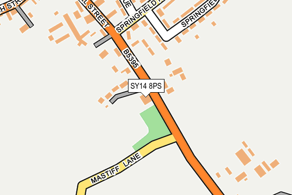
SY14 8PS is located in the Malpas electoral ward, within the unitary authority of Cheshire West and Chester and the English Parliamentary constituency of Eddisbury. The Sub Integrated Care Board (ICB) Location is NHS Cheshire and Merseyside ICB - 27D and the police force is Cheshire. This postcode has been in use since January 1980.


GetTheData
Source: OS OpenMap – Local (Ordnance Survey)
Source: OS VectorMap District (Ordnance Survey)
Licence: Open Government Licence (requires attribution)
| Easting | 348936 |
| Northing | 346967 |
| Latitude | 53.017553 |
| Longitude | -2.762638 |
GetTheData
Source: Open Postcode Geo
Licence: Open Government Licence
| Country | England |
| Postcode District | SY14 |
➜ See where SY14 is on a map ➜ Where is Malpas? | |
GetTheData
Source: Land Registry Price Paid Data
Licence: Open Government Licence
Elevation or altitude of SY14 8PS as distance above sea level:
| Metres | Feet | |
|---|---|---|
| Elevation | 100m | 328ft |
Elevation is measured from the approximate centre of the postcode, to the nearest point on an OS contour line from OS Terrain 50, which has contour spacing of ten vertical metres.
➜ How high above sea level am I? Find the elevation of your current position using your device's GPS.
GetTheData
Source: Open Postcode Elevation
Licence: Open Government Licence
| Ward | Malpas |
| Constituency | Eddisbury |
GetTheData
Source: ONS Postcode Database
Licence: Open Government Licence
| Oldhall Street (Springfield Road) | Malpas | 143m |
| Oldhall Street (Springfield Road) | Malpas | 160m |
| The Cross (High Street) | Malpas | 327m |
| Jubilee Hall (High Street) | Malpas | 392m |
| Primary School (Chester Road) | Malpas | 487m |
GetTheData
Source: NaPTAN
Licence: Open Government Licence
GetTheData
Source: ONS Postcode Database
Licence: Open Government Licence


➜ Get more ratings from the Food Standards Agency
GetTheData
Source: Food Standards Agency
Licence: FSA terms & conditions
| Last Collection | |||
|---|---|---|---|
| Location | Mon-Fri | Sat | Distance |
| Well Street | 17:15 | 10:00 | 360m |
| Malpas Post Office | 17:30 | 11:00 | 469m |
| Mercer Close | 17:15 | 11:00 | 491m |
GetTheData
Source: Dracos
Licence: Creative Commons Attribution-ShareAlike
The below table lists the International Territorial Level (ITL) codes (formerly Nomenclature of Territorial Units for Statistics (NUTS) codes) and Local Administrative Units (LAU) codes for SY14 8PS:
| ITL 1 Code | Name |
|---|---|
| TLD | North West (England) |
| ITL 2 Code | Name |
| TLD6 | Cheshire |
| ITL 3 Code | Name |
| TLD63 | Cheshire West and Chester |
| LAU 1 Code | Name |
| E06000050 | Cheshire West and Chester |
GetTheData
Source: ONS Postcode Directory
Licence: Open Government Licence
The below table lists the Census Output Area (OA), Lower Layer Super Output Area (LSOA), and Middle Layer Super Output Area (MSOA) for SY14 8PS:
| Code | Name | |
|---|---|---|
| OA | E00092598 | |
| LSOA | E01018355 | Cheshire West and Chester 047B |
| MSOA | E02003810 | Cheshire West and Chester 047 |
GetTheData
Source: ONS Postcode Directory
Licence: Open Government Licence
| SY14 8NA | The Orchards | 75m |
| SY14 8NY | Chapel Rise | 185m |
| SY14 8QB | Springfield Avenue | 205m |
| SY14 8QD | Springfield Avenue | 212m |
| SY14 8QE | Springfield Road | 216m |
| SY14 8NE | Old Hall Street | 225m |
| SY14 8QA | Well Avenue | 240m |
| SY14 8RA | St Georges Rise | 279m |
| SY14 8PB | Parbutts Lane | 287m |
| SY14 8QJ | Well Street | 308m |
GetTheData
Source: Open Postcode Geo; Land Registry Price Paid Data
Licence: Open Government Licence