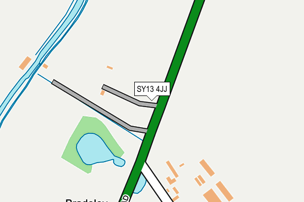
SY13 4JJ is located in the Wrenbury electoral ward, within the unitary authority of Cheshire East and the English Parliamentary constituency of Eddisbury. The Sub Integrated Care Board (ICB) Location is NHS Cheshire and Merseyside ICB - 27D and the police force is Cheshire. This postcode has been in use since April 2010.


GetTheData
Source: OS OpenMap – Local (Ordnance Survey)
Source: OS VectorMap District (Ordnance Survey)
Licence: Open Government Licence (requires attribution)
| Easting | 353596 |
| Northing | 345128 |
| Latitude | 53.001463 |
| Longitude | -2.692914 |
GetTheData
Source: Open Postcode Geo
Licence: Open Government Licence
| Country | England |
| Postcode District | SY13 |
➜ See where SY13 is on a map | |
GetTheData
Source: Land Registry Price Paid Data
Licence: Open Government Licence
Elevation or altitude of SY13 4JJ as distance above sea level:
| Metres | Feet | |
|---|---|---|
| Elevation | 80m | 262ft |
Elevation is measured from the approximate centre of the postcode, to the nearest point on an OS contour line from OS Terrain 50, which has contour spacing of ten vertical metres.
➜ How high above sea level am I? Find the elevation of your current position using your device's GPS.
GetTheData
Source: Open Postcode Elevation
Licence: Open Government Licence
| Ward | Wrenbury |
| Constituency | Eddisbury |
GetTheData
Source: ONS Postcode Database
Licence: Open Government Licence
| Bradeley Green Lane (Whitchurch Road) | Bradeley Green | 169m |
| Blue Bell Inn (Whitchurch Road) | Bell O' Th' Hill | 1,353m |
| Wirswall Hall (Wirswall Road) | Wirswall | 1,420m |
| Vicarage (Whitchurch Road) | Bell O' Th' Hill | 1,771m |
| Vicarage (Whitchurch Road) | Bell O' Th' Hill | 1,781m |
| Whitchurch (Shrops) Station | 4km |
GetTheData
Source: NaPTAN
Licence: Open Government Licence
GetTheData
Source: ONS Postcode Database
Licence: Open Government Licence


➜ Get more ratings from the Food Standards Agency
GetTheData
Source: Food Standards Agency
Licence: FSA terms & conditions
| Last Collection | |||
|---|---|---|---|
| Location | Mon-Fri | Sat | Distance |
| Brownlow Road | 17:30 | 11:15 | 3,486m |
| Gasworks | 17:30 | 11:45 | 3,523m |
| High Street | 17:45 | 11:30 | 3,554m |
GetTheData
Source: Dracos
Licence: Creative Commons Attribution-ShareAlike
The below table lists the International Territorial Level (ITL) codes (formerly Nomenclature of Territorial Units for Statistics (NUTS) codes) and Local Administrative Units (LAU) codes for SY13 4JJ:
| ITL 1 Code | Name |
|---|---|
| TLD | North West (England) |
| ITL 2 Code | Name |
| TLD6 | Cheshire |
| ITL 3 Code | Name |
| TLD62 | Cheshire East |
| LAU 1 Code | Name |
| E06000049 | Cheshire East |
GetTheData
Source: ONS Postcode Directory
Licence: Open Government Licence
The below table lists the Census Output Area (OA), Lower Layer Super Output Area (LSOA), and Middle Layer Super Output Area (MSOA) for SY13 4JJ:
| Code | Name | |
|---|---|---|
| OA | E00093421 | |
| LSOA | E01018514 | Cheshire East 051E |
| MSOA | E02003840 | Cheshire East 051 |
GetTheData
Source: ONS Postcode Directory
Licence: Open Government Licence
| SY13 4HD | Bradeley Green Lane | 272m |
| SY13 4QP | Willeymoor Lane | 662m |
| SY13 4HE | Bradeley Green Lane | 712m |
| SY13 4QR | Wobbs Lane | 1037m |
| SY13 4QN | Willeymoor Lane | 1082m |
| SY13 4HG | 1225m | |
| SY13 4LB | 1380m | |
| SY13 4LF | 1478m | |
| SY13 4LE | 1532m | |
| SY13 4QS | 1559m |
GetTheData
Source: Open Postcode Geo; Land Registry Price Paid Data
Licence: Open Government Licence