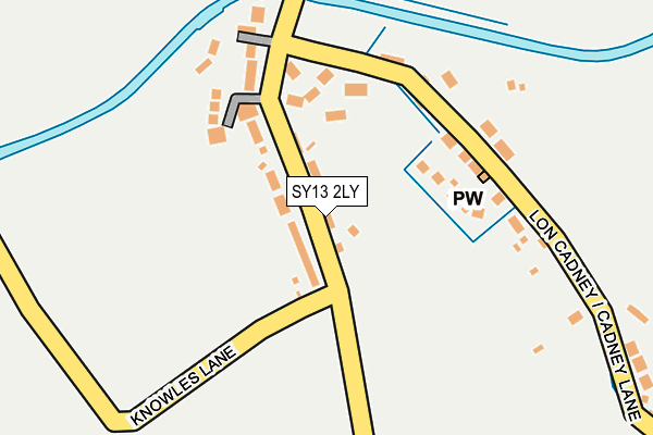
SY13 2LY is located in the Overton and Maelor South electoral ward, within the unitary authority of Wrexham and the Welsh Parliamentary constituency of Clwyd South. The Local Health Board is Betsi Cadwaladr University and the police force is North Wales. This postcode has been in use since March 2017.


GetTheData
Source: OS OpenMap – Local (Ordnance Survey)
Source: OS VectorMap District (Ordnance Survey)
Licence: Open Government Licence (requires attribution)
| Easting | 345981 |
| Northing | 335327 |
| Latitude | 52.912654 |
| Longitude | -2.804734 |
GetTheData
Source: Open Postcode Geo
Licence: Open Government Licence
| Country | Wales |
| Postcode District | SY13 |
➜ See where SY13 is on a map ➜ Where is Bettisfield? | |
GetTheData
Source: Land Registry Price Paid Data
Licence: Open Government Licence
| Ward | Overton And Maelor South |
| Constituency | Clwyd South |
GetTheData
Source: ONS Postcode Database
Licence: Open Government Licence
| Canal Bridge (B5063) | Hampton Bank | 1,270m |
| Canal Bridge (B5063) | Hampton Bank | 1,274m |
| Yew Tree (B5063) | Balmer Heath | 1,436m |
| Yew Tree (B5063) | Balmer Heath | 1,441m |
| Crossroads (Main Road) | Breadenheath | 1,496m |
GetTheData
Source: NaPTAN
Licence: Open Government Licence
| Percentage of properties with Next Generation Access | 100.0% |
| Percentage of properties with Superfast Broadband | 100.0% |
| Percentage of properties with Ultrafast Broadband | 0.0% |
| Percentage of properties with Full Fibre Broadband | 0.0% |
Superfast Broadband is between 30Mbps and 300Mbps
Ultrafast Broadband is > 300Mbps
| Percentage of properties unable to receive 2Mbps | 0.0% |
| Percentage of properties unable to receive 5Mbps | 0.0% |
| Percentage of properties unable to receive 10Mbps | 0.0% |
| Percentage of properties unable to receive 30Mbps | 0.0% |
GetTheData
Source: Ofcom
Licence: Ofcom Terms of Use (requires attribution)
GetTheData
Source: ONS Postcode Database
Licence: Open Government Licence

➜ Get more ratings from the Food Standards Agency
GetTheData
Source: Food Standards Agency
Licence: FSA terms & conditions
| Last Collection | |||
|---|---|---|---|
| Location | Mon-Fri | Sat | Distance |
| Penley Church | 17:00 | 08:15 | 6,717m |
GetTheData
Source: Dracos
Licence: Creative Commons Attribution-ShareAlike
The below table lists the International Territorial Level (ITL) codes (formerly Nomenclature of Territorial Units for Statistics (NUTS) codes) and Local Administrative Units (LAU) codes for SY13 2LY:
| ITL 1 Code | Name |
|---|---|
| TLL | Wales |
| ITL 2 Code | Name |
| TLL2 | East Wales |
| ITL 3 Code | Name |
| TLL23 | Flintshire and Wrexham |
| LAU 1 Code | Name |
| W06000006 | Wrexham |
GetTheData
Source: ONS Postcode Directory
Licence: Open Government Licence
The below table lists the Census Output Area (OA), Lower Layer Super Output Area (LSOA), and Middle Layer Super Output Area (MSOA) for SY13 2LY:
| Code | Name | |
|---|---|---|
| OA | W00002145 | |
| LSOA | W01000403 | Wrexham 018C |
| MSOA | W02000095 | Wrexham 018 |
GetTheData
Source: ONS Postcode Directory
Licence: Open Government Licence
| SY13 2LL | Cambrian View | 37m |
| SY13 2LJ | 81m | |
| SY13 2LX | Canal Paddocks | 138m |
| SY13 2LU | Chapel View | 138m |
| SY13 2LN | 199m | |
| SY13 2LW | Cadney Lane | 306m |
| SY13 2LH | Knowles Lane | 544m |
| SY13 2LP | 820m | |
| SY13 2LB | 880m | |
| SY12 0QD | Rowe Lane | 1068m |
GetTheData
Source: Open Postcode Geo; Land Registry Price Paid Data
Licence: Open Government Licence