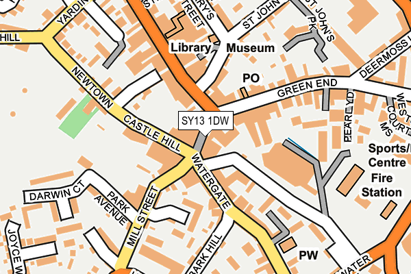
SY13 1DW is located in the Whitchurch North electoral ward, within the unitary authority of Shropshire and the English Parliamentary constituency of North Shropshire. The Sub Integrated Care Board (ICB) Location is NHS Shropshire, Telford and Wrekin ICB - M2L0M and the police force is West Mercia. This postcode has been in use since January 1980.


GetTheData
Source: OS OpenMap – Local (Ordnance Survey)
Source: OS VectorMap District (Ordnance Survey)
Licence: Open Government Licence (requires attribution)
| Easting | 354196 |
| Northing | 341468 |
| Latitude | 52.968603 |
| Longitude | -2.683455 |
GetTheData
Source: Open Postcode Geo
Licence: Open Government Licence
| Country | England |
| Postcode District | SY13 |
➜ See where SY13 is on a map ➜ Where is Whitchurch? | |
GetTheData
Source: Land Registry Price Paid Data
Licence: Open Government Licence
Elevation or altitude of SY13 1DW as distance above sea level:
| Metres | Feet | |
|---|---|---|
| Elevation | 100m | 328ft |
Elevation is measured from the approximate centre of the postcode, to the nearest point on an OS contour line from OS Terrain 50, which has contour spacing of ten vertical metres.
➜ How high above sea level am I? Find the elevation of your current position using your device's GPS.
GetTheData
Source: Open Postcode Elevation
Licence: Open Government Licence
| Ward | Whitchurch North |
| Constituency | North Shropshire |
GetTheData
Source: ONS Postcode Database
Licence: Open Government Licence
| Bulls Head Inn (Watergate) | Whitchurch | 78m |
| Bus Station (White Lion Meadow) | Whitchurch | 100m |
| St Alkmunds Church (High Street) | Whitchurch | 143m |
| The Wharfage Jct (Mill Street) | Whitchurch | 143m |
| Roman Way Jct (Yardington) | Whitchurch | 265m |
| Whitchurch (Shrops) Station | 0.8km |
GetTheData
Source: NaPTAN
Licence: Open Government Licence
Estimated total energy consumption in SY13 1DW by fuel type, 2015.
| Consumption (kWh) | 185,440 |
|---|---|
| Meter count | 7 |
| Mean (kWh/meter) | 26,491 |
| Median (kWh/meter) | 24,977 |
GetTheData
Source: Postcode level gas estimates: 2015 (experimental)
Source: Postcode level electricity estimates: 2015 (experimental)
Licence: Open Government Licence
GetTheData
Source: ONS Postcode Database
Licence: Open Government Licence


➜ Get more ratings from the Food Standards Agency
GetTheData
Source: Food Standards Agency
Licence: FSA terms & conditions
| Last Collection | |||
|---|---|---|---|
| Location | Mon-Fri | Sat | Distance |
| Bredwood Arcade | 17:30 | 11:30 | 48m |
| High Street | 17:45 | 11:30 | 158m |
| Whitchurch Delivery Office | 18:00 | 12:00 | 254m |
GetTheData
Source: Dracos
Licence: Creative Commons Attribution-ShareAlike
The below table lists the International Territorial Level (ITL) codes (formerly Nomenclature of Territorial Units for Statistics (NUTS) codes) and Local Administrative Units (LAU) codes for SY13 1DW:
| ITL 1 Code | Name |
|---|---|
| TLG | West Midlands (England) |
| ITL 2 Code | Name |
| TLG2 | Shropshire and Staffordshire |
| ITL 3 Code | Name |
| TLG22 | Shropshire |
| LAU 1 Code | Name |
| E06000051 | Shropshire |
GetTheData
Source: ONS Postcode Directory
Licence: Open Government Licence
The below table lists the Census Output Area (OA), Lower Layer Super Output Area (LSOA), and Middle Layer Super Output Area (MSOA) for SY13 1DW:
| Code | Name | |
|---|---|---|
| OA | E00147147 | |
| LSOA | E01028895 | Shropshire 001D |
| MSOA | E02006015 | Shropshire 001 |
GetTheData
Source: ONS Postcode Directory
Licence: Open Government Licence
| SY13 1AR | High Street | 52m |
| SY13 1DP | Watergate Street | 77m |
| SY13 1AU | High Street | 88m |
| SY13 1SE | Mill Street | 95m |
| SY13 1AX | High Street | 107m |
| SY13 1QU | St Marys Street | 110m |
| SY13 1BG | Pepper Street | 114m |
| SY13 1SA | The Wharfage | 125m |
| SY13 1AD | Green End | 136m |
| SY13 1GA | Mill Street | 138m |
GetTheData
Source: Open Postcode Geo; Land Registry Price Paid Data
Licence: Open Government Licence