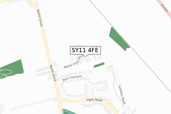
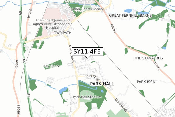
SY11 4FE is located in the Whittington electoral ward, within the unitary authority of Shropshire and the English Parliamentary constituency of North Shropshire. The Sub Integrated Care Board (ICB) Location is NHS Shropshire, Telford and Wrekin ICB - M2L0M and the police force is West Mercia. This postcode has been in use since December 2018.


GetTheData
Source: OS Open Zoomstack (Ordnance Survey)
Licence: Open Government Licence (requires attribution)
Attribution: Contains OS data © Crown copyright and database right 2024
Source: Open Postcode Geo
Licence: Open Government Licence (requires attribution)
Attribution: Contains OS data © Crown copyright and database right 2024; Contains Royal Mail data © Royal Mail copyright and database right 2024; Source: Office for National Statistics licensed under the Open Government Licence v.3.0
| Easting | 331059 |
| Northing | 331965 |
| Latitude | 52.880725 |
| Longitude | -3.025884 |
GetTheData
Source: Open Postcode Geo
Licence: Open Government Licence
| Country | England |
| Postcode District | SY11 |
➜ See where SY11 is on a map ➜ Where is Park Hall? | |
GetTheData
Source: Land Registry Price Paid Data
Licence: Open Government Licence
| Ward | Whittington |
| Constituency | North Shropshire |
GetTheData
Source: ONS Postcode Database
Licence: Open Government Licence
2024 23 FEB £405,000 |
2023 12 JAN £322,000 |
2022 15 AUG £385,877 |
2022 22 FEB £425,000 |
7, AGNES HUNT DRIVE, PARK HALL, OSWESTRY, SY11 4FE 2021 26 MAR £215,000 |
26, AGNES HUNT DRIVE, PARK HALL, OSWESTRY, SY11 4FE 2021 15 JAN £295,000 |
5, AGNES HUNT DRIVE, PARK HALL, OSWESTRY, SY11 4FE 2020 22 DEC £285,000 |
13, AGNES HUNT DRIVE, PARK HALL, OSWESTRY, SY11 4FE 2020 15 DEC £220,000 |
11, AGNES HUNT DRIVE, PARK HALL, OSWESTRY, SY11 4FE 2020 16 NOV £290,000 |
30, AGNES HUNT DRIVE, PARK HALL, OSWESTRY, SY11 4FE 2020 23 OCT £305,000 |
GetTheData
Source: HM Land Registry Price Paid Data
Licence: Contains HM Land Registry data © Crown copyright and database right 2024. This data is licensed under the Open Government Licence v3.0.
| Park Crescent Jct (Inglis Road) | Park Hall | 276m |
| Park Crescent Jct (Inglis Road) | Park Hall | 312m |
| Artillery Road Jct (Inglis Road) | Park Hall | 375m |
| Artillery Road Jct (Inglis Road) | Park Hall | 382m |
| North Lodge (North Drive) | Park Hall | 483m |
| Gobowen Station | 1.6km |
GetTheData
Source: NaPTAN
Licence: Open Government Licence
| Percentage of properties with Next Generation Access | 100.0% |
| Percentage of properties with Superfast Broadband | 100.0% |
| Percentage of properties with Ultrafast Broadband | 100.0% |
| Percentage of properties with Full Fibre Broadband | 100.0% |
Superfast Broadband is between 30Mbps and 300Mbps
Ultrafast Broadband is > 300Mbps
| Percentage of properties unable to receive 2Mbps | 0.0% |
| Percentage of properties unable to receive 5Mbps | 0.0% |
| Percentage of properties unable to receive 10Mbps | 0.0% |
| Percentage of properties unable to receive 30Mbps | 0.0% |
GetTheData
Source: Ofcom
Licence: Ofcom Terms of Use (requires attribution)
GetTheData
Source: ONS Postcode Database
Licence: Open Government Licence


➜ Get more ratings from the Food Standards Agency
GetTheData
Source: Food Standards Agency
Licence: FSA terms & conditions
| Last Collection | |||
|---|---|---|---|
| Location | Mon-Fri | Sat | Distance |
| Somerfield | 18:00 | 12:00 | 2,583m |
| Middleton Road | 17:45 | 11:30 | 2,829m |
| Beatrice Street | 18:00 | 12:00 | 2,840m |
GetTheData
Source: Dracos
Licence: Creative Commons Attribution-ShareAlike
The below table lists the International Territorial Level (ITL) codes (formerly Nomenclature of Territorial Units for Statistics (NUTS) codes) and Local Administrative Units (LAU) codes for SY11 4FE:
| ITL 1 Code | Name |
|---|---|
| TLG | West Midlands (England) |
| ITL 2 Code | Name |
| TLG2 | Shropshire and Staffordshire |
| ITL 3 Code | Name |
| TLG22 | Shropshire |
| LAU 1 Code | Name |
| E06000051 | Shropshire |
GetTheData
Source: ONS Postcode Directory
Licence: Open Government Licence
The below table lists the Census Output Area (OA), Lower Layer Super Output Area (LSOA), and Middle Layer Super Output Area (MSOA) for SY11 4FE:
| Code | Name | |
|---|---|---|
| OA | E00147294 | |
| LSOA | E01028927 | Shropshire 011D |
| MSOA | E02006026 | Shropshire 011 |
GetTheData
Source: ONS Postcode Directory
Licence: Open Government Licence
| SY11 4AR | Park Crescent | 150m |
| SY11 4AP | St Barbaras Place | 175m |
| SY11 4AL | Artillery Road | 184m |
| SY11 4AW | Larkhill Road | 216m |
| SY11 4AT | North Drive | 232m |
| SY11 4AU | North Drive Bungalows | 300m |
| SY11 4AN | Inglis Road | 317m |
| SY11 4AJ | Artillery Road | 360m |
| SY11 4QD | Park Meadow | 446m |
| SY10 7AQ | Twmpath Lane | 506m |
GetTheData
Source: Open Postcode Geo; Land Registry Price Paid Data
Licence: Open Government Licence