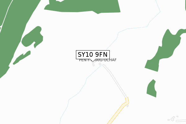
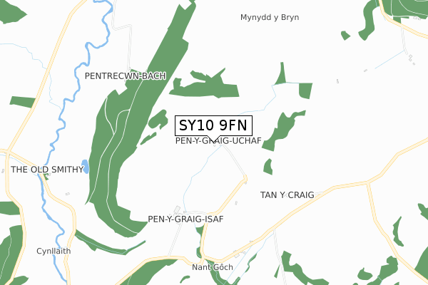
SY10 9FN is located in the Llanrhaeadr-ym-Mochnant and Llansilin electoral ward, within the unitary authority of Powys and the Welsh Parliamentary constituency of Montgomeryshire. The Local Health Board is Powys Teaching and the police force is Dyfed-Powys. This postcode has been in use since June 2018.


GetTheData
Source: OS Open Zoomstack (Ordnance Survey)
Licence: Open Government Licence (requires attribution)
Attribution: Contains OS data © Crown copyright and database right 2025
Source: Open Postcode Geo
Licence: Open Government Licence (requires attribution)
Attribution: Contains OS data © Crown copyright and database right 2025; Contains Royal Mail data © Royal Mail copyright and database right 2025; Source: Office for National Statistics licensed under the Open Government Licence v.3.0
| Easting | 321335 |
| Northing | 326107 |
| Latitude | 52.826741 |
| Longitude | -3.168934 |
GetTheData
Source: Open Postcode Geo
Licence: Open Government Licence
| Country | Wales |
| Postcode District | SY10 |
➜ See where SY10 is on a map | |
GetTheData
Source: Land Registry Price Paid Data
Licence: Open Government Licence
| Ward | Llanrhaeadr-ym-mochnant And Llansilin |
| Constituency | Montgomeryshire |
GetTheData
Source: ONS Postcode Database
Licence: Open Government Licence
| Pont Ty-newydd (Main Road) | Llansilin | 1,152m |
| Pont Ty-newydd (Main Road) | Llansilin | 1,159m |
| Sycharth (Main Road) | Sycharth | 1,270m |
| Sycharth (Main Road) | Sycharth | 1,274m |
| Quarry (Main Road) | Pwllymeirch | 1,483m |
GetTheData
Source: NaPTAN
Licence: Open Government Licence
| Percentage of properties with Next Generation Access | 100.0% |
| Percentage of properties with Superfast Broadband | 33.3% |
| Percentage of properties with Ultrafast Broadband | 33.3% |
| Percentage of properties with Full Fibre Broadband | 33.3% |
Superfast Broadband is between 30Mbps and 300Mbps
Ultrafast Broadband is > 300Mbps
| Percentage of properties unable to receive 2Mbps | 0.0% |
| Percentage of properties unable to receive 5Mbps | 0.0% |
| Percentage of properties unable to receive 10Mbps | 33.3% |
| Percentage of properties unable to receive 30Mbps | 66.7% |
GetTheData
Source: Ofcom
Licence: Ofcom Terms of Use (requires attribution)
GetTheData
Source: ONS Postcode Database
Licence: Open Government Licence
➜ Get more ratings from the Food Standards Agency
GetTheData
Source: Food Standards Agency
Licence: FSA terms & conditions
| Last Collection | |||
|---|---|---|---|
| Location | Mon-Fri | Sat | Distance |
| Wernddu | 10:00 | 10:00 | 1,823m |
| Llangedwyn Post Office | 17:00 | 11:00 | 3,507m |
| Llangadwaladr | 09:00 | 10:00 | 5,290m |
GetTheData
Source: Dracos
Licence: Creative Commons Attribution-ShareAlike
The below table lists the International Territorial Level (ITL) codes (formerly Nomenclature of Territorial Units for Statistics (NUTS) codes) and Local Administrative Units (LAU) codes for SY10 9FN:
| ITL 1 Code | Name |
|---|---|
| TLL | Wales |
| ITL 2 Code | Name |
| TLL2 | East Wales |
| ITL 3 Code | Name |
| TLL24 | Powys |
| LAU 1 Code | Name |
| W06000023 | Powys |
GetTheData
Source: ONS Postcode Directory
Licence: Open Government Licence
The below table lists the Census Output Area (OA), Lower Layer Super Output Area (LSOA), and Middle Layer Super Output Area (MSOA) for SY10 9FN:
| Code | Name | |
|---|---|---|
| OA | W00002497 | |
| LSOA | W01001907 | Powys 001G |
| MSOA | W02000097 | Powys 001 |
GetTheData
Source: ONS Postcode Directory
Licence: Open Government Licence
| SY10 7QF | 658m | |
| SY10 9BW | 1316m | |
| SY10 9BL | 1442m | |
| SY10 9BN | 1777m | |
| SY10 7QG | 1825m | |
| SY10 7QE | Maesyllan | 1865m |
| SY10 7QZ | Bryn Dentyr | 1930m |
| SY10 7QD | Bryncelyn | 1937m |
| SY10 9JY | 1952m | |
| SY10 9EF | 2064m |
GetTheData
Source: Open Postcode Geo; Land Registry Price Paid Data
Licence: Open Government Licence