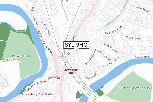
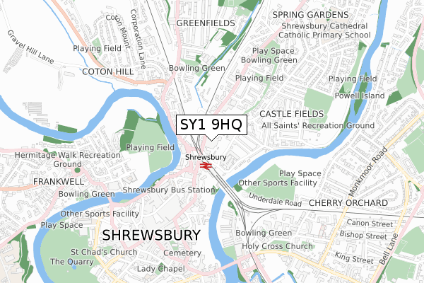
SY1 9HQ is located in the Quarry and Coton Hill electoral ward, within the unitary authority of Shropshire and the English Parliamentary constituency of Shrewsbury and Atcham. The Sub Integrated Care Board (ICB) Location is NHS Shropshire, Telford and Wrekin ICB - M2L0M and the police force is West Mercia. This postcode has been in use since August 2022.


GetTheData
Source: OS Open Zoomstack (Ordnance Survey)
Licence: Open Government Licence (requires attribution)
Attribution: Contains OS data © Crown copyright and database right 2024
Source: Open Postcode Geo
Licence: Open Government Licence (requires attribution)
Attribution: Contains OS data © Crown copyright and database right 2024; Contains Royal Mail data © Royal Mail copyright and database right 2024; Source: Office for National Statistics licensed under the Open Government Licence v.3.0
| Easting | 349490 |
| Northing | 313095 |
| Latitude | 52.713159 |
| Longitude | -2.749114 |
GetTheData
Source: Open Postcode Geo
Licence: Open Government Licence
| Country | England |
| Postcode District | SY1 |
➜ See where SY1 is on a map ➜ Where is Shrewsbury? | |
GetTheData
Source: Land Registry Price Paid Data
Licence: Open Government Licence
| Ward | Quarry And Coton Hill |
| Constituency | Shrewsbury And Atcham |
GetTheData
Source: ONS Postcode Database
Licence: Open Government Licence
| Post Office (Castle Foregate) | Shrewsbury | 60m |
| Railway Station (Castle Foregate) | Shrewsbury | 133m |
| Gasworks (Castle Foregate) | Castle Fields | 135m |
| Morris (New Park Road) | Castle Fields | 165m |
| The Gateway (Chester Street) | Shrewsbury | 168m |
| Shrewsbury Station | 0.1km |
GetTheData
Source: NaPTAN
Licence: Open Government Licence
GetTheData
Source: ONS Postcode Database
Licence: Open Government Licence


➜ Get more ratings from the Food Standards Agency
GetTheData
Source: Food Standards Agency
Licence: FSA terms & conditions
| Last Collection | |||
|---|---|---|---|
| Location | Mon-Fri | Sat | Distance |
| Castle Foregate Meter Box | 19:30 | 44m | |
| Shrewsbury Mail Centre | 19:30 | 16:00 | 44m |
| Shrewsbury Railway Station | 19:30 | 11:00 | 168m |
GetTheData
Source: Dracos
Licence: Creative Commons Attribution-ShareAlike
The below table lists the International Territorial Level (ITL) codes (formerly Nomenclature of Territorial Units for Statistics (NUTS) codes) and Local Administrative Units (LAU) codes for SY1 9HQ:
| ITL 1 Code | Name |
|---|---|
| TLG | West Midlands (England) |
| ITL 2 Code | Name |
| TLG2 | Shropshire and Staffordshire |
| ITL 3 Code | Name |
| TLG22 | Shropshire |
| LAU 1 Code | Name |
| E06000051 | Shropshire |
GetTheData
Source: ONS Postcode Directory
Licence: Open Government Licence
The below table lists the Census Output Area (OA), Lower Layer Super Output Area (LSOA), and Middle Layer Super Output Area (MSOA) for SY1 9HQ:
| Code | Name | |
|---|---|---|
| OA | E00174573 | |
| LSOA | E01028946 | Shropshire 019A |
| MSOA | E02006033 | Shropshire 019 |
GetTheData
Source: ONS Postcode Directory
Licence: Open Government Licence
| SY1 2EE | Castle Foregate | 63m |
| SY1 2EJ | Castle Foregate | 80m |
| SY1 2EH | Castle Foregate | 119m |
| SY1 2HU | Beacalls Lane | 165m |
| SY1 2DJ | Castle Foregate | 174m |
| SY1 2DS | Broome Place | 178m |
| SY1 2HT | Albert Street | 185m |
| SY1 1NX | Chester Street | 201m |
| SY1 2HP | The Dana | 211m |
| SY1 2HY | Albafont Terrace | 214m |
GetTheData
Source: Open Postcode Geo; Land Registry Price Paid Data
Licence: Open Government Licence