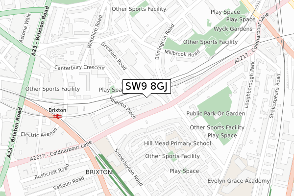
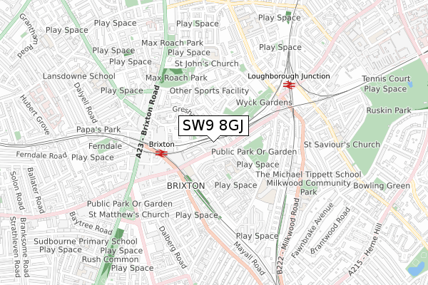
SW9 8GJ is located in the Brixton Windrush electoral ward, within the London borough of Lambeth and the English Parliamentary constituency of Dulwich and West Norwood. The Sub Integrated Care Board (ICB) Location is NHS South East London ICB - 72Q and the police force is Metropolitan Police. This postcode has been in use since September 2019.


GetTheData
Source: OS Open Zoomstack (Ordnance Survey)
Licence: Open Government Licence (requires attribution)
Attribution: Contains OS data © Crown copyright and database right 2025
Source: Open Postcode Geo
Licence: Open Government Licence (requires attribution)
Attribution: Contains OS data © Crown copyright and database right 2025; Contains Royal Mail data © Royal Mail copyright and database right 2025; Source: Office for National Statistics licensed under the Open Government Licence v.3.0
| Easting | 531481 |
| Northing | 175506 |
| Latitude | 51.463264 |
| Longitude | -0.108674 |
GetTheData
Source: Open Postcode Geo
Licence: Open Government Licence
| Country | England |
| Postcode District | SW9 |
➜ See where SW9 is on a map ➜ Where is London? | |
GetTheData
Source: Land Registry Price Paid Data
Licence: Open Government Licence
| Ward | Brixton Windrush |
| Constituency | Dulwich And West Norwood |
GetTheData
Source: ONS Postcode Database
Licence: Open Government Licence
| Brixton Station Road | Brixton | 34m |
| Brixton Station Road (Gresham Road) | Brixton | 134m |
| Moorland Road | Brixton | 139m |
| Western Road (Sw9) | Brixton | 222m |
| Somerleyton Rd Coldharbour Ln (Somerleyton Road) | Brixton | 242m |
| Brixton Underground Station | Brixton | 436m |
| Stockwell Underground Station | Stockwell | 1,387m |
| Clapham North Underground Station | Clapham | 1,496m |
| Brixton Station | 0.4km |
| Loughborough Junction Station | 0.6km |
| Herne Hill Station | 1.2km |
GetTheData
Source: NaPTAN
Licence: Open Government Licence
GetTheData
Source: ONS Postcode Database
Licence: Open Government Licence


➜ Get more ratings from the Food Standards Agency
GetTheData
Source: Food Standards Agency
Licence: FSA terms & conditions
| Last Collection | |||
|---|---|---|---|
| Location | Mon-Fri | Sat | Distance |
| 332 Coldharbour Lane | 17:30 | 12:00 | 53m |
| Somerleyton Road | 17:30 | 12:00 | 187m |
| Gresham Road | 17:30 | 12:00 | 246m |
GetTheData
Source: Dracos
Licence: Creative Commons Attribution-ShareAlike
The below table lists the International Territorial Level (ITL) codes (formerly Nomenclature of Territorial Units for Statistics (NUTS) codes) and Local Administrative Units (LAU) codes for SW9 8GJ:
| ITL 1 Code | Name |
|---|---|
| TLI | London |
| ITL 2 Code | Name |
| TLI4 | Inner London - East |
| ITL 3 Code | Name |
| TLI45 | Lambeth |
| LAU 1 Code | Name |
| E09000022 | Lambeth |
GetTheData
Source: ONS Postcode Directory
Licence: Open Government Licence
The below table lists the Census Output Area (OA), Lower Layer Super Output Area (LSOA), and Middle Layer Super Output Area (MSOA) for SW9 8GJ:
| Code | Name | |
|---|---|---|
| OA | E00015377 | |
| LSOA | E01003051 | Lambeth 018C |
| MSOA | E02000635 | Lambeth 018 |
GetTheData
Source: ONS Postcode Directory
Licence: Open Government Licence
| SW9 8QH | Coldharbour Lane | 33m |
| SW9 7JF | Barrington Road | 56m |
| SW9 7JE | Barrington Road | 91m |
| SW9 7JH | Barrington Road | 98m |
| SW9 8TN | Clarewood Walk | 106m |
| SW9 8TT | Clarewood Walk | 107m |
| SW9 8UR | Moorland Road | 107m |
| SW9 7NU | Gresham Road | 115m |
| SW9 8TX | Clarewood Walk | 125m |
| SW9 7JG | Barrington Road | 142m |
GetTheData
Source: Open Postcode Geo; Land Registry Price Paid Data
Licence: Open Government Licence