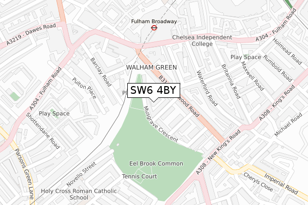
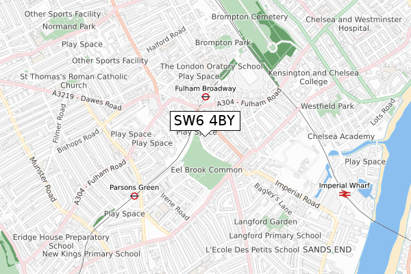
SW6 4BY is located in the Parsons Green & Sandford electoral ward, within the London borough of Hammersmith and Fulham and the English Parliamentary constituency of Chelsea and Fulham. The Sub Integrated Care Board (ICB) Location is NHS North West London ICB - W2U3Z and the police force is Metropolitan Police. This postcode has been in use since February 2020.


GetTheData
Source: OS Open Zoomstack (Ordnance Survey)
Licence: Open Government Licence (requires attribution)
Attribution: Contains OS data © Crown copyright and database right 2025
Source: Open Postcode Geo
Licence: Open Government Licence (requires attribution)
Attribution: Contains OS data © Crown copyright and database right 2025; Contains Royal Mail data © Royal Mail copyright and database right 2025; Source: Office for National Statistics licensed under the Open Government Licence v.3.0
| Easting | 525449 |
| Northing | 177033 |
| Latitude | 51.478355 |
| Longitude | -0.194919 |
GetTheData
Source: Open Postcode Geo
Licence: Open Government Licence
| Country | England |
| Postcode District | SW6 |
➜ See where SW6 is on a map ➜ Where is London? | |
GetTheData
Source: Land Registry Price Paid Data
Licence: Open Government Licence
| Ward | Parsons Green & Sandford |
| Constituency | Chelsea And Fulham |
GetTheData
Source: ONS Postcode Database
Licence: Open Government Licence
3, MOORE PARK MEWS, LONDON, SW6 4BY 2020 4 SEP £1,675,000 |
2, MOORE PARK MEWS, LONDON, SW6 4BY 2020 31 MAR £1,750,000 |
1, MOORE PARK MEWS, LONDON, SW6 4BY 2020 21 FEB £1,860,000 |
4, MOORE PARK MEWS, LONDON, SW6 4BY 2020 18 FEB £1,850,000 |
GetTheData
Source: HM Land Registry Price Paid Data
Licence: Contains HM Land Registry data © Crown copyright and database right 2025. This data is licensed under the Open Government Licence v3.0.
| Fulham Town Hall | Walham Green | 70m |
| Fulham Town Hall (Harwood Road) | Walham Green | 103m |
| Fulham Town Hall (Harwood Road) | Walham Green | 117m |
| Fulham Town Hall (Harwood Road) | Walham Green | 122m |
| Fulham Broadway Station (Fulham Road) | Fulham Broadway | 186m |
| Fulham Broadway Underground Station | Fulham Broadway | 195m |
| Parsons Green Underground Station | Parsons Green | 552m |
| West Brompton Underground Station | West Brompton | 992m |
| Putney Bridge Underground Station | Putney Bridge | 1,476m |
| West Kensington Underground Station | West Kensington | 1,572m |
| Imperial Wharf Station | 0.9km |
| West Brompton Station | 1km |
| Wandsworth Town Station | 2km |
GetTheData
Source: NaPTAN
Licence: Open Government Licence
GetTheData
Source: ONS Postcode Database
Licence: Open Government Licence


➜ Get more ratings from the Food Standards Agency
GetTheData
Source: Food Standards Agency
Licence: FSA terms & conditions
| Last Collection | |||
|---|---|---|---|
| Location | Mon-Fri | Sat | Distance |
| Kempson Road | 17:30 | 12:00 | 81m |
| Fulham Broadway | 17:30 | 12:00 | 179m |
| Moore Park Road | 17:30 | 12:00 | 186m |
GetTheData
Source: Dracos
Licence: Creative Commons Attribution-ShareAlike
The below table lists the International Territorial Level (ITL) codes (formerly Nomenclature of Territorial Units for Statistics (NUTS) codes) and Local Administrative Units (LAU) codes for SW6 4BY:
| ITL 1 Code | Name |
|---|---|
| TLI | London |
| ITL 2 Code | Name |
| TLI3 | Inner London - West |
| ITL 3 Code | Name |
| TLI33 | Kensington & Chelsea and Hammersmith & Fulham |
| LAU 1 Code | Name |
| E09000013 | Hammersmith and Fulham |
GetTheData
Source: ONS Postcode Directory
Licence: Open Government Licence
The below table lists the Census Output Area (OA), Lower Layer Super Output Area (LSOA), and Middle Layer Super Output Area (MSOA) for SW6 4BY:
| Code | Name | |
|---|---|---|
| OA | E00009622 | |
| LSOA | E01001921 | Hammersmith and Fulham 020B |
| MSOA | E02000391 | Hammersmith and Fulham 020 |
GetTheData
Source: ONS Postcode Directory
Licence: Open Government Licence
| SW6 4PT | Musgrave Crescent | 21m |
| SW6 4PS | Moore Park Road | 22m |
| SW6 4PU | Kempson Road | 29m |
| SW6 4PP | Moore Park Road | 47m |
| SW6 4PX | Kempson Road | 57m |
| SW6 4PY | Harwood Road | 59m |
| SW6 4PD | Harwood Mews | 78m |
| SW6 4QD | Musgrave Crescent | 85m |
| SW6 4QB | Blake Gardens | 91m |
| SW6 4PZ | Harwood Road | 96m |
GetTheData
Source: Open Postcode Geo; Land Registry Price Paid Data
Licence: Open Government Licence