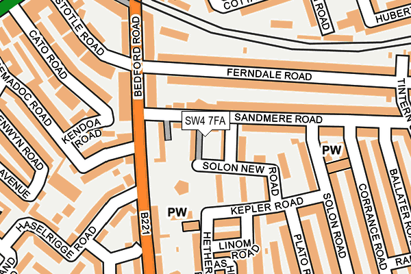
SW4 7FA is located in the Brixton Acre Lane electoral ward, within the London borough of Lambeth and the English Parliamentary constituency of Vauxhall. The Sub Integrated Care Board (ICB) Location is NHS South East London ICB - 72Q and the police force is Metropolitan Police. This postcode has been in use since February 2017.


GetTheData
Source: OS OpenMap – Local (Ordnance Survey)
Source: OS VectorMap District (Ordnance Survey)
Licence: Open Government Licence (requires attribution)
| Easting | 530146 |
| Northing | 175353 |
| Latitude | 51.462197 |
| Longitude | -0.127937 |
GetTheData
Source: Open Postcode Geo
Licence: Open Government Licence
| Country | England |
| Postcode District | SW4 |
➜ See where SW4 is on a map ➜ Where is London? | |
GetTheData
Source: Land Registry Price Paid Data
Licence: Open Government Licence
| Ward | Brixton Acre Lane |
| Constituency | Vauxhall |
GetTheData
Source: ONS Postcode Database
Licence: Open Government Licence
| Tremadoc Road (Bedford Road) | Clapham North | 85m |
| Tremadoc Road (Bedford Road) | Clapham North | 106m |
| Clapham Park Road (Bedford Road) | Clapham Park | 192m |
| Clapham Park Road (Bedford Road) | Clapham Park | 203m |
| Clapham North (Bedford Road) | Clapham North | 289m |
| Clapham North Underground Station | Clapham | 357m |
| Clapham Common Underground Station | Clapham | 721m |
| Brixton Underground Station | Brixton | 910m |
| Stockwell Underground Station | Stockwell | 1,171m |
| Clapham South Underground Station | Clapham South | 1,728m |
| Clapham High Street Station | 0.5km |
| Brixton Station | 1km |
| Wandsworth Road Station | 1.2km |
GetTheData
Source: NaPTAN
Licence: Open Government Licence
GetTheData
Source: ONS Postcode Database
Licence: Open Government Licence


➜ Get more ratings from the Food Standards Agency
GetTheData
Source: Food Standards Agency
Licence: FSA terms & conditions
| Last Collection | |||
|---|---|---|---|
| Location | Mon-Fri | Sat | Distance |
| Bedford Road | 17:30 | 12:00 | 93m |
| 120 Ferndale Road | 17:30 | 12:00 | 304m |
| Tremadoc Road | 17:30 | 12:00 | 312m |
GetTheData
Source: Dracos
Licence: Creative Commons Attribution-ShareAlike
The below table lists the International Territorial Level (ITL) codes (formerly Nomenclature of Territorial Units for Statistics (NUTS) codes) and Local Administrative Units (LAU) codes for SW4 7FA:
| ITL 1 Code | Name |
|---|---|
| TLI | London |
| ITL 2 Code | Name |
| TLI4 | Inner London - East |
| ITL 3 Code | Name |
| TLI45 | Lambeth |
| LAU 1 Code | Name |
| E09000022 | Lambeth |
GetTheData
Source: ONS Postcode Directory
Licence: Open Government Licence
The below table lists the Census Output Area (OA), Lower Layer Super Output Area (LSOA), and Middle Layer Super Output Area (MSOA) for SW4 7FA:
| Code | Name | |
|---|---|---|
| OA | E00015427 | |
| LSOA | E01003056 | Lambeth 015D |
| MSOA | E02000632 | Lambeth 015 |
GetTheData
Source: ONS Postcode Directory
Licence: Open Government Licence
| SW4 7LU | Solon New Road Estate | 24m |
| SW4 7LX | Solon New Road Estate | 27m |
| SW4 7QL | Sandmere Road | 34m |
| SW4 7QJ | Sandmere Road | 52m |
| SW4 7LS | Solon New Road Estate | 68m |
| SW4 7NS | Solon New Road Estate | 81m |
| SW4 7RJ | Ferndale Road | 84m |
| SW4 7NP | Solon New Road Estate | 92m |
| SW4 7PS | Sandmere Road | 103m |
| SW4 7RH | Bedford Road | 105m |
GetTheData
Source: Open Postcode Geo; Land Registry Price Paid Data
Licence: Open Government Licence