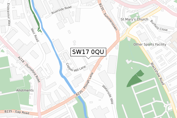
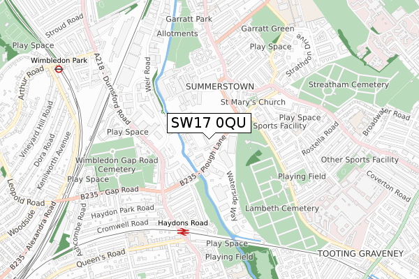
SW17 0QU is located in the Wandle electoral ward, within the London borough of Merton and the English Parliamentary constituency of Wimbledon. The Sub Integrated Care Board (ICB) Location is NHS South West London ICB - 36L and the police force is Metropolitan Police. This postcode has been in use since April 2020.


GetTheData
Source: OS Open Zoomstack (Ordnance Survey)
Licence: Open Government Licence (requires attribution)
Attribution: Contains OS data © Crown copyright and database right 2025
Source: Open Postcode Geo
Licence: Open Government Licence (requires attribution)
Attribution: Contains OS data © Crown copyright and database right 2025; Contains Royal Mail data © Royal Mail copyright and database right 2025; Source: Office for National Statistics licensed under the Open Government Licence v.3.0
| Easting | 526225 |
| Northing | 171766 |
| Latitude | 51.430847 |
| Longitude | -0.185627 |
GetTheData
Source: Open Postcode Geo
Licence: Open Government Licence
| Country | England |
| Postcode District | SW17 |
➜ See where SW17 is on a map ➜ Where is Wimbledon? | |
GetTheData
Source: Land Registry Price Paid Data
Licence: Open Government Licence
| Ward | Wandle |
| Constituency | Wimbledon |
GetTheData
Source: ONS Postcode Database
Licence: Open Government Licence
| Wimbledon Stadium | Summerstown | 50m |
| Waterside Way | Summerstown | 128m |
| Wimbledon Stadium | Summerstown | 129m |
| Hazelhurst Estate | Summerstown | 232m |
| Hazelhurst Estate | Summerstown | 264m |
| Wimbledon Park Underground Station | Wimbledon Park | 1,062m |
| Tooting Broadway Underground Station | Tooting Broadway | 1,254m |
| Colliers Wood Underground Station | Collier's Wood | 1,506m |
| Wimbledon Tram Stop (The Broadway) | Wimbledon | 1,776m |
| Wimbledon Underground Station | Wimbledon | 1,807m |
| Haydons Road Station | 0.6km |
| Earlsfield Station | 1.3km |
| Wimbledon Station | 1.8km |
GetTheData
Source: NaPTAN
Licence: Open Government Licence
GetTheData
Source: ONS Postcode Database
Licence: Open Government Licence


➜ Get more ratings from the Food Standards Agency
GetTheData
Source: Food Standards Agency
Licence: FSA terms & conditions
| Last Collection | |||
|---|---|---|---|
| Location | Mon-Fri | Sat | Distance |
| Wimbledon Road | 17:30 | 12:00 | 202m |
| 737 Garratt Lane | 17:30 | 12:00 | 393m |
| Garratt Lane | 17:30 | 12:00 | 415m |
GetTheData
Source: Dracos
Licence: Creative Commons Attribution-ShareAlike
The below table lists the International Territorial Level (ITL) codes (formerly Nomenclature of Territorial Units for Statistics (NUTS) codes) and Local Administrative Units (LAU) codes for SW17 0QU:
| ITL 1 Code | Name |
|---|---|
| TLI | London |
| ITL 2 Code | Name |
| TLI6 | Outer London - South |
| ITL 3 Code | Name |
| TLI63 | Merton, Kingston upon Thames and Sutton |
| LAU 1 Code | Name |
| E09000024 | Merton |
GetTheData
Source: ONS Postcode Directory
Licence: Open Government Licence
The below table lists the Census Output Area (OA), Lower Layer Super Output Area (LSOA), and Middle Layer Super Output Area (MSOA) for SW17 0QU:
| Code | Name | |
|---|---|---|
| OA | E00166829 | |
| LSOA | E01003475 | Merton 001D |
| MSOA | E02000689 | Merton 001 |
GetTheData
Source: ONS Postcode Directory
Licence: Open Government Licence
| SW17 0BN | Copper Mill Lane | 152m |
| SW17 0UJ | Wimbledon Road | 168m |
| SW17 0BQ | Summerstown | 210m |
| SW17 0UH | Keble Street | 219m |
| SW17 0DQ | Blackshaw Road | 233m |
| SW17 0DA | Blackshaw Road | 236m |
| SW17 0AY | Summerstown | 237m |
| SW17 0UF | Hazelhurst Road | 263m |
| SW17 0DH | Blackshaw Road | 266m |
| SW17 0BP | Blackshaw Road | 275m |
GetTheData
Source: Open Postcode Geo; Land Registry Price Paid Data
Licence: Open Government Licence