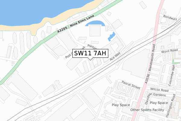
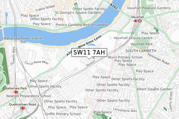
SW11 7AH is located in the Nine Elms electoral ward, within the London borough of Wandsworth and the English Parliamentary constituency of Battersea. The Sub Integrated Care Board (ICB) Location is NHS South West London ICB - 36L and the police force is Metropolitan Police. This postcode has been in use since May 2018.


GetTheData
Source: OS Open Zoomstack (Ordnance Survey)
Licence: Open Government Licence (requires attribution)
Attribution: Contains OS data © Crown copyright and database right 2025
Source: Open Postcode Geo
Licence: Open Government Licence (requires attribution)
Attribution: Contains OS data © Crown copyright and database right 2025; Contains Royal Mail data © Royal Mail copyright and database right 2025; Source: Office for National Statistics licensed under the Open Government Licence v.3.0
| Easting | 529775 |
| Northing | 177462 |
| Latitude | 51.481235 |
| Longitude | -0.132501 |
GetTheData
Source: Open Postcode Geo
Licence: Open Government Licence
| Country | England |
| Postcode District | SW11 |
➜ See where SW11 is on a map ➜ Where is London? | |
GetTheData
Source: Land Registry Price Paid Data
Licence: Open Government Licence
| Ward | Nine Elms |
| Constituency | Battersea |
GetTheData
Source: ONS Postcode Database
Licence: Open Government Licence
| Elm Quay Court (Nine Elms Lane) | Nine Elms | 183m |
| Elm Quay Court (Nine Elms Lane) | Nine Elms | 241m |
| Wilcox Road (Wandsworth Road) | South Lambeth | 332m |
| Wilcox Road (Wandsworth Road) | South Lambeth | 336m |
| Covent Garden Market East Side (Wandsworth Road) | Nine Elms | 369m |
| Vauxhall Underground Station | Vauxhall | 765m |
| Pimlico Underground Station | Pimlico | 879m |
| Stockwell Underground Station | Stockwell | 1,219m |
| Oval Underground Station | Oval | 1,397m |
| Vauxhall Station | 0.9km |
| Battersea Park Station | 1.1km |
| Queenstown Road (Battersea) Station | 1.2km |
GetTheData
Source: NaPTAN
Licence: Open Government Licence
| Percentage of properties with Next Generation Access | 100.0% |
| Percentage of properties with Superfast Broadband | 100.0% |
| Percentage of properties with Ultrafast Broadband | 100.0% |
| Percentage of properties with Full Fibre Broadband | 100.0% |
Superfast Broadband is between 30Mbps and 300Mbps
Ultrafast Broadband is > 300Mbps
Ofcom does not currently provide download speed data for SW11 7AH. This is because there are less than four broadband connections in this postcode.
Ofcom does not currently provide upload speed data for SW11 7AH. This is because there are less than four broadband connections in this postcode.
| Percentage of properties unable to receive 2Mbps | 0.0% |
| Percentage of properties unable to receive 5Mbps | 0.0% |
| Percentage of properties unable to receive 10Mbps | 0.0% |
| Percentage of properties unable to receive 30Mbps | 0.0% |
GetTheData
Source: Ofcom
Licence: Ofcom Terms of Use (requires attribution)
GetTheData
Source: ONS Postcode Database
Licence: Open Government Licence


➜ Get more ratings from the Food Standards Agency
GetTheData
Source: Food Standards Agency
Licence: FSA terms & conditions
| Last Collection | |||
|---|---|---|---|
| Location | Mon-Fri | Sat | Distance |
| Ponton Road | 18:30 | 12:00 | 148m |
| Covent Garden Flower Market | 17:30 | 12:00 | 338m |
| Wandsworth Road | 17:30 | 12:00 | 346m |
GetTheData
Source: Dracos
Licence: Creative Commons Attribution-ShareAlike
| Risk of SW11 7AH flooding from rivers and sea | Very Low |
| ➜ SW11 7AH flood map | |
GetTheData
Source: Open Flood Risk by Postcode
Licence: Open Government Licence
The below table lists the International Territorial Level (ITL) codes (formerly Nomenclature of Territorial Units for Statistics (NUTS) codes) and Local Administrative Units (LAU) codes for SW11 7AH:
| ITL 1 Code | Name |
|---|---|
| TLI | London |
| ITL 2 Code | Name |
| TLI3 | Inner London - West |
| ITL 3 Code | Name |
| TLI34 | Wandsworth |
| LAU 1 Code | Name |
| E09000032 | Wandsworth |
GetTheData
Source: ONS Postcode Directory
Licence: Open Government Licence
The below table lists the Census Output Area (OA), Lower Layer Super Output Area (LSOA), and Middle Layer Super Output Area (MSOA) for SW11 7AH:
| Code | Name | |
|---|---|---|
| OA | E00022974 | |
| LSOA | E01004562 | Wandsworth 002B |
| MSOA | E02000924 | Wandsworth 002 |
GetTheData
Source: ONS Postcode Directory
Licence: Open Government Licence
| SW11 7AS | New Mill Road | 178m |
| SW8 5DE | Nine Elms Lane | 236m |
| SW8 5DF | Nine Elms Lane | 236m |
| SW8 4SF | Fount Street | 254m |
| SW8 4SE | Fount Street | 272m |
| SW8 4SQ | Hemans Street | 277m |
| SW8 4SP | Hemans Street | 288m |
| SW8 5DB | Nine Elms Lane | 298m |
| SW8 4SL | Mill Pond Close | 307m |
| SW8 4SR | Hemans Street | 315m |
GetTheData
Source: Open Postcode Geo; Land Registry Price Paid Data
Licence: Open Government Licence