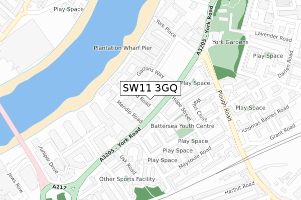
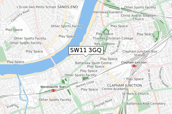
SW11 3GQ is located in the St Mary's electoral ward, within the London borough of Wandsworth and the English Parliamentary constituency of Battersea. The Sub Integrated Care Board (ICB) Location is NHS South West London ICB - 36L and the police force is Metropolitan Police. This postcode has been in use since October 2017.


GetTheData
Source: OS Open Zoomstack (Ordnance Survey)
Licence: Open Government Licence (requires attribution)
Attribution: Contains OS data © Crown copyright and database right 2025
Source: Open Postcode Geo
Licence: Open Government Licence (requires attribution)
Attribution: Contains OS data © Crown copyright and database right 2025; Contains Royal Mail data © Royal Mail copyright and database right 2025; Source: Office for National Statistics licensed under the Open Government Licence v.3.0
| Easting | 526455 |
| Northing | 175615 |
| Latitude | 51.465387 |
| Longitude | -0.180946 |
GetTheData
Source: Open Postcode Geo
Licence: Open Government Licence
| Country | England |
| Postcode District | SW11 |
➜ See where SW11 is on a map ➜ Where is London? | |
GetTheData
Source: Land Registry Price Paid Data
Licence: Open Government Licence
| Ward | St Mary's |
| Constituency | Battersea |
GetTheData
Source: ONS Postcode Database
Licence: Open Government Licence
| Chatfield Road (York Road) | Clapham Junction | 35m |
| Chatfield Road (York Road) | Clapham Junction | 81m |
| Hope Street (York Road) | Clapham Junction | 147m |
| Hope Street (York Road) | Clapham Junction | 148m |
| Wallis Close (Plough Road) | Clapham Junction | 233m |
| Parsons Green Underground Station | Parsons Green | 1,783m |
| Wandsworth Town Station | 0.7km |
| Clapham Junction Station | 0.8km |
| Imperial Wharf Station | 1.1km |
GetTheData
Source: NaPTAN
Licence: Open Government Licence
| Percentage of properties with Next Generation Access | 100.0% |
| Percentage of properties with Superfast Broadband | 100.0% |
| Percentage of properties with Ultrafast Broadband | 100.0% |
| Percentage of properties with Full Fibre Broadband | 100.0% |
Superfast Broadband is between 30Mbps and 300Mbps
Ultrafast Broadband is > 300Mbps
| Median download speed | 76.1Mbps |
| Average download speed | 59.7Mbps |
| Maximum download speed | 78.15Mbps |
| Median upload speed | 19.4Mbps |
| Average upload speed | 14.9Mbps |
| Maximum upload speed | 20.00Mbps |
| Percentage of properties unable to receive 2Mbps | 0.0% |
| Percentage of properties unable to receive 5Mbps | 0.0% |
| Percentage of properties unable to receive 10Mbps | 0.0% |
| Percentage of properties unable to receive 30Mbps | 0.0% |
GetTheData
Source: Ofcom
Licence: Ofcom Terms of Use (requires attribution)
GetTheData
Source: ONS Postcode Database
Licence: Open Government Licence


➜ Get more ratings from the Food Standards Agency
GetTheData
Source: Food Standards Agency
Licence: FSA terms & conditions
| Last Collection | |||
|---|---|---|---|
| Location | Mon-Fri | Sat | Distance |
| 200 York Road | 17:30 | 12:00 | 67m |
| York Road | 17:30 | 12:00 | 228m |
| 86 Plough Road | 17:30 | 12:00 | 350m |
GetTheData
Source: Dracos
Licence: Creative Commons Attribution-ShareAlike
| Risk of SW11 3GQ flooding from rivers and sea | Very Low |
| ➜ SW11 3GQ flood map | |
GetTheData
Source: Open Flood Risk by Postcode
Licence: Open Government Licence
The below table lists the International Territorial Level (ITL) codes (formerly Nomenclature of Territorial Units for Statistics (NUTS) codes) and Local Administrative Units (LAU) codes for SW11 3GQ:
| ITL 1 Code | Name |
|---|---|
| TLI | London |
| ITL 2 Code | Name |
| TLI3 | Inner London - West |
| ITL 3 Code | Name |
| TLI34 | Wandsworth |
| LAU 1 Code | Name |
| E09000032 | Wandsworth |
GetTheData
Source: ONS Postcode Directory
Licence: Open Government Licence
The below table lists the Census Output Area (OA), Lower Layer Super Output Area (LSOA), and Middle Layer Super Output Area (MSOA) for SW11 3GQ:
| Code | Name | |
|---|---|---|
| OA | E00171083 | |
| LSOA | E01033101 | Wandsworth 004F |
| MSOA | E02000926 | Wandsworth 004 |
GetTheData
Source: ONS Postcode Directory
Licence: Open Government Licence
| SW11 3SD | York Road | 30m |
| SW11 3SE | Chatfield Road | 44m |
| SW11 3SX | Gartons Way | 57m |
| SW11 3QS | York Road | 65m |
| SW11 3SJ | York Road | 70m |
| SW11 3QT | York Road | 75m |
| SW11 3QR | York Road | 88m |
| SW11 2QY | Great Chart Street | 121m |
| SW11 2QX | Great Chart Street | 125m |
| SW11 3QP | York Road | 127m |
GetTheData
Source: Open Postcode Geo; Land Registry Price Paid Data
Licence: Open Government Licence