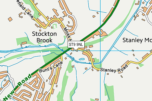
ST9 9NL is located in the Bagnall and Stanley electoral ward, within the local authority district of Staffordshire Moorlands and the English Parliamentary constituency of Staffordshire Moorlands. The Sub Integrated Care Board (ICB) Location is NHS Staffordshire and Stoke-on-Trent ICB - 05W and the police force is Staffordshire. This postcode has been in use since January 1980.


GetTheData
Source: OS OpenMap – Local (Ordnance Survey)
Source: OS VectorMap District (Ordnance Survey)
Licence: Open Government Licence (requires attribution)
| Easting | 391763 |
| Northing | 352001 |
| Latitude | 53.065186 |
| Longitude | -2.124371 |
GetTheData
Source: Open Postcode Geo
Licence: Open Government Licence
| Country | England |
| Postcode District | ST9 |
➜ See where ST9 is on a map ➜ Where is Stanley Moor? | |
GetTheData
Source: Land Registry Price Paid Data
Licence: Open Government Licence
Elevation or altitude of ST9 9NL as distance above sea level:
| Metres | Feet | |
|---|---|---|
| Elevation | 150m | 492ft |
Elevation is measured from the approximate centre of the postcode, to the nearest point on an OS contour line from OS Terrain 50, which has contour spacing of ten vertical metres.
➜ How high above sea level am I? Find the elevation of your current position using your device's GPS.
GetTheData
Source: Open Postcode Elevation
Licence: Open Government Licence
| Ward | Bagnall And Stanley |
| Constituency | Staffordshire Moorlands |
GetTheData
Source: ONS Postcode Database
Licence: Open Government Licence
| Moss Hill (Leek Rd) | Stocton Brook | 70m |
| Stanley Road (Leek Road) | Stocton Brook | 95m |
| Trintity Court Nursery (Leek Rd) | Stocton Brook | 357m |
| Trinity Court Nursery (Leek Road) | Stocton Brook | 376m |
| Nursery Avenue (Leek New Road) | Stockton Brook | 403m |
GetTheData
Source: NaPTAN
Licence: Open Government Licence
GetTheData
Source: ONS Postcode Database
Licence: Open Government Licence


➜ Get more ratings from the Food Standards Agency
GetTheData
Source: Food Standards Agency
Licence: FSA terms & conditions
| Last Collection | |||
|---|---|---|---|
| Location | Mon-Fri | Sat | Distance |
| Stockton Brook Post Office | 17:00 | 11:15 | 87m |
| Cadman Crescent | 16:30 | 10:00 | 2,577m |
| Robin Hood Pub | 17:30 | 10:00 | 2,736m |
GetTheData
Source: Dracos
Licence: Creative Commons Attribution-ShareAlike
The below table lists the International Territorial Level (ITL) codes (formerly Nomenclature of Territorial Units for Statistics (NUTS) codes) and Local Administrative Units (LAU) codes for ST9 9NL:
| ITL 1 Code | Name |
|---|---|
| TLG | West Midlands (England) |
| ITL 2 Code | Name |
| TLG2 | Shropshire and Staffordshire |
| ITL 3 Code | Name |
| TLG24 | Staffordshire CC |
| LAU 1 Code | Name |
| E07000198 | Staffordshire Moorlands |
GetTheData
Source: ONS Postcode Directory
Licence: Open Government Licence
The below table lists the Census Output Area (OA), Lower Layer Super Output Area (LSOA), and Middle Layer Super Output Area (MSOA) for ST9 9NL:
| Code | Name | |
|---|---|---|
| OA | E00151647 | |
| LSOA | E01029762 | Staffordshire Moorlands 008A |
| MSOA | E02006211 | Staffordshire Moorlands 008 |
GetTheData
Source: ONS Postcode Directory
Licence: Open Government Licence
| ST9 9NN | Leek Road | 48m |
| ST9 9NP | Nursery Villas | 125m |
| ST9 9LJ | Stanley Road | 167m |
| ST9 9NH | Leek Road | 244m |
| ST9 9NT | Leek New Road | 276m |
| ST9 9PR | Bunts Lane | 283m |
| ST9 9NW | Moss Hill | 288m |
| ST9 9NE | Amber Court | 298m |
| ST9 9PW | Greenway Hall Road | 355m |
| ST9 9PS | Heather Hills | 366m |
GetTheData
Source: Open Postcode Geo; Land Registry Price Paid Data
Licence: Open Government Licence