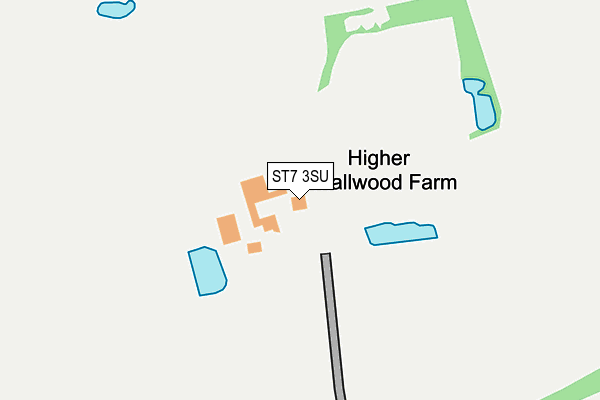
ST7 3SU is located in the Odd Rode electoral ward, within the unitary authority of Cheshire East and the English Parliamentary constituency of Congleton. The Sub Integrated Care Board (ICB) Location is NHS Cheshire and Merseyside ICB - 27D and the police force is Cheshire. This postcode has been in use since January 1980.


GetTheData
Source: OS OpenMap – Local (Ordnance Survey)
Source: OS VectorMap District (Ordnance Survey)
Licence: Open Government Licence (requires attribution)
| Easting | 381653 |
| Northing | 359249 |
| Latitude | 53.130084 |
| Longitude | -2.275657 |
GetTheData
Source: Open Postcode Geo
Licence: Open Government Licence
| Country | England |
| Postcode District | ST7 |
➜ See where ST7 is on a map | |
GetTheData
Source: Land Registry Price Paid Data
Licence: Open Government Licence
Elevation or altitude of ST7 3SU as distance above sea level:
| Metres | Feet | |
|---|---|---|
| Elevation | 100m | 328ft |
Elevation is measured from the approximate centre of the postcode, to the nearest point on an OS contour line from OS Terrain 50, which has contour spacing of ten vertical metres.
➜ How high above sea level am I? Find the elevation of your current position using your device's GPS.
GetTheData
Source: Open Postcode Elevation
Licence: Open Government Licence
| Ward | Odd Rode |
| Constituency | Congleton |
GetTheData
Source: ONS Postcode Database
Licence: Open Government Licence
| St John The Baptist's Church (Church Lane) | Smallwood | 1,331m |
| Bank House Lane (Congleton Road) | Smallwood | 1,334m |
| St John The Baptist's Church (Church Lane) | Smallwood | 1,345m |
| Bank House Lane (Congleton Road) | Smallwood | 1,350m |
| Primary School (School Lane) | Smallwood | 1,399m |
| Alsager Station | 4.4km |
| Kidsgrove Station | 5.3km |
GetTheData
Source: NaPTAN
Licence: Open Government Licence
GetTheData
Source: ONS Postcode Database
Licence: Open Government Licence


➜ Get more ratings from the Food Standards Agency
GetTheData
Source: Food Standards Agency
Licence: FSA terms & conditions
| Last Collection | |||
|---|---|---|---|
| Location | Mon-Fri | Sat | Distance |
| Warhams Bank | 16:00 | 11:00 | 1,382m |
| Streetlane | 16:00 | 08:00 | 1,394m |
| Spen Green 'l' | 16:00 | 11:45 | 1,451m |
GetTheData
Source: Dracos
Licence: Creative Commons Attribution-ShareAlike
The below table lists the International Territorial Level (ITL) codes (formerly Nomenclature of Territorial Units for Statistics (NUTS) codes) and Local Administrative Units (LAU) codes for ST7 3SU:
| ITL 1 Code | Name |
|---|---|
| TLD | North West (England) |
| ITL 2 Code | Name |
| TLD6 | Cheshire |
| ITL 3 Code | Name |
| TLD62 | Cheshire East |
| LAU 1 Code | Name |
| E06000049 | Cheshire East |
GetTheData
Source: ONS Postcode Directory
Licence: Open Government Licence
The below table lists the Census Output Area (OA), Lower Layer Super Output Area (LSOA), and Middle Layer Super Output Area (MSOA) for ST7 3SU:
| Code | Name | |
|---|---|---|
| OA | E00092995 | |
| LSOA | E01018431 | Cheshire East 033G |
| MSOA | E02003822 | Cheshire East 033 |
GetTheData
Source: ONS Postcode Directory
Licence: Open Government Licence
| ST7 3SR | Street Lane | 1216m |
| CW11 2GB | Newcastle Road | 1249m |
| ST7 3SN | Street Lane | 1329m |
| CW11 2UZ | Spen Green | 1330m |
| CW11 2UT | Church Lane | 1335m |
| CW11 2YH | Congleton Road | 1358m |
| CW11 2UY | Spen Green | 1380m |
| CW11 2UR | School Lane | 1407m |
| CW11 2TU | Church Lane | 1536m |
| CW11 2XA | Spen Green | 1580m |
GetTheData
Source: Open Postcode Geo; Land Registry Price Paid Data
Licence: Open Government Licence