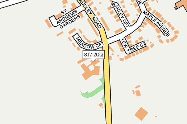
ST7 2QQ is located in the Alsager electoral ward, within the unitary authority of Cheshire East and the English Parliamentary constituency of Congleton. The Sub Integrated Care Board (ICB) Location is NHS Cheshire and Merseyside ICB - 27D and the police force is Cheshire. This postcode has been in use since September 1981.


GetTheData
Source: OS OpenMap – Local (Ordnance Survey)
Source: OS VectorMap District (Ordnance Survey)
Licence: Open Government Licence (requires attribution)
| Easting | 380153 |
| Northing | 354626 |
| Latitude | 53.088474 |
| Longitude | -2.297787 |
GetTheData
Source: Open Postcode Geo
Licence: Open Government Licence
| Country | England |
| Postcode District | ST7 |
➜ See where ST7 is on a map ➜ Where is Alsager? | |
GetTheData
Source: Land Registry Price Paid Data
Licence: Open Government Licence
Elevation or altitude of ST7 2QQ as distance above sea level:
| Metres | Feet | |
|---|---|---|
| Elevation | 100m | 328ft |
Elevation is measured from the approximate centre of the postcode, to the nearest point on an OS contour line from OS Terrain 50, which has contour spacing of ten vertical metres.
➜ How high above sea level am I? Find the elevation of your current position using your device's GPS.
GetTheData
Source: Open Postcode Elevation
Licence: Open Government Licence
| Ward | Alsager |
| Constituency | Congleton |
GetTheData
Source: ONS Postcode Database
Licence: Open Government Licence
| Townhouse Day Nursery (Birch Avenue) | Alsager | 90m |
| Townhouse Day Nursery (Birch Avenue) | Alsager | 101m |
| Excalibur Primary School (Ivy Lane) | Alsager | 347m |
| Excalibur Primary School (Ivy Lane) | Alsager | 354m |
| Birch Avenue (Talke Road) | Alsager | 451m |
| Alsager Station | 0.5km |
| Kidsgrove Station | 3.6km |
GetTheData
Source: NaPTAN
Licence: Open Government Licence
GetTheData
Source: ONS Postcode Database
Licence: Open Government Licence


➜ Get more ratings from the Food Standards Agency
GetTheData
Source: Food Standards Agency
Licence: FSA terms & conditions
| Last Collection | |||
|---|---|---|---|
| Location | Mon-Fri | Sat | Distance |
| Alsager Post Office | 17:30 | 11:30 | 525m |
| Barratt Road | 17:00 | 10:30 | 898m |
| Crewe Road | 16:30 | 10:30 | 1,167m |
GetTheData
Source: Dracos
Licence: Creative Commons Attribution-ShareAlike
The below table lists the International Territorial Level (ITL) codes (formerly Nomenclature of Territorial Units for Statistics (NUTS) codes) and Local Administrative Units (LAU) codes for ST7 2QQ:
| ITL 1 Code | Name |
|---|---|
| TLD | North West (England) |
| ITL 2 Code | Name |
| TLD6 | Cheshire |
| ITL 3 Code | Name |
| TLD62 | Cheshire East |
| LAU 1 Code | Name |
| E06000049 | Cheshire East |
GetTheData
Source: ONS Postcode Directory
Licence: Open Government Licence
The below table lists the Census Output Area (OA), Lower Layer Super Output Area (LSOA), and Middle Layer Super Output Area (MSOA) for ST7 2QQ:
| Code | Name | |
|---|---|---|
| OA | E00092777 | |
| LSOA | E01018389 | Cheshire East 040C |
| MSOA | E02003823 | Cheshire East 040 |
GetTheData
Source: ONS Postcode Directory
Licence: Open Government Licence
| ST7 2QP | Meadow Croft | 90m |
| ST7 2YQ | Yew Tree Court | 132m |
| ST7 2QT | Birch Avenue | 180m |
| ST7 2QN | Audley Road | 186m |
| ST7 2QU | Barley Croft | 192m |
| ST7 2XS | 193m | |
| ST7 2QW | Audley Road | 213m |
| ST7 2QY | Birch Avenue | 235m |
| ST7 2QX | Maple Avenue | 262m |
| ST7 2RA | Oak Avenue | 293m |
GetTheData
Source: Open Postcode Geo; Land Registry Price Paid Data
Licence: Open Government Licence