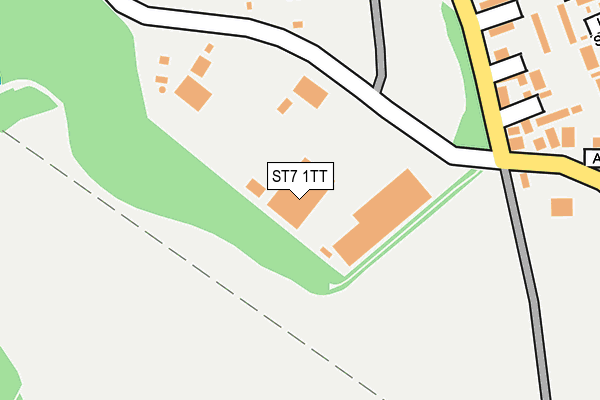
ST7 1TT is located in the Talke & Butt Lane electoral ward, within the local authority district of Newcastle-under-Lyme and the English Parliamentary constituency of Stoke-on-Trent North. The Sub Integrated Care Board (ICB) Location is NHS Staffordshire and Stoke-on-Trent ICB - 05G and the police force is Staffordshire. This postcode has been in use since March 1982.


GetTheData
Source: OS OpenMap – Local (Ordnance Survey)
Source: OS VectorMap District (Ordnance Survey)
Licence: Open Government Licence (requires attribution)
| Easting | 382470 |
| Northing | 352298 |
| Latitude | 53.067646 |
| Longitude | -2.263065 |
GetTheData
Source: Open Postcode Geo
Licence: Open Government Licence
| Country | England |
| Postcode District | ST7 |
➜ See where ST7 is on a map ➜ Where is Talke Pits? | |
GetTheData
Source: Land Registry Price Paid Data
Licence: Open Government Licence
Elevation or altitude of ST7 1TT as distance above sea level:
| Metres | Feet | |
|---|---|---|
| Elevation | 180m | 591ft |
Elevation is measured from the approximate centre of the postcode, to the nearest point on an OS contour line from OS Terrain 50, which has contour spacing of ten vertical metres.
➜ How high above sea level am I? Find the elevation of your current position using your device's GPS.
GetTheData
Source: Open Postcode Elevation
Licence: Open Government Licence
| Ward | Talke & Butt Lane |
| Constituency | Stoke-on-trent North |
GetTheData
Source: ONS Postcode Database
Licence: Open Government Licence
| Freeport Shopping Mall (Freeport Access Road) | Talke Pits | 254m |
| Clinic (High Street) | Talke Pits | 392m |
| Clinic (High Street) | Talke Pits | 396m |
| Arbour Street (High St) | Talke Pits | 431m |
| Arbour Street (High St) | Talke Pits | 439m |
| Kidsgrove Station | 2.4km |
| Alsager Station | 3.7km |
| Longport Station | 4.2km |
GetTheData
Source: NaPTAN
Licence: Open Government Licence
GetTheData
Source: ONS Postcode Database
Licence: Open Government Licence


➜ Get more ratings from the Food Standards Agency
GetTheData
Source: Food Standards Agency
Licence: FSA terms & conditions
| Last Collection | |||
|---|---|---|---|
| Location | Mon-Fri | Sat | Distance |
| Coalpit Hill | 16:45 | 09:00 | 1,448m |
| Audley Road | 17:00 | 10:30 | 1,674m |
| Barratt Road | 17:00 | 10:30 | 2,994m |
GetTheData
Source: Dracos
Licence: Creative Commons Attribution-ShareAlike
The below table lists the International Territorial Level (ITL) codes (formerly Nomenclature of Territorial Units for Statistics (NUTS) codes) and Local Administrative Units (LAU) codes for ST7 1TT:
| ITL 1 Code | Name |
|---|---|
| TLG | West Midlands (England) |
| ITL 2 Code | Name |
| TLG2 | Shropshire and Staffordshire |
| ITL 3 Code | Name |
| TLG24 | Staffordshire CC |
| LAU 1 Code | Name |
| E07000195 | Newcastle-under-Lyme |
GetTheData
Source: ONS Postcode Directory
Licence: Open Government Licence
The below table lists the Census Output Area (OA), Lower Layer Super Output Area (LSOA), and Middle Layer Super Output Area (MSOA) for ST7 1TT:
| Code | Name | |
|---|---|---|
| OA | E00150806 | |
| LSOA | E01029596 | Newcastle-under-Lyme 004E |
| MSOA | E02006161 | Newcastle-under-Lyme 004 |
GetTheData
Source: ONS Postcode Directory
Licence: Open Government Licence
| ST7 1XW | Jamage Industrial Estate | 205m |
| ST7 1QL | Jamage Road | 226m |
| ST7 1PQ | Elizabeth Court | 274m |
| ST7 1PG | Queens Gardens | 313m |
| ST7 1QJ | King Street | 318m |
| ST7 1QN | Princess Street | 321m |
| ST7 1QW | Arbour Street | 330m |
| ST7 1PH | Anne Court | 347m |
| ST7 1FA | Taylors Place | 364m |
| ST7 1QD | Jamage Road | 371m |
GetTheData
Source: Open Postcode Geo; Land Registry Price Paid Data
Licence: Open Government Licence