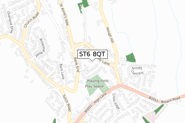
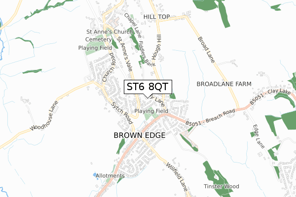
ST6 8QT is located in the Brown Edge and Endon electoral ward, within the local authority district of Staffordshire Moorlands and the English Parliamentary constituency of Staffordshire Moorlands. The Sub Integrated Care Board (ICB) Location is NHS Staffordshire and Stoke-on-Trent ICB - 05W and the police force is Staffordshire. This postcode has been in use since October 2018.


GetTheData
Source: OS Open Zoomstack (Ordnance Survey)
Licence: Open Government Licence (requires attribution)
Attribution: Contains OS data © Crown copyright and database right 2025
Source: Open Postcode Geo
Licence: Open Government Licence (requires attribution)
Attribution: Contains OS data © Crown copyright and database right 2025; Contains Royal Mail data © Royal Mail copyright and database right 2025; Source: Office for National Statistics licensed under the Open Government Licence v.3.0
| Easting | 390856 |
| Northing | 353447 |
| Latitude | 53.078187 |
| Longitude | -2.137947 |
GetTheData
Source: Open Postcode Geo
Licence: Open Government Licence
| Country | England |
| Postcode District | ST6 |
➜ See where ST6 is on a map ➜ Where is Brown Edge? | |
GetTheData
Source: Land Registry Price Paid Data
Licence: Open Government Licence
| Ward | Brown Edge And Endon |
| Constituency | Staffordshire Moorlands |
GetTheData
Source: ONS Postcode Database
Licence: Open Government Licence
| Post Office (High Lane) | Brown Edge | 191m |
| Post Office (High Lane) | Brown Edge | 204m |
| Rushton Close (Sytch Rd) | Brown Edge | 225m |
| Rushton Close (Sytch Rd) | Brown Edge | 253m |
| Greenfield Avenue (Leek Rd) | Brown Edge | 298m |
GetTheData
Source: NaPTAN
Licence: Open Government Licence
GetTheData
Source: ONS Postcode Database
Licence: Open Government Licence


➜ Get more ratings from the Food Standards Agency
GetTheData
Source: Food Standards Agency
Licence: FSA terms & conditions
| Last Collection | |||
|---|---|---|---|
| Location | Mon-Fri | Sat | Distance |
| Stockton Brook Post Office | 17:00 | 11:15 | 1,670m |
| Church Lane | 16:45 | 10:30 | 2,064m |
| Pinfold Avenue | 17:00 | 09:45 | 2,531m |
GetTheData
Source: Dracos
Licence: Creative Commons Attribution-ShareAlike
The below table lists the International Territorial Level (ITL) codes (formerly Nomenclature of Territorial Units for Statistics (NUTS) codes) and Local Administrative Units (LAU) codes for ST6 8QT:
| ITL 1 Code | Name |
|---|---|
| TLG | West Midlands (England) |
| ITL 2 Code | Name |
| TLG2 | Shropshire and Staffordshire |
| ITL 3 Code | Name |
| TLG24 | Staffordshire CC |
| LAU 1 Code | Name |
| E07000198 | Staffordshire Moorlands |
GetTheData
Source: ONS Postcode Directory
Licence: Open Government Licence
The below table lists the Census Output Area (OA), Lower Layer Super Output Area (LSOA), and Middle Layer Super Output Area (MSOA) for ST6 8QT:
| Code | Name | |
|---|---|---|
| OA | E00151719 | |
| LSOA | E01029775 | Staffordshire Moorlands 008B |
| MSOA | E02006211 | Staffordshire Moorlands 008 |
GetTheData
Source: ONS Postcode Directory
Licence: Open Government Licence
| ST6 8QL | Sandy Lane | 40m |
| ST6 8QN | Thelma Avenue | 47m |
| ST6 8QR | Bank End | 113m |
| ST6 8QJ | Sandy Lane | 145m |
| ST6 8QS | Back Lane | 151m |
| ST6 8TW | Hough Hill | 156m |
| ST6 8QW | Jobs Pool | 196m |
| ST6 8QP | The Rocks | 197m |
| ST6 8QD | High Lane | 209m |
| ST6 8QA | High Lane | 218m |
GetTheData
Source: Open Postcode Geo; Land Registry Price Paid Data
Licence: Open Government Licence