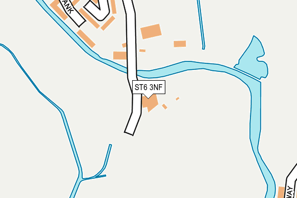
ST6 3NF is located in the Etruria & Hanley electoral ward, within the unitary authority of Stoke-on-Trent and the English Parliamentary constituency of Stoke-on-Trent Central. The Sub Integrated Care Board (ICB) Location is NHS Staffordshire and Stoke-on-Trent ICB - 05W and the police force is Staffordshire. This postcode has been in use since January 1980.


GetTheData
Source: OS OpenMap – Local (Ordnance Survey)
Source: OS VectorMap District (Ordnance Survey)
Licence: Open Government Licence (requires attribution)
| Easting | 386513 |
| Northing | 348695 |
| Latitude | 53.035360 |
| Longitude | -2.202576 |
GetTheData
Source: Open Postcode Geo
Licence: Open Government Licence
| Country | England |
| Postcode District | ST6 |
➜ See where ST6 is on a map ➜ Where is Stoke-on-Trent? | |
GetTheData
Source: Land Registry Price Paid Data
Licence: Open Government Licence
Elevation or altitude of ST6 3NF as distance above sea level:
| Metres | Feet | |
|---|---|---|
| Elevation | 120m | 394ft |
Elevation is measured from the approximate centre of the postcode, to the nearest point on an OS contour line from OS Terrain 50, which has contour spacing of ten vertical metres.
➜ How high above sea level am I? Find the elevation of your current position using your device's GPS.
GetTheData
Source: Open Postcode Elevation
Licence: Open Government Licence
| Ward | Etruria & Hanley |
| Constituency | Stoke-on-trent Central |
GetTheData
Source: ONS Postcode Database
Licence: Open Government Licence
| Clews Street | Middleport | 392m |
| Newport Lane | Middleport | 496m |
| Slater Street | Middleport | 517m |
| Burgess Street | Middleport | 635m |
| Marks & Spencer (Wolstanton Retail Park) | Wolstanton | 659m |
| Longport Station | 1.2km |
| Stoke-on-Trent Station | 3.4km |
GetTheData
Source: NaPTAN
Licence: Open Government Licence
GetTheData
Source: ONS Postcode Database
Licence: Open Government Licence


➜ Get more ratings from the Food Standards Agency
GetTheData
Source: Food Standards Agency
Licence: FSA terms & conditions
| Last Collection | |||
|---|---|---|---|
| Location | Mon-Fri | Sat | Distance |
| Dale Hall Post Office | 18:30 | 09:15 | 904m |
| Wolstanton Post Office | 17:00 | 12:00 | 1,083m |
| Cobridge Park | 18:15 | 11:00 | 1,141m |
GetTheData
Source: Dracos
Licence: Creative Commons Attribution-ShareAlike
The below table lists the International Territorial Level (ITL) codes (formerly Nomenclature of Territorial Units for Statistics (NUTS) codes) and Local Administrative Units (LAU) codes for ST6 3NF:
| ITL 1 Code | Name |
|---|---|
| TLG | West Midlands (England) |
| ITL 2 Code | Name |
| TLG2 | Shropshire and Staffordshire |
| ITL 3 Code | Name |
| TLG23 | Stoke-on-Trent |
| LAU 1 Code | Name |
| E06000021 | Stoke-on-Trent |
GetTheData
Source: ONS Postcode Directory
Licence: Open Government Licence
The below table lists the Census Output Area (OA), Lower Layer Super Output Area (LSOA), and Middle Layer Super Output Area (MSOA) for ST6 3NF:
| Code | Name | |
|---|---|---|
| OA | E00072126 | |
| LSOA | E01014285 | Stoke-on-Trent 015B |
| MSOA | E02002965 | Stoke-on-Trent 015 |
GetTheData
Source: ONS Postcode Directory
Licence: Open Government Licence
| ST6 3BB | Ribble Industrial Estate | 128m |
| ST6 3NZ | Sunny Bank | 178m |
| ST6 3NW | Sunny Bank | 259m |
| ST6 3ND | Sunny Bank | 315m |
| ST6 3LY | Luke Street | 355m |
| ST6 3PU | Moran Grove | 401m |
| ST6 3PR | Angels Way | 405m |
| ST6 3PT | Elers Grove | 456m |
| ST1 5RY | Lakeside | 488m |
| ST6 3PH | Candy Lane | 526m |
GetTheData
Source: Open Postcode Geo; Land Registry Price Paid Data
Licence: Open Government Licence