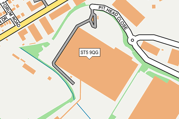
ST5 9QG is located in the Holditch & Chesterton electoral ward, within the local authority district of Newcastle-under-Lyme and the English Parliamentary constituency of Newcastle-under-Lyme. The Sub Integrated Care Board (ICB) Location is NHS Staffordshire and Stoke-on-Trent ICB - 05G and the police force is Staffordshire. This postcode has been in use since February 2006.


GetTheData
Source: OS OpenMap – Local (Ordnance Survey)
Source: OS VectorMap District (Ordnance Survey)
Licence: Open Government Licence (requires attribution)
| Easting | 383074 |
| Northing | 348246 |
| Latitude | 53.031226 |
| Longitude | -2.253836 |
GetTheData
Source: Open Postcode Geo
Licence: Open Government Licence
| Country | England |
| Postcode District | ST5 |
➜ See where ST5 is on a map ➜ Where is Newcastle-under-Lyme? | |
GetTheData
Source: Land Registry Price Paid Data
Licence: Open Government Licence
Elevation or altitude of ST5 9QG as distance above sea level:
| Metres | Feet | |
|---|---|---|
| Elevation | 140m | 459ft |
Elevation is measured from the approximate centre of the postcode, to the nearest point on an OS contour line from OS Terrain 50, which has contour spacing of ten vertical metres.
➜ How high above sea level am I? Find the elevation of your current position using your device's GPS.
GetTheData
Source: Open Postcode Elevation
Licence: Open Government Licence
| Ward | Holditch & Chesterton |
| Constituency | Newcastle-under-lyme |
GetTheData
Source: ONS Postcode Database
Licence: Open Government Licence
| Brutus Road (Loomer Road) | Chesterton | 276m |
| Dalewood Road (Coaldale Road) | Chesterton | 407m |
| Dalewood Road (Coaldale Road) | Chesterton | 425m |
| Asda Stores Warehouse (Coaldale Road) | Chesterton | 472m |
| Asda Stores Warehouse (Coaldale Road) | Chesterton | 485m |
| Longport Station | 2.8km |
| Stoke-on-Trent Station | 5.5km |
GetTheData
Source: NaPTAN
Licence: Open Government Licence
GetTheData
Source: ONS Postcode Database
Licence: Open Government Licence


➜ Get more ratings from the Food Standards Agency
GetTheData
Source: Food Standards Agency
Licence: FSA terms & conditions
| Last Collection | |||
|---|---|---|---|
| Location | Mon-Fri | Sat | Distance |
| Bradwell Post Office | 17:30 | 11:45 | 1,679m |
| Pirehill Road | 18:30 | 09:00 | 1,946m |
| Scott Hay | 16:00 | 09:30 | 2,188m |
GetTheData
Source: Dracos
Licence: Creative Commons Attribution-ShareAlike
The below table lists the International Territorial Level (ITL) codes (formerly Nomenclature of Territorial Units for Statistics (NUTS) codes) and Local Administrative Units (LAU) codes for ST5 9QG:
| ITL 1 Code | Name |
|---|---|
| TLG | West Midlands (England) |
| ITL 2 Code | Name |
| TLG2 | Shropshire and Staffordshire |
| ITL 3 Code | Name |
| TLG24 | Staffordshire CC |
| LAU 1 Code | Name |
| E07000195 | Newcastle-under-Lyme |
GetTheData
Source: ONS Postcode Directory
Licence: Open Government Licence
The below table lists the Census Output Area (OA), Lower Layer Super Output Area (LSOA), and Middle Layer Super Output Area (MSOA) for ST5 9QG:
| Code | Name | |
|---|---|---|
| OA | E00150624 | |
| LSOA | E01029559 | Newcastle-under-Lyme 007C |
| MSOA | E02006164 | Newcastle-under-Lyme 007 |
GetTheData
Source: ONS Postcode Directory
Licence: Open Government Licence
| ST5 7LB | Loomer Road | 234m |
| ST5 7QA | Forum Road | 306m |
| ST5 7QZ | Hadrian Way | 309m |
| ST5 7LL | Tuscan Way | 322m |
| ST5 7QB | Roman Drive | 352m |
| ST5 7QE | Brutus Road | 380m |
| ST5 7LE | Landseer Place | 387m |
| ST5 7QD | Tiber Drive | 411m |
| ST5 7JR | Romney Avenue | 424m |
| ST5 7QY | Palatine Drive | 450m |
GetTheData
Source: Open Postcode Geo; Land Registry Price Paid Data
Licence: Open Government Licence