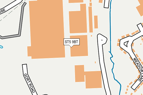
ST5 9BT is located in the Holditch & Chesterton electoral ward, within the local authority district of Newcastle-under-Lyme and the English Parliamentary constituency of Newcastle-under-Lyme. The Sub Integrated Care Board (ICB) Location is NHS Staffordshire and Stoke-on-Trent ICB - 05G and the police force is Staffordshire. This postcode has been in use since January 1980.


GetTheData
Source: OS OpenMap – Local (Ordnance Survey)
Source: OS VectorMap District (Ordnance Survey)
Licence: Open Government Licence (requires attribution)
| Easting | 383858 |
| Northing | 347664 |
| Latitude | 53.026019 |
| Longitude | -2.242117 |
GetTheData
Source: Open Postcode Geo
Licence: Open Government Licence
| Country | England |
| Postcode District | ST5 |
➜ See where ST5 is on a map ➜ Where is Newcastle-under-Lyme? | |
GetTheData
Source: Land Registry Price Paid Data
Licence: Open Government Licence
Elevation or altitude of ST5 9BT as distance above sea level:
| Metres | Feet | |
|---|---|---|
| Elevation | 130m | 427ft |
Elevation is measured from the approximate centre of the postcode, to the nearest point on an OS contour line from OS Terrain 50, which has contour spacing of ten vertical metres.
➜ How high above sea level am I? Find the elevation of your current position using your device's GPS.
GetTheData
Source: Open Postcode Elevation
Licence: Open Government Licence
| Ward | Holditch & Chesterton |
| Constituency | Newcastle-under-lyme |
GetTheData
Source: ONS Postcode Database
Licence: Open Government Licence
| Meadow Avenue (Meadow Ln) | Cross Heath | 211m |
| Tk Taxx Warehouse (Ore Close) | Chesterton | 294m |
| Tk Taxx Warehouse (Ore Close) | Chesterton | 310m |
| Dalewood Road (Ore Close) | Chesterton | 340m |
| Redmine Close (Brymbo Rd) | Cross Heath | 386m |
| Longport Station | 2.5km |
| Stoke-on-Trent Station | 4.6km |
GetTheData
Source: NaPTAN
Licence: Open Government Licence
GetTheData
Source: ONS Postcode Database
Licence: Open Government Licence


➜ Get more ratings from the Food Standards Agency
GetTheData
Source: Food Standards Agency
Licence: FSA terms & conditions
| Last Collection | |||
|---|---|---|---|
| Location | Mon-Fri | Sat | Distance |
| Pirehill Road | 18:30 | 09:00 | 1,600m |
| May Avenue | 18:00 | 09:15 | 1,680m |
| Bradwell Post Office | 17:30 | 11:45 | 1,714m |
GetTheData
Source: Dracos
Licence: Creative Commons Attribution-ShareAlike
The below table lists the International Territorial Level (ITL) codes (formerly Nomenclature of Territorial Units for Statistics (NUTS) codes) and Local Administrative Units (LAU) codes for ST5 9BT:
| ITL 1 Code | Name |
|---|---|
| TLG | West Midlands (England) |
| ITL 2 Code | Name |
| TLG2 | Shropshire and Staffordshire |
| ITL 3 Code | Name |
| TLG24 | Staffordshire CC |
| LAU 1 Code | Name |
| E07000195 | Newcastle-under-Lyme |
GetTheData
Source: ONS Postcode Directory
Licence: Open Government Licence
The below table lists the Census Output Area (OA), Lower Layer Super Output Area (LSOA), and Middle Layer Super Output Area (MSOA) for ST5 9BT:
| Code | Name | |
|---|---|---|
| OA | E00150623 | |
| LSOA | E01029559 | Newcastle-under-Lyme 007C |
| MSOA | E02006164 | Newcastle-under-Lyme 007 |
GetTheData
Source: ONS Postcode Directory
Licence: Open Government Licence
| ST5 9AH | Meadow Lane | 224m |
| ST5 9AZ | Wilmot Drive | 229m |
| ST5 9BB | Wilmot Close | 257m |
| ST5 9BA | Wilmot Drive | 267m |
| ST5 9AX | Robertson Drive | 274m |
| ST5 9AJ | Meadow Lane | 300m |
| ST5 9AQ | Meadow Avenue | 318m |
| ST5 9BD | Wilmot Drive | 339m |
| ST5 9AG | Johnson Avenue | 368m |
| ST5 9AE | Meadow Avenue | 371m |
GetTheData
Source: Open Postcode Geo; Land Registry Price Paid Data
Licence: Open Government Licence