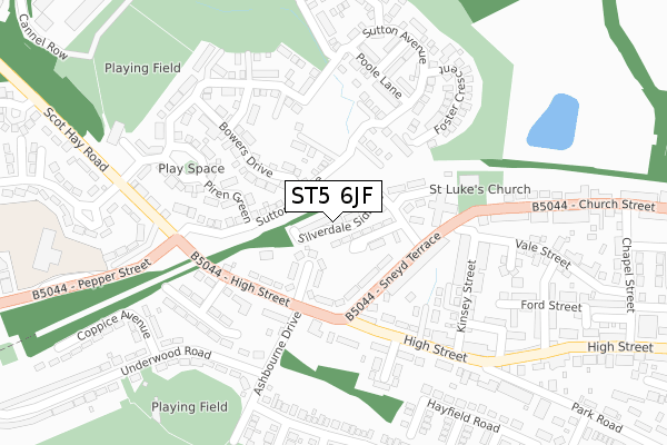
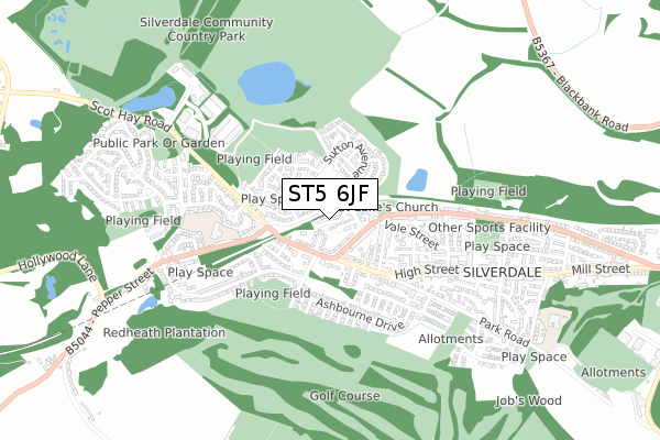
ST5 6JF is located in the Silverdale electoral ward, within the local authority district of Newcastle-under-Lyme and the English Parliamentary constituency of Newcastle-under-Lyme. The Sub Integrated Care Board (ICB) Location is NHS Staffordshire and Stoke-on-Trent ICB - 05G and the police force is Staffordshire. This postcode has been in use since June 2018.


GetTheData
Source: OS Open Zoomstack (Ordnance Survey)
Licence: Open Government Licence (requires attribution)
Attribution: Contains OS data © Crown copyright and database right 2025
Source: Open Postcode Geo
Licence: Open Government Licence (requires attribution)
Attribution: Contains OS data © Crown copyright and database right 2025; Contains Royal Mail data © Royal Mail copyright and database right 2025; Source: Office for National Statistics licensed under the Open Government Licence v.3.0
| Easting | 381576 |
| Northing | 346645 |
| Latitude | 53.016802 |
| Longitude | -2.276081 |
GetTheData
Source: Open Postcode Geo
Licence: Open Government Licence
| Country | England |
| Postcode District | ST5 |
➜ See where ST5 is on a map ➜ Where is Newcastle-under-Lyme? | |
GetTheData
Source: Land Registry Price Paid Data
Licence: Open Government Licence
| Ward | Silverdale |
| Constituency | Newcastle-under-lyme |
GetTheData
Source: ONS Postcode Database
Licence: Open Government Licence
1, SILVERDALE SIDINGS, SILVERDALE, NEWCASTLE, ST5 6JF 2021 30 JUL £265,000 |
1, SILVERDALE SIDINGS, SILVERDALE, NEWCASTLE, ST5 6JF 2018 31 AUG £265,000 |
➜ Newcastle-under-Lyme house prices
GetTheData
Source: HM Land Registry Price Paid Data
Licence: Contains HM Land Registry data © Crown copyright and database right 2025. This data is licensed under the Open Government Licence v3.0.
| The Bush Inn (High St) | Silverdale | 133m |
| The Bush Inn (High Street) | Silverdale | 166m |
| St Luke's Church (Church Street) | Silverdale | 221m |
| St Luke's Church (Church St) | Silverdale | 230m |
| Pepper Street (Scot Hay Road) | Silverdale | 265m |
| Longport Station | 4.9km |
GetTheData
Source: NaPTAN
Licence: Open Government Licence
| Percentage of properties with Next Generation Access | 100.0% |
| Percentage of properties with Superfast Broadband | 100.0% |
| Percentage of properties with Ultrafast Broadband | 0.0% |
| Percentage of properties with Full Fibre Broadband | 0.0% |
Superfast Broadband is between 30Mbps and 300Mbps
Ultrafast Broadband is > 300Mbps
| Median download speed | 55.0Mbps |
| Average download speed | 51.3Mbps |
| Maximum download speed | 70.43Mbps |
| Median upload speed | 10.0Mbps |
| Average upload speed | 10.6Mbps |
| Maximum upload speed | 19.90Mbps |
| Percentage of properties unable to receive 2Mbps | 0.0% |
| Percentage of properties unable to receive 5Mbps | 0.0% |
| Percentage of properties unable to receive 10Mbps | 0.0% |
| Percentage of properties unable to receive 30Mbps | 0.0% |
GetTheData
Source: Ofcom
Licence: Ofcom Terms of Use (requires attribution)
GetTheData
Source: ONS Postcode Database
Licence: Open Government Licence


➜ Get more ratings from the Food Standards Agency
GetTheData
Source: Food Standards Agency
Licence: FSA terms & conditions
| Last Collection | |||
|---|---|---|---|
| Location | Mon-Fri | Sat | Distance |
| Scott Hay | 16:00 | 09:30 | 174m |
| Quarry Bank | 17:00 | 09:00 | 1,143m |
| Keele University | 16:30 | 11:15 | 1,363m |
GetTheData
Source: Dracos
Licence: Creative Commons Attribution-ShareAlike
The below table lists the International Territorial Level (ITL) codes (formerly Nomenclature of Territorial Units for Statistics (NUTS) codes) and Local Administrative Units (LAU) codes for ST5 6JF:
| ITL 1 Code | Name |
|---|---|
| TLG | West Midlands (England) |
| ITL 2 Code | Name |
| TLG2 | Shropshire and Staffordshire |
| ITL 3 Code | Name |
| TLG24 | Staffordshire CC |
| LAU 1 Code | Name |
| E07000195 | Newcastle-under-Lyme |
GetTheData
Source: ONS Postcode Directory
Licence: Open Government Licence
The below table lists the Census Output Area (OA), Lower Layer Super Output Area (LSOA), and Middle Layer Super Output Area (MSOA) for ST5 6JF:
| Code | Name | |
|---|---|---|
| OA | E00150794 | |
| LSOA | E01029593 | Newcastle-under-Lyme 012B |
| MSOA | E02006169 | Newcastle-under-Lyme 012 |
GetTheData
Source: ONS Postcode Directory
Licence: Open Government Licence
| ST5 6JX | Ash Grove | 78m |
| ST5 6JU | High Street | 125m |
| ST5 6TA | Sutton Avenue | 130m |
| ST5 6JT | Sneyd Terrace | 140m |
| ST5 6JZ | High Street | 165m |
| ST5 6SL | Bowers Drive | 177m |
| ST5 6SX | Piren Green | 198m |
| ST5 6SY | Poole Lane | 216m |
| ST5 6LJ | High Street | 216m |
| ST5 6TB | Sutton Avenue | 219m |
GetTheData
Source: Open Postcode Geo; Land Registry Price Paid Data
Licence: Open Government Licence