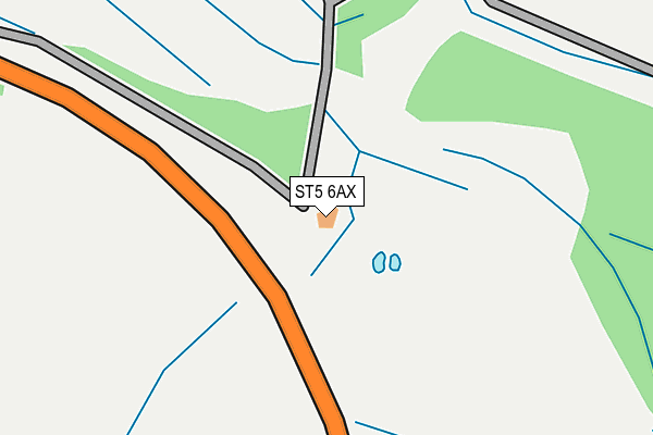
ST5 6AX is located in the Audley electoral ward, within the local authority district of Newcastle-under-Lyme and the English Parliamentary constituency of Newcastle-under-Lyme. The Sub Integrated Care Board (ICB) Location is NHS Staffordshire and Stoke-on-Trent ICB - 05G and the police force is Staffordshire. This postcode has been in use since May 2011.


GetTheData
Source: OS OpenMap – Local (Ordnance Survey)
Source: OS VectorMap District (Ordnance Survey)
Licence: Open Government Licence (requires attribution)
| Easting | 382269 |
| Northing | 347786 |
| Latitude | 53.027065 |
| Longitude | -2.265814 |
GetTheData
Source: Open Postcode Geo
Licence: Open Government Licence
| Country | England |
| Postcode District | ST5 |
➜ See where ST5 is on a map | |
GetTheData
Source: Land Registry Price Paid Data
Licence: Open Government Licence
Elevation or altitude of ST5 6AX as distance above sea level:
| Metres | Feet | |
|---|---|---|
| Elevation | 170m | 558ft |
Elevation is measured from the approximate centre of the postcode, to the nearest point on an OS contour line from OS Terrain 50, which has contour spacing of ten vertical metres.
➜ How high above sea level am I? Find the elevation of your current position using your device's GPS.
GetTheData
Source: Open Postcode Elevation
Licence: Open Government Licence
| Ward | Audley |
| Constituency | Newcastle-under-lyme |
GetTheData
Source: ONS Postcode Database
Licence: Open Government Licence
| Brutus Road (Loomer Road) | Chesterton | 988m |
| Asda Stores Warehouse (Coaldale Road) | Chesterton | 1,027m |
| Asda Stores Warehouse (Coaldale Road) | Chesterton | 1,038m |
| Dalewood Road (Coaldale Road) | Chesterton | 1,207m |
| St Luke's Church (Church Street) | Silverdale | 1,214m |
| Longport Station | 3.7km |
GetTheData
Source: NaPTAN
Licence: Open Government Licence
GetTheData
Source: ONS Postcode Database
Licence: Open Government Licence


➜ Get more ratings from the Food Standards Agency
GetTheData
Source: Food Standards Agency
Licence: FSA terms & conditions
| Last Collection | |||
|---|---|---|---|
| Location | Mon-Fri | Sat | Distance |
| Scott Hay | 16:00 | 09:30 | 1,299m |
| Quarry Bank | 17:00 | 09:00 | 2,386m |
| Keele University | 16:30 | 11:15 | 2,433m |
GetTheData
Source: Dracos
Licence: Creative Commons Attribution-ShareAlike
The below table lists the International Territorial Level (ITL) codes (formerly Nomenclature of Territorial Units for Statistics (NUTS) codes) and Local Administrative Units (LAU) codes for ST5 6AX:
| ITL 1 Code | Name |
|---|---|
| TLG | West Midlands (England) |
| ITL 2 Code | Name |
| TLG2 | Shropshire and Staffordshire |
| ITL 3 Code | Name |
| TLG24 | Staffordshire CC |
| LAU 1 Code | Name |
| E07000195 | Newcastle-under-Lyme |
GetTheData
Source: ONS Postcode Directory
Licence: Open Government Licence
The below table lists the Census Output Area (OA), Lower Layer Super Output Area (LSOA), and Middle Layer Super Output Area (MSOA) for ST5 6AX:
| Code | Name | |
|---|---|---|
| OA | E00150605 | |
| LSOA | E01029556 | Newcastle-under-Lyme 005E |
| MSOA | E02006162 | Newcastle-under-Lyme 005 |
GetTheData
Source: ONS Postcode Directory
Licence: Open Government Licence
| ST5 7QB | Roman Drive | 763m |
| ST5 7QD | Tiber Drive | 783m |
| ST5 6HU | Cheviot Close | 838m |
| ST5 7QA | Forum Road | 840m |
| ST5 7QG | Horatius Road | 882m |
| ST5 7QE | Brutus Road | 896m |
| ST5 7QZ | Hadrian Way | 927m |
| ST5 6HS | Cotswold Avenue | 949m |
| ST5 6HY | Pentland Grove | 951m |
| ST5 7LB | Loomer Road | 960m |
GetTheData
Source: Open Postcode Geo; Land Registry Price Paid Data
Licence: Open Government Licence