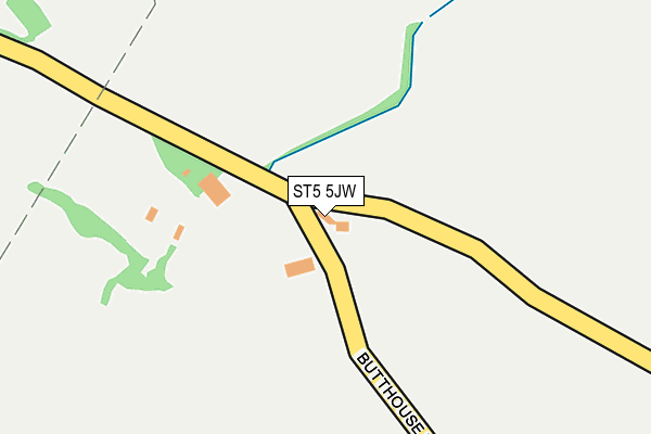
ST5 5JW is located in the Maer & Whitmore electoral ward, within the local authority district of Newcastle-under-Lyme and the English Parliamentary constituency of Stone. The Sub Integrated Care Board (ICB) Location is NHS Staffordshire and Stoke-on-Trent ICB - 05G and the police force is Staffordshire. This postcode has been in use since January 1980.


GetTheData
Source: OS OpenMap – Local (Ordnance Survey)
Source: OS VectorMap District (Ordnance Survey)
Licence: Open Government Licence (requires attribution)
| Easting | 381668 |
| Northing | 337567 |
| Latitude | 52.935185 |
| Longitude | -2.274192 |
GetTheData
Source: Open Postcode Geo
Licence: Open Government Licence
| Country | England |
| Postcode District | ST5 |
➜ See where ST5 is on a map ➜ Where is Chapel Chorlton? | |
GetTheData
Source: Land Registry Price Paid Data
Licence: Open Government Licence
Elevation or altitude of ST5 5JW as distance above sea level:
| Metres | Feet | |
|---|---|---|
| Elevation | 120m | 394ft |
Elevation is measured from the approximate centre of the postcode, to the nearest point on an OS contour line from OS Terrain 50, which has contour spacing of ten vertical metres.
➜ How high above sea level am I? Find the elevation of your current position using your device's GPS.
GetTheData
Source: Open Postcode Elevation
Licence: Open Government Licence
| Ward | Maer & Whitmore |
| Constituency | Stone |
GetTheData
Source: ONS Postcode Database
Licence: Open Government Licence
| Lower Hatton Farm (Biddles Lane) | Lower Hatton | 1,395m |
| Lower Hatton Farm (Biddles Lane) | Lower Hatton | 1,406m |
| Red Lion Ph (Biddles Lane) | Cranberry | 1,716m |
| Red Lion Ph (Biddles Lane) | Cranberry | 1,718m |
GetTheData
Source: NaPTAN
Licence: Open Government Licence
GetTheData
Source: ONS Postcode Database
Licence: Open Government Licence


➜ Get more ratings from the Food Standards Agency
GetTheData
Source: Food Standards Agency
Licence: FSA terms & conditions
| Last Collection | |||
|---|---|---|---|
| Location | Mon-Fri | Sat | Distance |
| Swynnerton Post Office | 16:30 | 10:45 | 4,029m |
| Dairyfields | 18:00 | 09:30 | 5,985m |
| Allerton Road | 17:30 | 11:00 | 6,240m |
GetTheData
Source: Dracos
Licence: Creative Commons Attribution-ShareAlike
The below table lists the International Territorial Level (ITL) codes (formerly Nomenclature of Territorial Units for Statistics (NUTS) codes) and Local Administrative Units (LAU) codes for ST5 5JW:
| ITL 1 Code | Name |
|---|---|
| TLG | West Midlands (England) |
| ITL 2 Code | Name |
| TLG2 | Shropshire and Staffordshire |
| ITL 3 Code | Name |
| TLG24 | Staffordshire CC |
| LAU 1 Code | Name |
| E07000195 | Newcastle-under-Lyme |
GetTheData
Source: ONS Postcode Directory
Licence: Open Government Licence
The below table lists the Census Output Area (OA), Lower Layer Super Output Area (LSOA), and Middle Layer Super Output Area (MSOA) for ST5 5JW:
| Code | Name | |
|---|---|---|
| OA | E00150666 | |
| LSOA | E01029570 | Newcastle-under-Lyme 016B |
| MSOA | E02006173 | Newcastle-under-Lyme 016 |
GetTheData
Source: ONS Postcode Directory
Licence: Open Government Licence
| ST5 5JN | 525m | |
| ST5 4EN | The Rowe | 947m |
| ST21 6SH | Hatton Waterworks Cottages | 1106m |
| ST5 5JH | Stableford Court | 1173m |
| ST5 5JL | Haddon Lane | 1286m |
| ST21 6SD | Hatton Manor | 1386m |
| ST5 5JQ | 1575m | |
| ST21 6RF | Weston | 1580m |
| ST21 6RD | Bowers | 1632m |
| ST21 6SQ | Cranberry | 1734m |
GetTheData
Source: Open Postcode Geo; Land Registry Price Paid Data
Licence: Open Government Licence