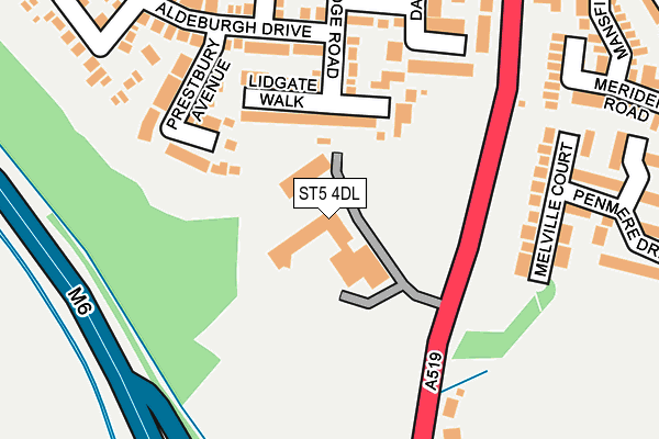
ST5 4DL lies on Clayton Road in Newcastle. ST5 4DL is located in the Westbury Park & Northwood electoral ward, within the local authority district of Newcastle-under-Lyme and the English Parliamentary constituency of Newcastle-under-Lyme. The Sub Integrated Care Board (ICB) Location is NHS Staffordshire and Stoke-on-Trent ICB - 05G and the police force is Staffordshire. This postcode has been in use since January 1980.


GetTheData
Source: OS OpenMap – Local (Ordnance Survey)
Source: OS VectorMap District (Ordnance Survey)
Licence: Open Government Licence (requires attribution)
| Easting | 384989 |
| Northing | 342400 |
| Latitude | 52.978733 |
| Longitude | -2.225008 |
GetTheData
Source: Open Postcode Geo
Licence: Open Government Licence
| Street | Clayton Road |
| Town/City | Newcastle |
| Country | England |
| Postcode District | ST5 |
➜ See where ST5 is on a map ➜ Where is Newcastle-under-Lyme? | |
GetTheData
Source: Land Registry Price Paid Data
Licence: Open Government Licence
Elevation or altitude of ST5 4DL as distance above sea level:
| Metres | Feet | |
|---|---|---|
| Elevation | 120m | 394ft |
Elevation is measured from the approximate centre of the postcode, to the nearest point on an OS contour line from OS Terrain 50, which has contour spacing of ten vertical metres.
➜ How high above sea level am I? Find the elevation of your current position using your device's GPS.
GetTheData
Source: Open Postcode Elevation
Licence: Open Government Licence
| Ward | Westbury Park & Northwood |
| Constituency | Newcastle-under-lyme |
GetTheData
Source: ONS Postcode Database
Licence: Open Government Licence
| The Spinney (Ferndown Drive) | Clayton Village | 359m |
| Mansfield Close (Ferndown Drive) | Clayton Village | 363m |
| Ashridge Avenue (Westbury Road) | Westbury Park | 447m |
| Moss Rise (Ferndown Drive South) | Clayton Village | 453m |
| The Brackens (Westbury Rd) | Westbury Park | 471m |
| Stoke-on-Trent Station | 4.4km |
| Wedgwood Station | 4.8km |
| Barlaston Station | 5.5km |
GetTheData
Source: NaPTAN
Licence: Open Government Licence
GetTheData
Source: ONS Postcode Database
Licence: Open Government Licence


➜ Get more ratings from the Food Standards Agency
GetTheData
Source: Food Standards Agency
Licence: FSA terms & conditions
| Last Collection | |||
|---|---|---|---|
| Location | Mon-Fri | Sat | Distance |
| Windermere Road Post Office | 17:00 | 11:45 | 1,346m |
| Dairyfields | 18:00 | 09:30 | 1,666m |
| Bankhouse Road | 17:00 | 09:15 | 1,746m |
GetTheData
Source: Dracos
Licence: Creative Commons Attribution-ShareAlike
The below table lists the International Territorial Level (ITL) codes (formerly Nomenclature of Territorial Units for Statistics (NUTS) codes) and Local Administrative Units (LAU) codes for ST5 4DL:
| ITL 1 Code | Name |
|---|---|
| TLG | West Midlands (England) |
| ITL 2 Code | Name |
| TLG2 | Shropshire and Staffordshire |
| ITL 3 Code | Name |
| TLG24 | Staffordshire CC |
| LAU 1 Code | Name |
| E07000195 | Newcastle-under-Lyme |
GetTheData
Source: ONS Postcode Directory
Licence: Open Government Licence
The below table lists the Census Output Area (OA), Lower Layer Super Output Area (LSOA), and Middle Layer Super Output Area (MSOA) for ST5 4DL:
| Code | Name | |
|---|---|---|
| OA | E00150779 | |
| LSOA | E01033257 | Newcastle-under-Lyme 015H |
| MSOA | E02006172 | Newcastle-under-Lyme 015 |
GetTheData
Source: ONS Postcode Directory
Licence: Open Government Licence
| ST5 4LT | Lidgate Walk | 92m |
| ST5 4QY | Prestbury Avenue | 150m |
| ST5 4HJ | Melville Court | 188m |
| ST5 4LH | Aldeburgh Drive | 191m |
| ST5 4HD | Glendale Court | 248m |
| ST5 4LA | Woodbridge Road | 250m |
| ST5 4HH | Penmere Drive | 252m |
| ST5 4LW | Darsham Gardens | 256m |
| ST5 4LS | Morston Drive | 277m |
| ST5 4LB | Sudbury Place | 277m |
GetTheData
Source: Open Postcode Geo; Land Registry Price Paid Data
Licence: Open Government Licence