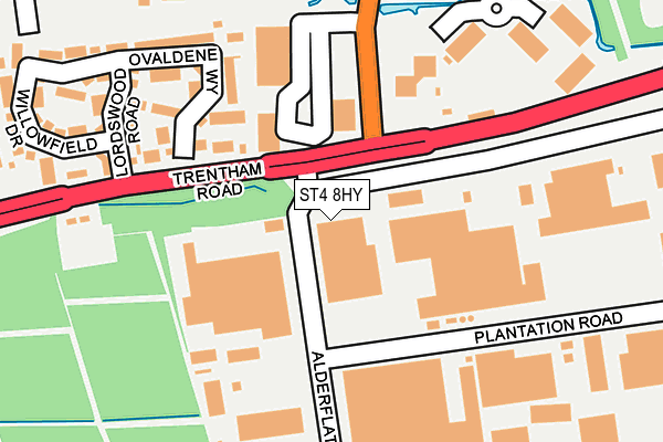
ST4 8HY is located in the Hanford, Newstead & Trentham electoral ward, within the unitary authority of Stoke-on-Trent and the English Parliamentary constituency of Stoke-on-Trent South. The Sub Integrated Care Board (ICB) Location is NHS Staffordshire and Stoke-on-Trent ICB - 05W and the police force is Staffordshire. This postcode has been in use since June 2017.


GetTheData
Source: OS OpenMap – Local (Ordnance Survey)
Source: OS VectorMap District (Ordnance Survey)
Licence: Open Government Licence (requires attribution)
| Easting | 389187 |
| Northing | 341055 |
| Latitude | 52.966762 |
| Longitude | -2.162441 |
GetTheData
Source: Open Postcode Geo
Licence: Open Government Licence
| Country | England |
| Postcode District | ST4 |
➜ See where ST4 is on a map ➜ Where is Stoke-on-Trent? | |
GetTheData
Source: Land Registry Price Paid Data
Licence: Open Government Licence
| Ward | Hanford, Newstead & Trentham |
| Constituency | Stoke-on-trent South |
GetTheData
Source: ONS Postcode Database
Licence: Open Government Licence
| Shepley Grove (Waterside Drive) | Newstead | 217m |
| Magdalen Road (Trentham Road) | Newstead | 219m |
| Crowcrofts Road (Trentham Road) | Newstead | 224m |
| Selby Walk (Trentham Road) | Blurton | 270m |
| Ufton Close (Waterside Drive) | Newstead | 348m |
| Wedgwood Station | 1.8km |
| Barlaston Station | 2.7km |
| Longton Station | 3.1km |
GetTheData
Source: NaPTAN
Licence: Open Government Licence
GetTheData
Source: ONS Postcode Database
Licence: Open Government Licence


➜ Get more ratings from the Food Standards Agency
GetTheData
Source: Food Standards Agency
Licence: FSA terms & conditions
| Last Collection | |||
|---|---|---|---|
| Location | Mon-Fri | Sat | Distance |
| Trentham Lakes South | 16:00 | 11:15 | 454m |
| Beaconsfield Drive | 16:15 | 12:30 | 482m |
| Newstead Post Office | 16:30 | 11:30 | 553m |
GetTheData
Source: Dracos
Licence: Creative Commons Attribution-ShareAlike
The below table lists the International Territorial Level (ITL) codes (formerly Nomenclature of Territorial Units for Statistics (NUTS) codes) and Local Administrative Units (LAU) codes for ST4 8HY:
| ITL 1 Code | Name |
|---|---|
| TLG | West Midlands (England) |
| ITL 2 Code | Name |
| TLG2 | Shropshire and Staffordshire |
| ITL 3 Code | Name |
| TLG23 | Stoke-on-Trent |
| LAU 1 Code | Name |
| E06000021 | Stoke-on-Trent |
GetTheData
Source: ONS Postcode Directory
Licence: Open Government Licence
The below table lists the Census Output Area (OA), Lower Layer Super Output Area (LSOA), and Middle Layer Super Output Area (MSOA) for ST4 8HY:
| Code | Name | |
|---|---|---|
| OA | E00071869 | |
| LSOA | E01014238 | Stoke-on-Trent 032D |
| MSOA | E02002982 | Stoke-on-Trent 032 |
GetTheData
Source: ONS Postcode Directory
Licence: Open Government Licence
| ST3 3NN | Springside Place | 179m |
| ST3 3NS | Shirebrook Close | 195m |
| ST3 3NP | Shepley Grove | 213m |
| ST3 3HR | Magdalen Walk | 264m |
| ST3 3NL | Waterside Drive | 265m |
| ST3 3NJ | Waterside Drive | 270m |
| ST3 3DF | Penton Walk | 287m |
| ST4 8HX | Newstead Industrial Trading Estate | 296m |
| ST3 3NB | Umberleigh Road | 318m |
| ST3 3DJ | Waterside Drive | 339m |
GetTheData
Source: Open Postcode Geo; Land Registry Price Paid Data
Licence: Open Government Licence