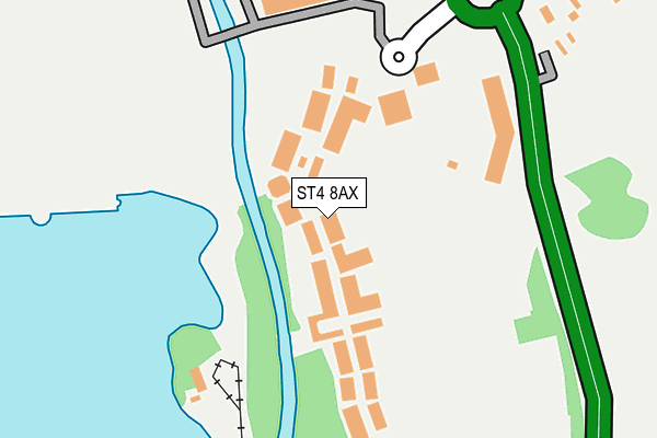
ST4 8AX is located in the Swynnerton & Oulton electoral ward, within the local authority district of Stafford and the English Parliamentary constituency of Stone. The Sub Integrated Care Board (ICB) Location is NHS Staffordshire and Stoke-on-Trent ICB - 05V and the police force is Staffordshire. This postcode has been in use since January 1980.


GetTheData
Source: OS OpenMap – Local (Ordnance Survey)
Source: OS VectorMap District (Ordnance Survey)
Licence: Open Government Licence (requires attribution)
| Easting | 386815 |
| Northing | 340578 |
| Latitude | 52.962420 |
| Longitude | -2.197738 |
GetTheData
Source: Open Postcode Geo
Licence: Open Government Licence
| Country | England |
| Postcode District | ST4 |
➜ See where ST4 is on a map ➜ Where is Stoke-on-Trent? | |
GetTheData
Source: Land Registry Price Paid Data
Licence: Open Government Licence
Elevation or altitude of ST4 8AX as distance above sea level:
| Metres | Feet | |
|---|---|---|
| Elevation | 100m | 328ft |
Elevation is measured from the approximate centre of the postcode, to the nearest point on an OS contour line from OS Terrain 50, which has contour spacing of ten vertical metres.
➜ How high above sea level am I? Find the elevation of your current position using your device's GPS.
GetTheData
Source: Open Postcode Elevation
Licence: Open Government Licence
| Ward | Swynnerton & Oulton |
| Constituency | Stone |
GetTheData
Source: ONS Postcode Database
Licence: Open Government Licence
| Trentham Gardens (Trentham Estate) | Trentham | 132m |
| Longton Road (Stone Road) | Trentham | 212m |
| Trentham Gardens (Stone Road) | Trentham | 398m |
| Poachers Cottage Ph (Trentham Gardens) | Trentham | 451m |
| Brinsley Avenue (Longton Road) | Trentham | 616m |
| Wedgwood Station | 2.2km |
| Barlaston Station | 2.9km |
| Longton Station | 5.1km |
GetTheData
Source: NaPTAN
Licence: Open Government Licence
| Median download speed | 18.9Mbps |
| Average download speed | 17.7Mbps |
| Maximum download speed | 20.67Mbps |
| Median upload speed | 1.0Mbps |
| Average upload speed | 1.0Mbps |
| Maximum upload speed | 1.28Mbps |
GetTheData
Source: Ofcom
Licence: Ofcom Terms of Use (requires attribution)
GetTheData
Source: ONS Postcode Database
Licence: Open Government Licence


➜ Get more ratings from the Food Standards Agency
GetTheData
Source: Food Standards Agency
Licence: FSA terms & conditions
| Last Collection | |||
|---|---|---|---|
| Location | Mon-Fri | Sat | Distance |
| Brinsley Avenue | 18:00 | 09:00 | 551m |
| Allerton Road | 17:30 | 11:00 | 781m |
| Dairyfields | 18:00 | 09:30 | 943m |
GetTheData
Source: Dracos
Licence: Creative Commons Attribution-ShareAlike
| Risk of ST4 8AX flooding from rivers and sea | Medium |
| ➜ ST4 8AX flood map | |
GetTheData
Source: Open Flood Risk by Postcode
Licence: Open Government Licence
The below table lists the International Territorial Level (ITL) codes (formerly Nomenclature of Territorial Units for Statistics (NUTS) codes) and Local Administrative Units (LAU) codes for ST4 8AX:
| ITL 1 Code | Name |
|---|---|
| TLG | West Midlands (England) |
| ITL 2 Code | Name |
| TLG2 | Shropshire and Staffordshire |
| ITL 3 Code | Name |
| TLG24 | Staffordshire CC |
| LAU 1 Code | Name |
| E07000197 | Stafford |
GetTheData
Source: ONS Postcode Directory
Licence: Open Government Licence
The below table lists the Census Output Area (OA), Lower Layer Super Output Area (LSOA), and Middle Layer Super Output Area (MSOA) for ST4 8AX:
| Code | Name | |
|---|---|---|
| OA | E00151581 | |
| LSOA | E01029748 | Stafford 002D |
| MSOA | E02006189 | Stafford 002 |
GetTheData
Source: ONS Postcode Directory
Licence: Open Government Licence
| ST4 8NF | Stone Road | 272m |
| ST4 8NB | Longton Road | 376m |
| ST4 8NE | Paddock Rise | 382m |
| ST4 8ND | Longton Road | 418m |
| ST4 8NA | Longton Road | 426m |
| ST4 8LH | Swanton Place | 450m |
| ST4 8LQ | Werburgh Drive | 456m |
| ST4 8AA | Stone Road | 521m |
| ST4 8LT | Brinsley Avenue | 540m |
| ST4 8LF | Werburgh Drive | 546m |
GetTheData
Source: Open Postcode Geo; Land Registry Price Paid Data
Licence: Open Government Licence