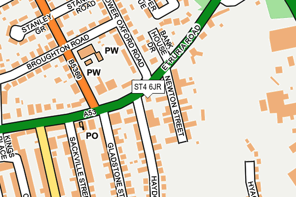
ST4 6JR is located in the Basford & Hartshill electoral ward, within the unitary authority of Stoke-on-Trent and the English Parliamentary constituency of Stoke-on-Trent Central. The Sub Integrated Care Board (ICB) Location is NHS Staffordshire and Stoke-on-Trent ICB - 05W and the police force is Staffordshire. This postcode has been in use since June 2017.


GetTheData
Source: OS OpenMap – Local (Ordnance Survey)
Source: OS VectorMap District (Ordnance Survey)
Licence: Open Government Licence (requires attribution)
| Easting | 386152 |
| Northing | 346627 |
| Latitude | 53.016779 |
| Longitude | -2.207870 |
GetTheData
Source: Open Postcode Geo
Licence: Open Government Licence
| Country | England |
| Postcode District | ST4 |
➜ See where ST4 is on a map ➜ Where is Stoke-on-Trent? | |
GetTheData
Source: Land Registry Price Paid Data
Licence: Open Government Licence
| Ward | Basford & Hartshill |
| Constituency | Stoke-on-trent Central |
GetTheData
Source: ONS Postcode Database
Licence: Open Government Licence
| Haydon Street (Etruria Road) | Etruria | 32m |
| Haydon Street (Etruria Road) | Basford | 33m |
| St Mark's Church (Basford Park Road) | Basford | 155m |
| St Mark's Church (Basford Park Road) | Basford | 221m |
| The Avenue (Etruria Road) | Etruria | 287m |
| Stoke-on-Trent Station | 2.1km |
| Longport Station | 2.9km |
| Longton Station | 5.6km |
GetTheData
Source: NaPTAN
Licence: Open Government Licence
GetTheData
Source: ONS Postcode Database
Licence: Open Government Licence

➜ Get more ratings from the Food Standards Agency
GetTheData
Source: Food Standards Agency
Licence: FSA terms & conditions
| Last Collection | |||
|---|---|---|---|
| Location | Mon-Fri | Sat | Distance |
| Basford Post Office | 17:00 | 11:45 | 134m |
| Curzon Street | 18:00 | 09:30 | 318m |
| Basford Food & Wine Supermarke | 18:00 | 09:30 | 539m |
GetTheData
Source: Dracos
Licence: Creative Commons Attribution-ShareAlike
The below table lists the International Territorial Level (ITL) codes (formerly Nomenclature of Territorial Units for Statistics (NUTS) codes) and Local Administrative Units (LAU) codes for ST4 6JR:
| ITL 1 Code | Name |
|---|---|
| TLG | West Midlands (England) |
| ITL 2 Code | Name |
| TLG2 | Shropshire and Staffordshire |
| ITL 3 Code | Name |
| TLG23 | Stoke-on-Trent |
| LAU 1 Code | Name |
| E06000021 | Stoke-on-Trent |
GetTheData
Source: ONS Postcode Directory
Licence: Open Government Licence
The below table lists the Census Output Area (OA), Lower Layer Super Output Area (LSOA), and Middle Layer Super Output Area (MSOA) for ST4 6JR:
| Code | Name | |
|---|---|---|
| OA | E00072157 | |
| LSOA | E01014291 | Stoke-on-Trent 018D |
| MSOA | E02002968 | Stoke-on-Trent 018 |
GetTheData
Source: ONS Postcode Directory
Licence: Open Government Licence
| ST5 0SY | Etruria Road | 52m |
| ST4 6JL | Newton Street | 59m |
| ST4 6JN | Newton Street | 80m |
| ST5 0QQ | Bankhouse Drive | 125m |
| ST4 6JJ | Etruria Road | 130m |
| ST4 6JE | Haydon Street | 144m |
| ST5 0PG | Basford Park Road | 163m |
| ST4 6HT | Etruria Road | 180m |
| ST5 0PB | Lower Oxford Road | 183m |
| ST5 0QG | Cooper Avenue | 183m |
GetTheData
Source: Open Postcode Geo; Land Registry Price Paid Data
Licence: Open Government Licence