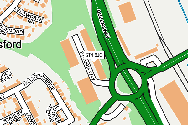
ST4 6JQ is located in the May Bank electoral ward, within the local authority district of Newcastle-under-Lyme and the English Parliamentary constituency of Newcastle-under-Lyme. The Sub Integrated Care Board (ICB) Location is NHS Staffordshire and Stoke-on-Trent ICB - 05G and the police force is Staffordshire. This postcode has been in use since June 1981.


GetTheData
Source: OS OpenMap – Local (Ordnance Survey)
Source: OS VectorMap District (Ordnance Survey)
Licence: Open Government Licence (requires attribution)
| Easting | 386285 |
| Northing | 347004 |
| Latitude | 53.020172 |
| Longitude | -2.205903 |
GetTheData
Source: Open Postcode Geo
Licence: Open Government Licence
| Country | England |
| Postcode District | ST4 |
➜ See where ST4 is on a map ➜ Where is Newcastle-under-Lyme? | |
GetTheData
Source: Land Registry Price Paid Data
Licence: Open Government Licence
Elevation or altitude of ST4 6JQ as distance above sea level:
| Metres | Feet | |
|---|---|---|
| Elevation | 130m | 427ft |
Elevation is measured from the approximate centre of the postcode, to the nearest point on an OS contour line from OS Terrain 50, which has contour spacing of ten vertical metres.
➜ How high above sea level am I? Find the elevation of your current position using your device's GPS.
GetTheData
Source: Open Postcode Elevation
Licence: Open Government Licence
| Ward | May Bank |
| Constituency | Newcastle-under-lyme |
GetTheData
Source: ONS Postcode Database
Licence: Open Government Licence
| Queensway Roundabout (Etruria Road) | Etruria | 287m |
| Haydon Street (Etruria Road) | Etruria | 368m |
| Forge Lane (Etruria Road) | Etruria | 392m |
| Haydon Street (Etruria Road) | Basford | 401m |
| St Mark's Church (Basford Park Road) | Basford | 406m |
| Stoke-on-Trent Station | 2.2km |
| Longport Station | 2.5km |
| Longton Station | 5.7km |
GetTheData
Source: NaPTAN
Licence: Open Government Licence
Estimated total energy consumption in ST4 6JQ by fuel type, 2015.
| Consumption (kWh) | 219,451 |
|---|---|
| Meter count | 9 |
| Mean (kWh/meter) | 24,383 |
| Median (kWh/meter) | 11,507 |
GetTheData
Source: Postcode level gas estimates: 2015 (experimental)
Source: Postcode level electricity estimates: 2015 (experimental)
Licence: Open Government Licence
GetTheData
Source: ONS Postcode Database
Licence: Open Government Licence


➜ Get more ratings from the Food Standards Agency
GetTheData
Source: Food Standards Agency
Licence: FSA terms & conditions
| Last Collection | |||
|---|---|---|---|
| Location | Mon-Fri | Sat | Distance |
| Curzon Street | 18:00 | 09:30 | 389m |
| Basford Food & Wine Supermarke | 18:00 | 09:30 | 407m |
| Basford Post Office | 17:00 | 11:45 | 493m |
GetTheData
Source: Dracos
Licence: Creative Commons Attribution-ShareAlike
The below table lists the International Territorial Level (ITL) codes (formerly Nomenclature of Territorial Units for Statistics (NUTS) codes) and Local Administrative Units (LAU) codes for ST4 6JQ:
| ITL 1 Code | Name |
|---|---|
| TLG | West Midlands (England) |
| ITL 2 Code | Name |
| TLG2 | Shropshire and Staffordshire |
| ITL 3 Code | Name |
| TLG24 | Staffordshire CC |
| LAU 1 Code | Name |
| E07000195 | Newcastle-under-Lyme |
GetTheData
Source: ONS Postcode Directory
Licence: Open Government Licence
The below table lists the Census Output Area (OA), Lower Layer Super Output Area (LSOA), and Middle Layer Super Output Area (MSOA) for ST4 6JQ:
| Code | Name | |
|---|---|---|
| OA | E00150723 | |
| LSOA | E01029580 | Newcastle-under-Lyme 009C |
| MSOA | E02006166 | Newcastle-under-Lyme 009 |
GetTheData
Source: ONS Postcode Directory
Licence: Open Government Licence
| ST5 0QF | Hilltop Avenue | 165m |
| ST4 6JW | Etruria Road | 203m |
| ST5 0LE | Kenilworth Grove | 233m |
| ST5 0QG | Cooper Avenue | 238m |
| ST5 0LF | Richmond Grove | 259m |
| ST5 0LD | Warwick Grove | 259m |
| ST5 0PB | Lower Oxford Road | 272m |
| ST5 0QQ | Bankhouse Drive | 275m |
| ST4 6JJ | Etruria Road | 291m |
| ST5 0PD | Curzon Street | 298m |
GetTheData
Source: Open Postcode Geo; Land Registry Price Paid Data
Licence: Open Government Licence