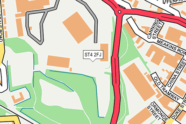
ST4 2FJ is located in the Fenton West & Mount Pleasant electoral ward, within the unitary authority of Stoke-on-Trent and the English Parliamentary constituency of Stoke-on-Trent South. The Sub Integrated Care Board (ICB) Location is NHS Staffordshire and Stoke-on-Trent ICB - 05W and the police force is Staffordshire. This postcode has been in use since April 2017.


GetTheData
Source: OS OpenMap – Local (Ordnance Survey)
Source: OS VectorMap District (Ordnance Survey)
Licence: Open Government Licence (requires attribution)
| Easting | 389540 |
| Northing | 344339 |
| Latitude | 52.996290 |
| Longitude | -2.157293 |
GetTheData
Source: Open Postcode Geo
Licence: Open Government Licence
| Country | England |
| Postcode District | ST4 |
➜ See where ST4 is on a map ➜ Where is Stoke-on-Trent? | |
GetTheData
Source: Land Registry Price Paid Data
Licence: Open Government Licence
| Ward | Fenton West & Mount Pleasant |
| Constituency | Stoke-on-trent South |
GetTheData
Source: ONS Postcode Database
Licence: Open Government Licence
| Duke Of Wellington (King Street) | Fenton | 225m |
| Park Street | Fenton | 259m |
| Park Street | Fenton | 261m |
| Duke Street (King Street) | Fenton | 275m |
| Victoria Place (Victoria Road) | Fenton | 343m |
| Longton Station | 1.5km |
| Stoke-on-Trent Station | 2.1km |
GetTheData
Source: NaPTAN
Licence: Open Government Licence
GetTheData
Source: ONS Postcode Database
Licence: Open Government Licence


➜ Get more ratings from the Food Standards Agency
GetTheData
Source: Food Standards Agency
Licence: FSA terms & conditions
| Last Collection | |||
|---|---|---|---|
| Location | Mon-Fri | Sat | Distance |
| Warrington Street | 17:20 | 11:30 | 436m |
| Heron Cross Post Office | 17:30 | 11:45 | 480m |
| Fenton Post Office | 17:45 | 12:15 | 568m |
GetTheData
Source: Dracos
Licence: Creative Commons Attribution-ShareAlike
The below table lists the International Territorial Level (ITL) codes (formerly Nomenclature of Territorial Units for Statistics (NUTS) codes) and Local Administrative Units (LAU) codes for ST4 2FJ:
| ITL 1 Code | Name |
|---|---|
| TLG | West Midlands (England) |
| ITL 2 Code | Name |
| TLG2 | Shropshire and Staffordshire |
| ITL 3 Code | Name |
| TLG23 | Stoke-on-Trent |
| LAU 1 Code | Name |
| E06000021 | Stoke-on-Trent |
GetTheData
Source: ONS Postcode Directory
Licence: Open Government Licence
The below table lists the Census Output Area (OA), Lower Layer Super Output Area (LSOA), and Middle Layer Super Output Area (MSOA) for ST4 2FJ:
| Code | Name | |
|---|---|---|
| OA | E00072093 | |
| LSOA | E01014274 | Stoke-on-Trent 020A |
| MSOA | E02002970 | Stoke-on-Trent 020 |
GetTheData
Source: ONS Postcode Directory
Licence: Open Government Licence
| ST4 3ND | King Street | 161m |
| ST4 3LZ | King Street | 187m |
| ST4 3RR | Ormonde Street | 240m |
| ST4 3JB | Park Street | 241m |
| ST4 3JF | Appleton Court | 264m |
| ST4 3JE | Elworth Court | 277m |
| ST4 3PA | Duke Street | 296m |
| ST4 3JJ | Fenpark Road | 297m |
| ST4 3NR | Duke Street | 299m |
| ST4 3LT | Glebedale Road | 315m |
GetTheData
Source: Open Postcode Geo; Land Registry Price Paid Data
Licence: Open Government Licence