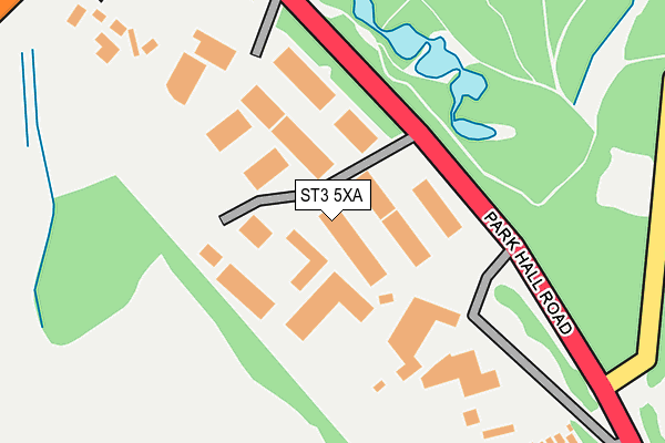
ST3 5XA is located in the Meir Hay North, Parkhall & Weston Coyney electoral ward, within the unitary authority of Stoke-on-Trent and the English Parliamentary constituency of Stoke-on-Trent South. The Sub Integrated Care Board (ICB) Location is NHS Staffordshire and Stoke-on-Trent ICB - 05W and the police force is Staffordshire. This postcode has been in use since January 1991.


GetTheData
Source: OS OpenMap – Local (Ordnance Survey)
Source: OS VectorMap District (Ordnance Survey)
Licence: Open Government Licence (requires attribution)
| Easting | 392234 |
| Northing | 344506 |
| Latitude | 52.997820 |
| Longitude | -2.117159 |
GetTheData
Source: Open Postcode Geo
Licence: Open Government Licence
| Country | England |
| Postcode District | ST3 |
➜ See where ST3 is on a map ➜ Where is Stoke-on-Trent? | |
GetTheData
Source: Land Registry Price Paid Data
Licence: Open Government Licence
Elevation or altitude of ST3 5XA as distance above sea level:
| Metres | Feet | |
|---|---|---|
| Elevation | 190m | 623ft |
Elevation is measured from the approximate centre of the postcode, to the nearest point on an OS contour line from OS Terrain 50, which has contour spacing of ten vertical metres.
➜ How high above sea level am I? Find the elevation of your current position using your device's GPS.
GetTheData
Source: Open Postcode Elevation
Licence: Open Government Licence
| Ward | Meir Hay North, Parkhall & Weston Coyney |
| Constituency | Stoke-on-trent South |
GetTheData
Source: ONS Postcode Database
Licence: Open Government Licence
| Mossfield Road (Anchor Road) | Adderley Green | 383m |
| Mossfield Road (Anchor Road) | Adderley Green | 400m |
| Defoe Drive (Park Hall Road) | Park Hall | 427m |
| Brightgreen Street (Bambury Street) | Adderley Green | 491m |
| Brightgreen Street (Bambury Street) | Adderley Green | 494m |
| Longton Station | 1.6km |
| Stoke-on-Trent Station | 4.4km |
| Blythe Bridge Station | 4.7km |
GetTheData
Source: NaPTAN
Licence: Open Government Licence
| Median download speed | 33.2Mbps |
| Average download speed | 34.0Mbps |
| Maximum download speed | 72.62Mbps |
| Median upload speed | 7.5Mbps |
| Average upload speed | 7.7Mbps |
| Maximum upload speed | 16.93Mbps |
GetTheData
Source: Ofcom
Licence: Ofcom Terms of Use (requires attribution)
Estimated total energy consumption in ST3 5XA by fuel type, 2015.
| Consumption (kWh) | 252,659 |
|---|---|
| Meter count | 18 |
| Mean (kWh/meter) | 14,037 |
| Median (kWh/meter) | 8,439 |
GetTheData
Source: Postcode level gas estimates: 2015 (experimental)
Source: Postcode level electricity estimates: 2015 (experimental)
Licence: Open Government Licence
GetTheData
Source: ONS Postcode Database
Licence: Open Government Licence


➜ Get more ratings from the Food Standards Agency
GetTheData
Source: Food Standards Agency
Licence: FSA terms & conditions
| Last Collection | |||
|---|---|---|---|
| Location | Mon-Fri | Sat | Distance |
| Ashwood | 18:00 | 10:15 | 1,191m |
| Newmount Road | 17:30 | 11:15 | 1,465m |
| Gladstone Pottery | 14:45 | 1,561m | |
GetTheData
Source: Dracos
Licence: Creative Commons Attribution-ShareAlike
The below table lists the International Territorial Level (ITL) codes (formerly Nomenclature of Territorial Units for Statistics (NUTS) codes) and Local Administrative Units (LAU) codes for ST3 5XA:
| ITL 1 Code | Name |
|---|---|
| TLG | West Midlands (England) |
| ITL 2 Code | Name |
| TLG2 | Shropshire and Staffordshire |
| ITL 3 Code | Name |
| TLG23 | Stoke-on-Trent |
| LAU 1 Code | Name |
| E06000021 | Stoke-on-Trent |
GetTheData
Source: ONS Postcode Directory
Licence: Open Government Licence
The below table lists the Census Output Area (OA), Lower Layer Super Output Area (LSOA), and Middle Layer Super Output Area (MSOA) for ST3 5XA:
| Code | Name | |
|---|---|---|
| OA | E00072195 | |
| LSOA | E01014296 | Stoke-on-Trent 022A |
| MSOA | E02002972 | Stoke-on-Trent 022 |
GetTheData
Source: ONS Postcode Directory
Licence: Open Government Licence
| ST3 5SZ | Hazlitt Way | 306m |
| ST3 5BT | Short Bambury Street | 349m |
| ST3 5SU | Harington Drive | 372m |
| ST3 5YF | Verona Grove | 381m |
| ST3 5ST | Harington Drive | 387m |
| ST3 5SY | Linacre Way | 392m |
| ST3 5BL | Anchor Road | 395m |
| ST3 5BS | Anchor Road | 397m |
| ST3 5BB | Ashridge Grove | 408m |
| ST3 5SX | Webster Avenue | 411m |
GetTheData
Source: Open Postcode Geo; Land Registry Price Paid Data
Licence: Open Government Licence