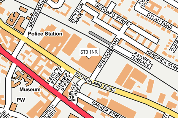
ST3 1NR is located in the Longton & Meir Hay South electoral ward, within the unitary authority of Stoke-on-Trent and the English Parliamentary constituency of Stoke-on-Trent South. The Sub Integrated Care Board (ICB) Location is NHS Staffordshire and Stoke-on-Trent ICB - 05W and the police force is Staffordshire. This postcode has been in use since June 2017.


GetTheData
Source: OS OpenMap – Local (Ordnance Survey)
Source: OS VectorMap District (Ordnance Survey)
Licence: Open Government Licence (requires attribution)
| Easting | 391493 |
| Northing | 343365 |
| Latitude | 52.987569 |
| Longitude | -2.128169 |
GetTheData
Source: Open Postcode Geo
Licence: Open Government Licence
| Country | England |
| Postcode District | ST3 |
➜ See where ST3 is on a map ➜ Where is Stoke-on-Trent? | |
GetTheData
Source: Land Registry Price Paid Data
Licence: Open Government Licence
| Ward | Longton & Meir Hay South |
| Constituency | Stoke-on-trent South |
GetTheData
Source: ONS Postcode Database
Licence: Open Government Licence
| Landon Street (Sutherland Road) | Longton | 115m |
| Landon Street (Sutherland Road) | Longton | 122m |
| Sutherland Road | Longton | 163m |
| St James' Church (Uttoxeter Road) | Longton | 206m |
| St James' Church (Uttoxeter Road) | Longton | 219m |
| Longton Station | 0.7km |
| Stoke-on-Trent Station | 4.2km |
| Blythe Bridge Station | 4.6km |
GetTheData
Source: NaPTAN
Licence: Open Government Licence
GetTheData
Source: ONS Postcode Database
Licence: Open Government Licence


➜ Get more ratings from the Food Standards Agency
GetTheData
Source: Food Standards Agency
Licence: FSA terms & conditions
| Last Collection | |||
|---|---|---|---|
| Location | Mon-Fri | Sat | Distance |
| Gladstone Pottery | 14:45 | 247m | |
| The Strand | 17:30 | 11:00 | 537m |
| Lilleshall Street | 16:00 | 11:00 | 722m |
GetTheData
Source: Dracos
Licence: Creative Commons Attribution-ShareAlike
The below table lists the International Territorial Level (ITL) codes (formerly Nomenclature of Territorial Units for Statistics (NUTS) codes) and Local Administrative Units (LAU) codes for ST3 1NR:
| ITL 1 Code | Name |
|---|---|
| TLG | West Midlands (England) |
| ITL 2 Code | Name |
| TLG2 | Shropshire and Staffordshire |
| ITL 3 Code | Name |
| TLG23 | Stoke-on-Trent |
| LAU 1 Code | Name |
| E06000021 | Stoke-on-Trent |
GetTheData
Source: ONS Postcode Directory
Licence: Open Government Licence
The below table lists the Census Output Area (OA), Lower Layer Super Output Area (LSOA), and Middle Layer Super Output Area (MSOA) for ST3 1NR:
| Code | Name | |
|---|---|---|
| OA | E00072218 | |
| LSOA | E01014302 | Stoke-on-Trent 022D |
| MSOA | E02002972 | Stoke-on-Trent 022 |
GetTheData
Source: ONS Postcode Directory
Licence: Open Government Licence
| ST3 1NJ | Royston Walk | 102m |
| ST3 1JE | Paragon Road | 103m |
| ST3 1JG | Hillcott Walk | 117m |
| ST3 1JH | Goddard Street | 142m |
| ST3 1TW | Landon Street | 148m |
| ST3 1NG | Whitegate Grove | 170m |
| ST3 1LR | Goddard Street | 175m |
| ST3 1HZ | Sutherland Road | 180m |
| ST3 1LT | Holmesfield Walk | 185m |
| ST3 1NY | Uttoxeter Road | 190m |
GetTheData
Source: Open Postcode Geo; Land Registry Price Paid Data
Licence: Open Government Licence