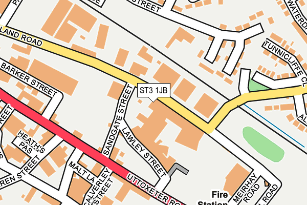
ST3 1JB lies on Sutherland Road in Stoke-on-trent. ST3 1JB is located in the Longton & Meir Hay South electoral ward, within the unitary authority of Stoke-on-Trent and the English Parliamentary constituency of Stoke-on-Trent South. The Sub Integrated Care Board (ICB) Location is NHS Staffordshire and Stoke-on-Trent ICB - 05W and the police force is Staffordshire. This postcode has been in use since January 1980.


GetTheData
Source: OS OpenMap – Local (Ordnance Survey)
Source: OS VectorMap District (Ordnance Survey)
Licence: Open Government Licence (requires attribution)
| Easting | 391796 |
| Northing | 343106 |
| Latitude | 52.985245 |
| Longitude | -2.123649 |
GetTheData
Source: Open Postcode Geo
Licence: Open Government Licence
| Street | Sutherland Road |
| Town/City | Stoke-on-trent |
| Country | England |
| Postcode District | ST3 |
➜ See where ST3 is on a map ➜ Where is Stoke-on-Trent? | |
GetTheData
Source: Land Registry Price Paid Data
Licence: Open Government Licence
Elevation or altitude of ST3 1JB as distance above sea level:
| Metres | Feet | |
|---|---|---|
| Elevation | 160m | 525ft |
Elevation is measured from the approximate centre of the postcode, to the nearest point on an OS contour line from OS Terrain 50, which has contour spacing of ten vertical metres.
➜ How high above sea level am I? Find the elevation of your current position using your device's GPS.
GetTheData
Source: Open Postcode Elevation
Licence: Open Government Licence
| Ward | Longton & Meir Hay South |
| Constituency | Stoke-on-trent South |
GetTheData
Source: ONS Postcode Database
Licence: Open Government Licence
| Sutherland Road (Weston Coyney Road) | Meir Hay | 125m |
| Sutherland Road (Weston Coyney Road) | Meir Hay | 137m |
| Calverley Street (Uttoxeter Road) | Normacot | 156m |
| Sutherland Road | Longton | 179m |
| Longton Fire Station (Uttoxeter Road) | Normacot | 198m |
| Longton Station | 1km |
| Blythe Bridge Station | 4.3km |
| Stoke-on-Trent Station | 4.6km |
GetTheData
Source: NaPTAN
Licence: Open Government Licence
GetTheData
Source: ONS Postcode Database
Licence: Open Government Licence


➜ Get more ratings from the Food Standards Agency
GetTheData
Source: Food Standards Agency
Licence: FSA terms & conditions
| Last Collection | |||
|---|---|---|---|
| Location | Mon-Fri | Sat | Distance |
| Normacot Post Office | 17:00 | 12:00 | 534m |
| Gladstone Pottery | 14:45 | 567m | |
| Lilleshall Street | 16:00 | 11:00 | 612m |
GetTheData
Source: Dracos
Licence: Creative Commons Attribution-ShareAlike
The below table lists the International Territorial Level (ITL) codes (formerly Nomenclature of Territorial Units for Statistics (NUTS) codes) and Local Administrative Units (LAU) codes for ST3 1JB:
| ITL 1 Code | Name |
|---|---|
| TLG | West Midlands (England) |
| ITL 2 Code | Name |
| TLG2 | Shropshire and Staffordshire |
| ITL 3 Code | Name |
| TLG23 | Stoke-on-Trent |
| LAU 1 Code | Name |
| E06000021 | Stoke-on-Trent |
GetTheData
Source: ONS Postcode Directory
Licence: Open Government Licence
The below table lists the Census Output Area (OA), Lower Layer Super Output Area (LSOA), and Middle Layer Super Output Area (MSOA) for ST3 1JB:
| Code | Name | |
|---|---|---|
| OA | E00072218 | |
| LSOA | E01014302 | Stoke-on-Trent 022D |
| MSOA | E02002972 | Stoke-on-Trent 022 |
GetTheData
Source: ONS Postcode Directory
Licence: Open Government Licence
| ST3 1QN | Uttoxeter Road | 136m |
| ST3 1QQ | Uttoxeter Road | 159m |
| ST3 1QH | Uttoxeter Road | 176m |
| ST3 1HN | Kendrick Street | 197m |
| ST3 1HZ | Sutherland Road | 219m |
| ST3 5HU | Weston Coyney Road | 242m |
| ST3 5LF | Weston Coyney Road | 249m |
| ST3 1QU | Bell Avenue | 256m |
| ST3 1QD | Warren Street | 269m |
| ST3 1LS | Honiton Walk | 270m |
GetTheData
Source: Open Postcode Geo; Land Registry Price Paid Data
Licence: Open Government Licence