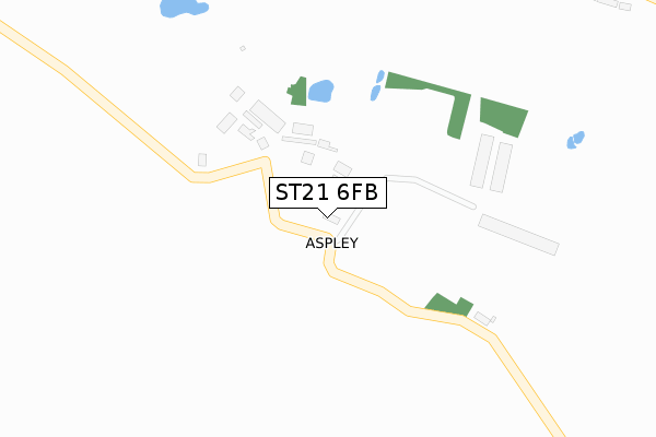
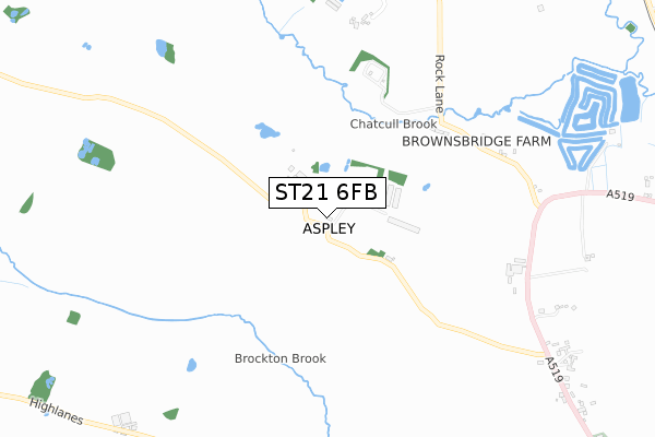
ST21 6FB is located in the Eccleshall electoral ward, within the local authority district of Stafford and the English Parliamentary constituency of Stone. The Sub Integrated Care Board (ICB) Location is NHS Staffordshire and Stoke-on-Trent ICB - 05V and the police force is Staffordshire. This postcode has been in use since January 2019.


GetTheData
Source: OS Open Zoomstack (Ordnance Survey)
Licence: Open Government Licence (requires attribution)
Attribution: Contains OS data © Crown copyright and database right 2025
Source: Open Postcode Geo
Licence: Open Government Licence (requires attribution)
Attribution: Contains OS data © Crown copyright and database right 2025; Contains Royal Mail data © Royal Mail copyright and database right 2025; Source: Office for National Statistics licensed under the Open Government Licence v.3.0
| Easting | 381718 |
| Northing | 333045 |
| Latitude | 52.894553 |
| Longitude | -2.273191 |
GetTheData
Source: Open Postcode Geo
Licence: Open Government Licence
| Country | England |
| Postcode District | ST21 |
➜ See where ST21 is on a map ➜ Where is Aspley? | |
GetTheData
Source: Land Registry Price Paid Data
Licence: Open Government Licence
| Ward | Eccleshall |
| Constituency | Stone |
GetTheData
Source: ONS Postcode Database
Licence: Open Government Licence
| Old Post Office (Newcastle Rd) | Slindon | 1,199m |
| Old Post Office (Newcastle Road) | Slindon | 1,242m |
GetTheData
Source: NaPTAN
Licence: Open Government Licence
| Percentage of properties with Next Generation Access | 100.0% |
| Percentage of properties with Superfast Broadband | 100.0% |
| Percentage of properties with Ultrafast Broadband | 100.0% |
| Percentage of properties with Full Fibre Broadband | 100.0% |
Superfast Broadband is between 30Mbps and 300Mbps
Ultrafast Broadband is > 300Mbps
| Median download speed | 7.4Mbps |
| Average download speed | 8.9Mbps |
| Maximum download speed | 12.87Mbps |
| Median upload speed | 0.9Mbps |
| Average upload speed | 0.8Mbps |
| Maximum upload speed | 1.07Mbps |
| Percentage of properties unable to receive 2Mbps | 0.0% |
| Percentage of properties unable to receive 5Mbps | 0.0% |
| Percentage of properties unable to receive 10Mbps | 0.0% |
| Percentage of properties unable to receive 30Mbps | 0.0% |
GetTheData
Source: Ofcom
Licence: Ofcom Terms of Use (requires attribution)
GetTheData
Source: ONS Postcode Database
Licence: Open Government Licence


➜ Get more ratings from the Food Standards Agency
GetTheData
Source: Food Standards Agency
Licence: FSA terms & conditions
| Last Collection | |||
|---|---|---|---|
| Location | Mon-Fri | Sat | Distance |
| Raleigh Hall | 16:20 | 09:00 | 2,960m |
| Copmere End | 15:00 | 07:00 | 3,868m |
| High Street | 14:55 | 07:00 | 4,073m |
GetTheData
Source: Dracos
Licence: Creative Commons Attribution-ShareAlike
The below table lists the International Territorial Level (ITL) codes (formerly Nomenclature of Territorial Units for Statistics (NUTS) codes) and Local Administrative Units (LAU) codes for ST21 6FB:
| ITL 1 Code | Name |
|---|---|
| TLG | West Midlands (England) |
| ITL 2 Code | Name |
| TLG2 | Shropshire and Staffordshire |
| ITL 3 Code | Name |
| TLG24 | Staffordshire CC |
| LAU 1 Code | Name |
| E07000197 | Stafford |
GetTheData
Source: ONS Postcode Directory
Licence: Open Government Licence
The below table lists the Census Output Area (OA), Lower Layer Super Output Area (LSOA), and Middle Layer Super Output Area (MSOA) for ST21 6FB:
| Code | Name | |
|---|---|---|
| OA | E00151321 | |
| LSOA | E01029697 | Stafford 005C |
| MSOA | E02006192 | Stafford 005 |
GetTheData
Source: ONS Postcode Directory
Licence: Open Government Licence
| ST21 6QR | Browns Bridge | 548m |
| ST21 6QP | 796m | |
| ST21 6LX | 1155m | |
| ST21 6LY | Brockton | 1222m |
| ST21 6QE | Aspley Lane | 1580m |
| ST21 6QT | 1750m | |
| ST21 6QZ | 1871m | |
| ST21 6QB | Highlanes | 1885m |
| ST21 6QU | Waterworks Cottages | 1899m |
| ST21 6RN | 1958m |
GetTheData
Source: Open Postcode Geo; Land Registry Price Paid Data
Licence: Open Government Licence