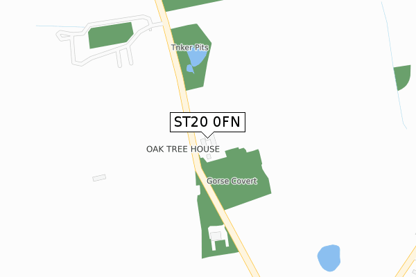
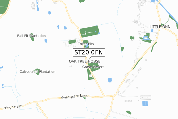
ST20 0FN is located in the Seighford & Church Eaton electoral ward, within the local authority district of Stafford and the English Parliamentary constituency of Stone. The Sub Integrated Care Board (ICB) Location is NHS Staffordshire and Stoke-on-Trent ICB - 05V and the police force is Staffordshire. This postcode has been in use since March 2019.


GetTheData
Source: OS Open Zoomstack (Ordnance Survey)
Licence: Open Government Licence (requires attribution)
Attribution: Contains OS data © Crown copyright and database right 2025
Source: Open Postcode Geo
Licence: Open Government Licence (requires attribution)
Attribution: Contains OS data © Crown copyright and database right 2025; Contains Royal Mail data © Royal Mail copyright and database right 2025; Source: Office for National Statistics licensed under the Open Government Licence v.3.0
| Easting | 383230 |
| Northing | 315333 |
| Latitude | 52.735382 |
| Longitude | -2.249800 |
GetTheData
Source: Open Postcode Geo
Licence: Open Government Licence
| Country | England |
| Postcode District | ST20 |
➜ See where ST20 is on a map | |
GetTheData
Source: Land Registry Price Paid Data
Licence: Open Government Licence
| Ward | Seighford & Church Eaton |
| Constituency | Stone |
GetTheData
Source: ONS Postcode Database
Licence: Open Government Licence
| The Gables (Little Onn Road) | Little Onn | 674m |
| The Gables (Little Onn Road) | Little Onn | 677m |
| Badgers Barn (High Onn Road) | High Onn | 940m |
| Gay Lane (Marston Road) | Marston | 1,458m |
| Gay Lane (Marston Road) | Marston | 1,485m |
GetTheData
Source: NaPTAN
Licence: Open Government Licence
| Percentage of properties with Next Generation Access | 100.0% |
| Percentage of properties with Superfast Broadband | 100.0% |
| Percentage of properties with Ultrafast Broadband | 0.0% |
| Percentage of properties with Full Fibre Broadband | 0.0% |
Superfast Broadband is between 30Mbps and 300Mbps
Ultrafast Broadband is > 300Mbps
| Percentage of properties unable to receive 2Mbps | 0.0% |
| Percentage of properties unable to receive 5Mbps | 0.0% |
| Percentage of properties unable to receive 10Mbps | 0.0% |
| Percentage of properties unable to receive 30Mbps | 0.0% |
GetTheData
Source: Ofcom
Licence: Ofcom Terms of Use (requires attribution)
GetTheData
Source: ONS Postcode Database
Licence: Open Government Licence
➜ Get more ratings from the Food Standards Agency
GetTheData
Source: Food Standards Agency
Licence: FSA terms & conditions
| Last Collection | |||
|---|---|---|---|
| Location | Mon-Fri | Sat | Distance |
| Brineton | 10:30 | 10:30 | 2,851m |
| Blymhill Post Office | 11:00 | 11:00 | 3,765m |
| Allimore Green | 16:00 | 08:00 | 4,366m |
GetTheData
Source: Dracos
Licence: Creative Commons Attribution-ShareAlike
The below table lists the International Territorial Level (ITL) codes (formerly Nomenclature of Territorial Units for Statistics (NUTS) codes) and Local Administrative Units (LAU) codes for ST20 0FN:
| ITL 1 Code | Name |
|---|---|
| TLG | West Midlands (England) |
| ITL 2 Code | Name |
| TLG2 | Shropshire and Staffordshire |
| ITL 3 Code | Name |
| TLG24 | Staffordshire CC |
| LAU 1 Code | Name |
| E07000197 | Stafford |
GetTheData
Source: ONS Postcode Directory
Licence: Open Government Licence
The below table lists the Census Output Area (OA), Lower Layer Super Output Area (LSOA), and Middle Layer Super Output Area (MSOA) for ST20 0FN:
| Code | Name | |
|---|---|---|
| OA | E00151271 | |
| LSOA | E01029688 | Stafford 015A |
| MSOA | E02006202 | Stafford 015 |
GetTheData
Source: ONS Postcode Directory
Licence: Open Government Licence
| ST20 0AU | 762m | |
| ST20 0AX | High Onn | 1071m |
| ST20 0AS | Marston | 1242m |
| ST20 0AB | 2118m | |
| ST20 0BA | The Oaklands | 2286m |
| ST20 0AY | Little Onn Road | 2293m |
| ST20 0AH | Parkers Close | 2358m |
| ST20 0AJ | 2397m | |
| ST20 0AZ | Malthouse Lane | 2413m |
| ST20 0AQ | Oak Close | 2448m |
GetTheData
Source: Open Postcode Geo; Land Registry Price Paid Data
Licence: Open Government Licence