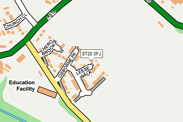
ST20 0FJ is located in the Gnosall & Woodseaves electoral ward, within the local authority district of Stafford and the English Parliamentary constituency of Stone. The Sub Integrated Care Board (ICB) Location is NHS Staffordshire and Stoke-on-Trent ICB - 05V and the police force is Staffordshire. This postcode has been in use since June 2017.


GetTheData
Source: OS OpenMap – Local (Ordnance Survey)
Source: OS VectorMap District (Ordnance Survey)
Licence: Open Government Licence (requires attribution)
| Easting | 379597 |
| Northing | 322519 |
| Latitude | 52.799855 |
| Longitude | -2.304055 |
GetTheData
Source: Open Postcode Geo
Licence: Open Government Licence
| Country | England |
| Postcode District | ST20 |
➜ See where ST20 is on a map | |
GetTheData
Source: Land Registry Price Paid Data
Licence: Open Government Licence
| Ward | Gnosall & Woodseaves |
| Constituency | Stone |
GetTheData
Source: ONS Postcode Database
Licence: Open Government Licence
| Junction Inn Ph (Main Rd) | Norbury Junction | 471m |
| Junction Inn (Main Road) | Norbury Junction | 480m |
| Norbury Village Hall (Spring Leasows) | Norbury | 1,706m |
| Norbury Village Hall (Spring Leasows) | Norbury | 1,717m |
GetTheData
Source: NaPTAN
Licence: Open Government Licence
GetTheData
Source: ONS Postcode Database
Licence: Open Government Licence


➜ Get more ratings from the Food Standards Agency
GetTheData
Source: Food Standards Agency
Licence: FSA terms & conditions
| Last Collection | |||
|---|---|---|---|
| Location | Mon-Fri | Sat | Distance |
| Woodseaves Post Office | 16:30 | 10:45 | 2,907m |
| Gnosall Post Office | 16:45 | 11:15 | 3,673m |
| High Street | 17:15 | 09:00 | 3,745m |
GetTheData
Source: Dracos
Licence: Creative Commons Attribution-ShareAlike
| Risk of ST20 0FJ flooding from rivers and sea | Medium |
| ➜ ST20 0FJ flood map | |
GetTheData
Source: Open Flood Risk by Postcode
Licence: Open Government Licence
The below table lists the International Territorial Level (ITL) codes (formerly Nomenclature of Territorial Units for Statistics (NUTS) codes) and Local Administrative Units (LAU) codes for ST20 0FJ:
| ITL 1 Code | Name |
|---|---|
| TLG | West Midlands (England) |
| ITL 2 Code | Name |
| TLG2 | Shropshire and Staffordshire |
| ITL 3 Code | Name |
| TLG24 | Staffordshire CC |
| LAU 1 Code | Name |
| E07000197 | Stafford |
GetTheData
Source: ONS Postcode Directory
Licence: Open Government Licence
The below table lists the Census Output Area (OA), Lower Layer Super Output Area (LSOA), and Middle Layer Super Output Area (MSOA) for ST20 0FJ:
| Code | Name | |
|---|---|---|
| OA | E00151380 | |
| LSOA | E01029708 | Stafford 015D |
| MSOA | E02006202 | Stafford 015 |
GetTheData
Source: ONS Postcode Directory
Licence: Open Government Licence
| ST20 0PN | 405m | |
| ST20 0RL | Manor Drive | 626m |
| ST20 0NL | Oulton Lane | 966m |
| ST20 0PL | 1163m | |
| ST20 0PE | High Meadow | 1201m |
| ST20 0PW | 1244m | |
| ST20 0PD | High Meadow | 1266m |
| ST20 0PG | 1298m | |
| ST20 0EG | Radmore Lane | 1371m |
| ST20 0PQ | St Peters Court | 1519m |
GetTheData
Source: Open Postcode Geo; Land Registry Price Paid Data
Licence: Open Government Licence