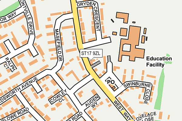
ST17 9ZL is located in the Highfields & Western Downs electoral ward, within the local authority district of Stafford and the English Parliamentary constituency of Stafford. The Sub Integrated Care Board (ICB) Location is NHS Staffordshire and Stoke-on-Trent ICB - 05V and the police force is Staffordshire. This postcode has been in use since February 2017.


GetTheData
Source: OS OpenMap – Local (Ordnance Survey)
Source: OS VectorMap District (Ordnance Survey)
Licence: Open Government Licence (requires attribution)
| Easting | 391137 |
| Northing | 321985 |
| Latitude | 52.795370 |
| Longitude | -2.132879 |
GetTheData
Source: Open Postcode Geo
Licence: Open Government Licence
| Country | England |
| Postcode District | ST17 |
➜ See where ST17 is on a map ➜ Where is Stafford? | |
GetTheData
Source: Land Registry Price Paid Data
Licence: Open Government Licence
| Ward | Highfields & Western Downs |
| Constituency | Stafford |
GetTheData
Source: ONS Postcode Database
Licence: Open Government Licence
| Dryden Crescent (West Way) | Highfields | 24m |
| Cowley Close (Shakespeare Road) | Highfields | 81m |
| Masefield Drive (West Way) | Highfields | 123m |
| Cowley Close (Wordsworth Avenue) | Highfields | 141m |
| Lovelace Close (West Way) | Highfields | 277m |
| Stafford Station | 1.2km |
GetTheData
Source: NaPTAN
Licence: Open Government Licence
| Percentage of properties with Next Generation Access | 100.0% |
| Percentage of properties with Superfast Broadband | 100.0% |
| Percentage of properties with Ultrafast Broadband | 0.0% |
| Percentage of properties with Full Fibre Broadband | 0.0% |
Superfast Broadband is between 30Mbps and 300Mbps
Ultrafast Broadband is > 300Mbps
| Median download speed | 39.1Mbps |
| Average download speed | 27.8Mbps |
| Maximum download speed | 54.64Mbps |
| Median upload speed | 7.2Mbps |
| Average upload speed | 7.0Mbps |
| Maximum upload speed | 19.98Mbps |
| Percentage of properties unable to receive 2Mbps | 0.0% |
| Percentage of properties unable to receive 5Mbps | 0.0% |
| Percentage of properties unable to receive 10Mbps | 0.0% |
| Percentage of properties unable to receive 30Mbps | 0.0% |
GetTheData
Source: Ofcom
Licence: Ofcom Terms of Use (requires attribution)
GetTheData
Source: ONS Postcode Database
Licence: Open Government Licence


➜ Get more ratings from the Food Standards Agency
GetTheData
Source: Food Standards Agency
Licence: FSA terms & conditions
| Last Collection | |||
|---|---|---|---|
| Location | Mon-Fri | Sat | Distance |
| Border Way | 17:45 | 10:45 | 609m |
| Castle Bank | 17:30 | 10:45 | 709m |
| Castlefields | 19:30 | 12:00 | 924m |
GetTheData
Source: Dracos
Licence: Creative Commons Attribution-ShareAlike
The below table lists the International Territorial Level (ITL) codes (formerly Nomenclature of Territorial Units for Statistics (NUTS) codes) and Local Administrative Units (LAU) codes for ST17 9ZL:
| ITL 1 Code | Name |
|---|---|
| TLG | West Midlands (England) |
| ITL 2 Code | Name |
| TLG2 | Shropshire and Staffordshire |
| ITL 3 Code | Name |
| TLG24 | Staffordshire CC |
| LAU 1 Code | Name |
| E07000197 | Stafford |
GetTheData
Source: ONS Postcode Directory
Licence: Open Government Licence
The below table lists the Census Output Area (OA), Lower Layer Super Output Area (LSOA), and Middle Layer Super Output Area (MSOA) for ST17 9ZL:
| Code | Name | |
|---|---|---|
| OA | E00151522 | |
| LSOA | E01029737 | Stafford 012C |
| MSOA | E02006199 | Stafford 012 |
GetTheData
Source: ONS Postcode Directory
Licence: Open Government Licence
| ST17 9UU | West Way | 47m |
| ST17 9UP | West Way Green | 61m |
| ST17 9YF | West Way | 96m |
| ST17 9YG | West Way | 127m |
| ST17 9UR | Masefield Drive | 130m |
| ST17 9YH | Dryden Crescent | 143m |
| ST17 9TX | Auden Way | 148m |
| ST17 9UB | Wordsworth Avenue | 158m |
| ST17 9UX | West Way | 158m |
| ST17 9TZ | Wordsworth Avenue | 163m |
GetTheData
Source: Open Postcode Geo; Land Registry Price Paid Data
Licence: Open Government Licence