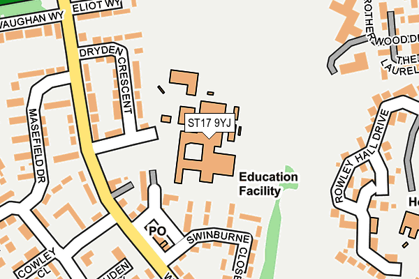
ST17 9YJ is located in the Highfields & Western Downs electoral ward, within the local authority district of Stafford and the English Parliamentary constituency of Stafford. The Sub Integrated Care Board (ICB) Location is NHS Staffordshire and Stoke-on-Trent ICB - 05V and the police force is Staffordshire. This postcode has been in use since January 1980.


GetTheData
Source: OS OpenMap – Local (Ordnance Survey)
Source: OS VectorMap District (Ordnance Survey)
Licence: Open Government Licence (requires attribution)
| Easting | 391277 |
| Northing | 322045 |
| Latitude | 52.795896 |
| Longitude | -2.130808 |
GetTheData
Source: Open Postcode Geo
Licence: Open Government Licence
| Country | England |
| Postcode District | ST17 |
➜ See where ST17 is on a map ➜ Where is Stafford? | |
GetTheData
Source: Land Registry Price Paid Data
Licence: Open Government Licence
Elevation or altitude of ST17 9YJ as distance above sea level:
| Metres | Feet | |
|---|---|---|
| Elevation | 90m | 295ft |
Elevation is measured from the approximate centre of the postcode, to the nearest point on an OS contour line from OS Terrain 50, which has contour spacing of ten vertical metres.
➜ How high above sea level am I? Find the elevation of your current position using your device's GPS.
GetTheData
Source: Open Postcode Elevation
Licence: Open Government Licence
| Ward | Highfields & Western Downs |
| Constituency | Stafford |
GetTheData
Source: ONS Postcode Database
Licence: Open Government Licence
| Dryden Crescent (West Way) | Highfields | 166m |
| Masefield Drive (West Way) | Highfields | 201m |
| Cowley Close (Shakespeare Road) | Highfields | 222m |
| Cowley Close (Wordsworth Avenue) | Highfields | 267m |
| Oakbrook Close (Newport Road) | Stafford | 281m |
| Stafford Station | 1.1km |
GetTheData
Source: NaPTAN
Licence: Open Government Licence
GetTheData
Source: ONS Postcode Database
Licence: Open Government Licence


➜ Get more ratings from the Food Standards Agency
GetTheData
Source: Food Standards Agency
Licence: FSA terms & conditions
| Last Collection | |||
|---|---|---|---|
| Location | Mon-Fri | Sat | Distance |
| Border Way | 17:45 | 10:45 | 476m |
| Castlefields | 19:30 | 12:00 | 795m |
| Castle Bank | 17:30 | 10:45 | 850m |
GetTheData
Source: Dracos
Licence: Creative Commons Attribution-ShareAlike
The below table lists the International Territorial Level (ITL) codes (formerly Nomenclature of Territorial Units for Statistics (NUTS) codes) and Local Administrative Units (LAU) codes for ST17 9YJ:
| ITL 1 Code | Name |
|---|---|
| TLG | West Midlands (England) |
| ITL 2 Code | Name |
| TLG2 | Shropshire and Staffordshire |
| ITL 3 Code | Name |
| TLG24 | Staffordshire CC |
| LAU 1 Code | Name |
| E07000197 | Stafford |
GetTheData
Source: ONS Postcode Directory
Licence: Open Government Licence
The below table lists the Census Output Area (OA), Lower Layer Super Output Area (LSOA), and Middle Layer Super Output Area (MSOA) for ST17 9YJ:
| Code | Name | |
|---|---|---|
| OA | E00151517 | |
| LSOA | E01029737 | Stafford 012C |
| MSOA | E02006199 | Stafford 012 |
GetTheData
Source: ONS Postcode Directory
Licence: Open Government Licence
| ST17 9YE | Swinburne Close | 150m |
| ST17 9YF | West Way | 157m |
| ST17 9YH | Dryden Crescent | 158m |
| ST17 9YG | West Way | 183m |
| ST17 9UU | West Way | 191m |
| ST17 9UP | West Way Green | 208m |
| ST17 9YD | West Way | 220m |
| ST17 9UX | West Way | 221m |
| ST17 9AH | Rowley Hall Close | 230m |
| ST17 9YL | Eliot Way | 232m |
GetTheData
Source: Open Postcode Geo; Land Registry Price Paid Data
Licence: Open Government Licence