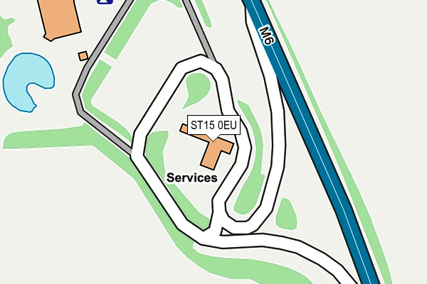
ST15 0EU is located in the Eccleshall electoral ward, within the local authority district of Stafford and the English Parliamentary constituency of Stone. The Sub Integrated Care Board (ICB) Location is NHS Staffordshire and Stoke-on-Trent ICB - 05V and the police force is Staffordshire. This postcode has been in use since July 1995.


GetTheData
Source: OS OpenMap – Local (Ordnance Survey)
Source: OS VectorMap District (Ordnance Survey)
Licence: Open Government Licence (requires attribution)
| Easting | 388622 |
| Northing | 331895 |
| Latitude | 52.884392 |
| Longitude | -2.170530 |
GetTheData
Source: Open Postcode Geo
Licence: Open Government Licence
| Country | England |
| Postcode District | ST15 |
➜ See where ST15 is on a map | |
GetTheData
Source: Land Registry Price Paid Data
Licence: Open Government Licence
Elevation or altitude of ST15 0EU as distance above sea level:
| Metres | Feet | |
|---|---|---|
| Elevation | 120m | 394ft |
Elevation is measured from the approximate centre of the postcode, to the nearest point on an OS contour line from OS Terrain 50, which has contour spacing of ten vertical metres.
➜ How high above sea level am I? Find the elevation of your current position using your device's GPS.
GetTheData
Source: Open Postcode Elevation
Licence: Open Government Licence
| Ward | Eccleshall |
| Constituency | Stone |
GetTheData
Source: ONS Postcode Database
Licence: Open Government Licence
| Dutton Way (Redfern Rd) | Walton | 1,072m |
| Common Lane (Meadow Way) | Walton | 1,290m |
| Capula (Beacon Road) | Walton | 1,453m |
| Pirehill Lane (Meadow Way) | Walton | 1,455m |
| Capula (Beacon Road) | Walton | 1,455m |
| Norton Bridge Station | 2.4km |
| Stone Station | 2.9km |
GetTheData
Source: NaPTAN
Licence: Open Government Licence
GetTheData
Source: ONS Postcode Database
Licence: Open Government Licence


➜ Get more ratings from the Food Standards Agency
GetTheData
Source: Food Standards Agency
Licence: FSA terms & conditions
| Last Collection | |||
|---|---|---|---|
| Location | Mon-Fri | Sat | Distance |
| Eccleshall Road | 17:30 | 09:45 | 1,754m |
| Walton Old Post Office | 17:30 | 09:15 | 2,021m |
| Grove Road | 17:30 | 09:15 | 2,037m |
GetTheData
Source: Dracos
Licence: Creative Commons Attribution-ShareAlike
The below table lists the International Territorial Level (ITL) codes (formerly Nomenclature of Territorial Units for Statistics (NUTS) codes) and Local Administrative Units (LAU) codes for ST15 0EU:
| ITL 1 Code | Name |
|---|---|
| TLG | West Midlands (England) |
| ITL 2 Code | Name |
| TLG2 | Shropshire and Staffordshire |
| ITL 3 Code | Name |
| TLG24 | Staffordshire CC |
| LAU 1 Code | Name |
| E07000197 | Stafford |
GetTheData
Source: ONS Postcode Directory
Licence: Open Government Licence
The below table lists the Census Output Area (OA), Lower Layer Super Output Area (LSOA), and Middle Layer Super Output Area (MSOA) for ST15 0EU:
| Code | Name | |
|---|---|---|
| OA | E00151307 | |
| LSOA | E01029695 | Stafford 005A |
| MSOA | E02006192 | Stafford 005 |
GetTheData
Source: ONS Postcode Directory
Licence: Open Government Licence
| ST15 0BZ | Eccleshall Road | 655m |
| ST15 0BY | Eccleshall Road | 763m |
| ST15 0BF | Lakesedge | 839m |
| ST15 0LD | Windsor Close | 1009m |
| ST15 0XS | Spode Close | 1034m |
| ST15 0LB | Essex Drive | 1044m |
| ST15 0XR | Wedgwood Avenue | 1064m |
| ST15 0LE | Dutton Way | 1069m |
| ST15 0XU | Coalport Drive | 1097m |
| ST15 0XT | Doulton Close | 1107m |
GetTheData
Source: Open Postcode Geo; Land Registry Price Paid Data
Licence: Open Government Licence