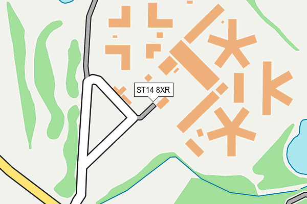
ST14 8XR is located in the Crown electoral ward, within the local authority district of East Staffordshire and the English Parliamentary constituency of Burton. The Sub Integrated Care Board (ICB) Location is NHS Staffordshire and Stoke-on-Trent ICB - 05D and the police force is Staffordshire. This postcode has been in use since December 1999.


GetTheData
Source: OS OpenMap – Local (Ordnance Survey)
Source: OS VectorMap District (Ordnance Survey)
Licence: Open Government Licence (requires attribution)
| Easting | 414696 |
| Northing | 330528 |
| Latitude | 52.872046 |
| Longitude | -1.783109 |
GetTheData
Source: Open Postcode Geo
Licence: Open Government Licence
| Country | England |
| Postcode District | ST14 |
➜ See where ST14 is on a map | |
GetTheData
Source: Land Registry Price Paid Data
Licence: Open Government Licence
Elevation or altitude of ST14 8XR as distance above sea level:
| Metres | Feet | |
|---|---|---|
| Elevation | 70m | 230ft |
Elevation is measured from the approximate centre of the postcode, to the nearest point on an OS contour line from OS Terrain 50, which has contour spacing of ten vertical metres.
➜ How high above sea level am I? Find the elevation of your current position using your device's GPS.
GetTheData
Source: Open Postcode Elevation
Licence: Open Government Licence
| Ward | Crown |
| Constituency | Burton |
GetTheData
Source: ONS Postcode Database
Licence: Open Government Licence
| Dovegate Prison (Moreton Lane) | Moreton | 140m |
| Bulls Head Ph (Bag Lane) | Marchington | 1,437m |
| Bulls Head Ph (Bag Lane) | Marchington | 1,455m |
| Woodedge Lane (Stubby Lane) | Marchington Cliff | 1,541m |
| Woodedge Lane (Stubby Lane) | Marchington Cliff | 1,551m |
| Uttoxeter Station | 5.7km |
GetTheData
Source: NaPTAN
Licence: Open Government Licence
GetTheData
Source: ONS Postcode Database
Licence: Open Government Licence


➜ Get more ratings from the Food Standards Agency
GetTheData
Source: Food Standards Agency
Licence: FSA terms & conditions
| Last Collection | |||
|---|---|---|---|
| Location | Mon-Fri | Sat | Distance |
| Deep Cut Lane | 16:00 | 10:30 | 1,465m |
| Tobys Hill | 16:00 | 10:30 | 1,519m |
| Sudbury Station | 16:00 | 09:00 | 1,554m |
GetTheData
Source: Dracos
Licence: Creative Commons Attribution-ShareAlike
The below table lists the International Territorial Level (ITL) codes (formerly Nomenclature of Territorial Units for Statistics (NUTS) codes) and Local Administrative Units (LAU) codes for ST14 8XR:
| ITL 1 Code | Name |
|---|---|
| TLG | West Midlands (England) |
| ITL 2 Code | Name |
| TLG2 | Shropshire and Staffordshire |
| ITL 3 Code | Name |
| TLG24 | Staffordshire CC |
| LAU 1 Code | Name |
| E07000193 | East Staffordshire |
GetTheData
Source: ONS Postcode Directory
Licence: Open Government Licence
The below table lists the Census Output Area (OA), Lower Layer Super Output Area (LSOA), and Middle Layer Super Output Area (MSOA) for ST14 8XR:
| Code | Name | |
|---|---|---|
| OA | E00168365 | |
| LSOA | E01029425 | East Staffordshire 006D |
| MSOA | E02006136 | East Staffordshire 006 |
GetTheData
Source: ONS Postcode Directory
Licence: Open Government Licence
| ST14 8LN | Hound Hill | 501m |
| DE6 5BZ | Moreton Lane | 843m |
| ST14 8NQ | Church Close | 1018m |
| ST14 8LL | Silver Lane | 1062m |
| ST14 8LJ | Church Lane | 1089m |
| ST14 8LH | 1259m | |
| ST14 8LF | The Square | 1310m |
| DE6 5BW | Deepcut Road | 1336m |
| ST14 8LD | High Street | 1360m |
| ST14 8LU | Corsham Place | 1375m |
GetTheData
Source: Open Postcode Geo; Land Registry Price Paid Data
Licence: Open Government Licence