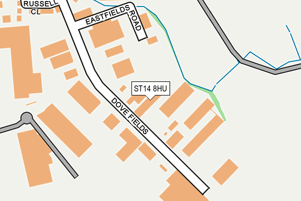
ST14 8HU lies on Dovefields in Dovefields Industrial Estate, Uttoxeter. ST14 8HU is located in the Town electoral ward, within the local authority district of East Staffordshire and the English Parliamentary constituency of Burton. The Sub Integrated Care Board (ICB) Location is NHS Staffordshire and Stoke-on-Trent ICB - 05D and the police force is Staffordshire. This postcode has been in use since June 1996.


GetTheData
Source: OS OpenMap – Local (Ordnance Survey)
Source: OS VectorMap District (Ordnance Survey)
Licence: Open Government Licence (requires attribution)
| Easting | 409882 |
| Northing | 333624 |
| Latitude | 52.899986 |
| Longitude | -1.854536 |
GetTheData
Source: Open Postcode Geo
Licence: Open Government Licence
| Street | Dovefields |
| Locality | Dovefields Industrial Estate |
| Town/City | Uttoxeter |
| Country | England |
| Postcode District | ST14 |
➜ See where ST14 is on a map ➜ Where is Uttoxeter? | |
GetTheData
Source: Land Registry Price Paid Data
Licence: Open Government Licence
Elevation or altitude of ST14 8HU as distance above sea level:
| Metres | Feet | |
|---|---|---|
| Elevation | 80m | 262ft |
Elevation is measured from the approximate centre of the postcode, to the nearest point on an OS contour line from OS Terrain 50, which has contour spacing of ten vertical metres.
➜ How high above sea level am I? Find the elevation of your current position using your device's GPS.
GetTheData
Source: Open Postcode Elevation
Licence: Open Government Licence
| Ward | Town |
| Constituency | Burton |
GetTheData
Source: ONS Postcode Database
Licence: Open Government Licence
| Tesco Store (Town Meadows Way) | Uttoxeter Town Centre | 266m |
| St Catherines Close (Derby Road) | Uttoxeter Town Centre | 375m |
| St Catherines Close (Derby Road) | Uttoxeter | 393m |
| Railway Station (Station Road) | Uttoxeter | 455m |
| Thomas Alleynes High School (Dove Bank (S)) | Uttoxeter Town Centre | 491m |
| Uttoxeter Station | 0.4km |
GetTheData
Source: NaPTAN
Licence: Open Government Licence
| Median download speed | 20.4Mbps |
| Average download speed | 22.9Mbps |
| Maximum download speed | 39.99Mbps |
| Median upload speed | 3.1Mbps |
| Average upload speed | 3.4Mbps |
| Maximum upload speed | 7.19Mbps |
GetTheData
Source: Ofcom
Licence: Ofcom Terms of Use (requires attribution)
GetTheData
Source: ONS Postcode Database
Licence: Open Government Licence


➜ Get more ratings from the Food Standards Agency
GetTheData
Source: Food Standards Agency
Licence: FSA terms & conditions
| Last Collection | |||
|---|---|---|---|
| Location | Mon-Fri | Sat | Distance |
| Uttoxeter Post Office | 18:15 | 12:15 | 812m |
| Park Crescent | 16:00 | 08:00 | 1,811m |
| Upwards Road | 16:30 | 10:45 | 1,960m |
GetTheData
Source: Dracos
Licence: Creative Commons Attribution-ShareAlike
The below table lists the International Territorial Level (ITL) codes (formerly Nomenclature of Territorial Units for Statistics (NUTS) codes) and Local Administrative Units (LAU) codes for ST14 8HU:
| ITL 1 Code | Name |
|---|---|
| TLG | West Midlands (England) |
| ITL 2 Code | Name |
| TLG2 | Shropshire and Staffordshire |
| ITL 3 Code | Name |
| TLG24 | Staffordshire CC |
| LAU 1 Code | Name |
| E07000193 | East Staffordshire |
GetTheData
Source: ONS Postcode Directory
Licence: Open Government Licence
The below table lists the Census Output Area (OA), Lower Layer Super Output Area (LSOA), and Middle Layer Super Output Area (MSOA) for ST14 8HU:
| Code | Name | |
|---|---|---|
| OA | E00168364 | |
| LSOA | E01029461 | East Staffordshire 003C |
| MSOA | E02006133 | East Staffordshire 003 |
GetTheData
Source: ONS Postcode Directory
Licence: Open Government Licence
| ST14 8HZ | Russell Close | 302m |
| ST14 8EH | Dove Walk | 311m |
| ST14 8EF | St Catherines Close | 358m |
| ST14 8EA | Derby Road | 378m |
| ST14 8EB | Derby Road | 401m |
| ST14 8ES | Town Meadows Way | 433m |
| ST14 8AJ | Roebuck Close | 454m |
| ST14 8ET | Chamberlain Close | 470m |
| ST14 8DZ | Dove Bank | 471m |
| ST14 8XG | Wilsford Avenue | 471m |
GetTheData
Source: Open Postcode Geo; Land Registry Price Paid Data
Licence: Open Government Licence