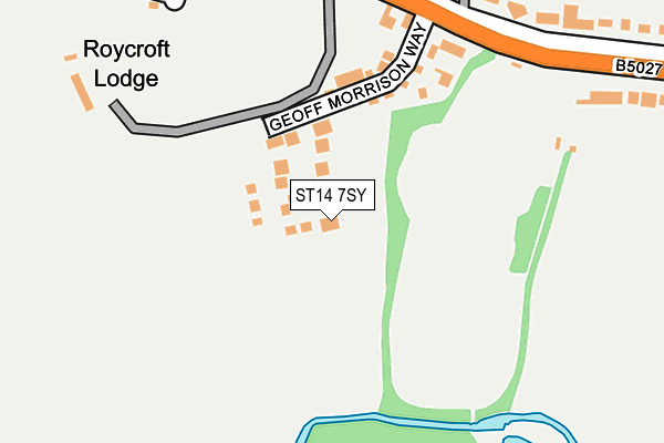
ST14 7SY is located in the Heath electoral ward, within the local authority district of East Staffordshire and the English Parliamentary constituency of Burton. The Sub Integrated Care Board (ICB) Location is NHS Staffordshire and Stoke-on-Trent ICB - 05D and the police force is Staffordshire. This postcode has been in use since May 2017.


GetTheData
Source: OS OpenMap – Local (Ordnance Survey)
Source: OS VectorMap District (Ordnance Survey)
Licence: Open Government Licence (requires attribution)
| Easting | 407949 |
| Northing | 333491 |
| Latitude | 52.898822 |
| Longitude | -1.883275 |
GetTheData
Source: Open Postcode Geo
Licence: Open Government Licence
| Country | England |
| Postcode District | ST14 |
➜ See where ST14 is on a map ➜ Where is Uttoxeter? | |
GetTheData
Source: Land Registry Price Paid Data
Licence: Open Government Licence
| Ward | Heath |
| Constituency | Burton |
GetTheData
Source: ONS Postcode Database
Licence: Open Government Licence
2022 3 NOV £455,000 |
2020 17 JAN £495,000 |
8, ORCHID CLOSE, UTTOXETER, ST14 7SY 2019 18 OCT £482,500 |
10, ORCHID CLOSE, UTTOXETER, ST14 7SY 2018 30 NOV £480,000 |
12, ORCHID CLOSE, UTTOXETER, ST14 7SY 2018 9 NOV £477,500 |
3, ORCHID CLOSE, UTTOXETER, ST14 7SY 2018 29 JUN £470,000 |
6, ORCHID CLOSE, UTTOXETER, ST14 7SY 2018 7 JUN £475,000 |
2018 23 MAR £470,000 |
2, ORCHID CLOSE, UTTOXETER, ST14 7SY 2018 23 FEB £345,000 |
5, ORCHID CLOSE, UTTOXETER, ST14 7SY 2018 23 FEB £475,000 |
GetTheData
Source: HM Land Registry Price Paid Data
Licence: Contains HM Land Registry data © Crown copyright and database right 2024. This data is licensed under the Open Government Licence v3.0.
| Stone Road (Holly Road) | The Heath | 415m |
| Oldfields Hall School (Stone Road) | The Heath | 457m |
| Hawthornden Avenue (Holly Road) | The Heath | 480m |
| Bentley Road (Byrds Lane) | The Heath | 487m |
| Pennycroft Road (Byrds Lane) | The Heath | 493m |
| Uttoxeter Station | 1.8km |
GetTheData
Source: NaPTAN
Licence: Open Government Licence
| Percentage of properties with Next Generation Access | 100.0% |
| Percentage of properties with Superfast Broadband | 100.0% |
| Percentage of properties with Ultrafast Broadband | 0.0% |
| Percentage of properties with Full Fibre Broadband | 0.0% |
Superfast Broadband is between 30Mbps and 300Mbps
Ultrafast Broadband is > 300Mbps
| Median download speed | 18.4Mbps |
| Average download speed | 17.0Mbps |
| Maximum download speed | 20.33Mbps |
| Median upload speed | 1.2Mbps |
| Average upload speed | 1.1Mbps |
| Maximum upload speed | 1.26Mbps |
| Percentage of properties unable to receive 2Mbps | 0.0% |
| Percentage of properties unable to receive 5Mbps | 0.0% |
| Percentage of properties unable to receive 10Mbps | 0.0% |
| Percentage of properties unable to receive 30Mbps | 0.0% |
GetTheData
Source: Ofcom
Licence: Ofcom Terms of Use (requires attribution)
GetTheData
Source: ONS Postcode Database
Licence: Open Government Licence


➜ Get more ratings from the Food Standards Agency
GetTheData
Source: Food Standards Agency
Licence: FSA terms & conditions
| Last Collection | |||
|---|---|---|---|
| Location | Mon-Fri | Sat | Distance |
| Copes Way | 17:00 | 07:30 | 854m |
| Uttoxeter Post Office | 18:15 | 12:15 | 1,152m |
| Park Crescent | 16:00 | 08:00 | 3,719m |
GetTheData
Source: Dracos
Licence: Creative Commons Attribution-ShareAlike
The below table lists the International Territorial Level (ITL) codes (formerly Nomenclature of Territorial Units for Statistics (NUTS) codes) and Local Administrative Units (LAU) codes for ST14 7SY:
| ITL 1 Code | Name |
|---|---|
| TLG | West Midlands (England) |
| ITL 2 Code | Name |
| TLG2 | Shropshire and Staffordshire |
| ITL 3 Code | Name |
| TLG24 | Staffordshire CC |
| LAU 1 Code | Name |
| E07000193 | East Staffordshire |
GetTheData
Source: ONS Postcode Directory
Licence: Open Government Licence
The below table lists the Census Output Area (OA), Lower Layer Super Output Area (LSOA), and Middle Layer Super Output Area (MSOA) for ST14 7SY:
| Code | Name | |
|---|---|---|
| OA | E00149947 | |
| LSOA | E01029430 | East Staffordshire 002A |
| MSOA | E02006132 | East Staffordshire 002 |
GetTheData
Source: ONS Postcode Directory
Licence: Open Government Licence
| ST14 7PF | Bramshall Road | 250m |
| ST14 7PG | Bramshall Road | 262m |
| ST14 7PH | Hawthornden Manor | 314m |
| ST14 7PE | Hawthornden Close | 338m |
| ST14 7PB | Hawthornden Gardens | 341m |
| ST14 7SG | Hawthornden Manor Drive | 367m |
| ST14 7NL | Pine Walk | 379m |
| ST14 7PD | Hawthornden Avenue | 395m |
| ST14 7NY | Holly Road | 407m |
| ST14 7PA | Hawthornden Avenue | 413m |
GetTheData
Source: Open Postcode Geo; Land Registry Price Paid Data
Licence: Open Government Licence