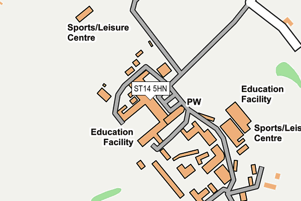
ST14 5HN is located in the Stramshall & Weaver electoral ward, within the local authority district of East Staffordshire and the English Parliamentary constituency of Burton. The Sub Integrated Care Board (ICB) Location is NHS Staffordshire and Stoke-on-Trent ICB - 05D and the police force is Staffordshire. This postcode has been in use since January 1980.


GetTheData
Source: OS OpenMap – Local (Ordnance Survey)
Source: OS VectorMap District (Ordnance Survey)
Licence: Open Government Licence (requires attribution)
| Easting | 408963 |
| Northing | 340283 |
| Latitude | 52.959844 |
| Longitude | -1.868019 |
GetTheData
Source: Open Postcode Geo
Licence: Open Government Licence
| Country | England |
| Postcode District | ST14 |
➜ See where ST14 is on a map ➜ Where is Denstone? | |
GetTheData
Source: Land Registry Price Paid Data
Licence: Open Government Licence
Elevation or altitude of ST14 5HN as distance above sea level:
| Metres | Feet | |
|---|---|---|
| Elevation | 140m | 459ft |
Elevation is measured from the approximate centre of the postcode, to the nearest point on an OS contour line from OS Terrain 50, which has contour spacing of ten vertical metres.
➜ How high above sea level am I? Find the elevation of your current position using your device's GPS.
GetTheData
Source: Open Postcode Elevation
Licence: Open Government Licence
| Ward | Stramshall & Weaver |
| Constituency | Burton |
GetTheData
Source: ONS Postcode Database
Licence: Open Government Licence
| Taylors Lane (Stubwood Lane) | Stubwood | 748m |
| Taylors Lane (Stubwood Lane) | Stubwood | 761m |
| Mowbrays (Denstone Lane) | Rocester | 932m |
| Mowbrays (Denstone Lane) | Rocester | 957m |
| Marlpit Lane (Denstone Lane) | Denstone | 988m |
GetTheData
Source: NaPTAN
Licence: Open Government Licence
GetTheData
Source: ONS Postcode Database
Licence: Open Government Licence


➜ Get more ratings from the Food Standards Agency
GetTheData
Source: Food Standards Agency
Licence: FSA terms & conditions
| Last Collection | |||
|---|---|---|---|
| Location | Mon-Fri | Sat | Distance |
| Ellaston Post Office | 16:45 | 10:00 | 3,736m |
| Alton Towers | 17:00 | 08:00 | 3,839m |
| Norbury | 16:45 | 09:00 | 4,064m |
GetTheData
Source: Dracos
Licence: Creative Commons Attribution-ShareAlike
The below table lists the International Territorial Level (ITL) codes (formerly Nomenclature of Territorial Units for Statistics (NUTS) codes) and Local Administrative Units (LAU) codes for ST14 5HN:
| ITL 1 Code | Name |
|---|---|
| TLG | West Midlands (England) |
| ITL 2 Code | Name |
| TLG2 | Shropshire and Staffordshire |
| ITL 3 Code | Name |
| TLG24 | Staffordshire CC |
| LAU 1 Code | Name |
| E07000193 | East Staffordshire |
GetTheData
Source: ONS Postcode Directory
Licence: Open Government Licence
The below table lists the Census Output Area (OA), Lower Layer Super Output Area (LSOA), and Middle Layer Super Output Area (MSOA) for ST14 5HN:
| Code | Name | |
|---|---|---|
| OA | E00149910 | |
| LSOA | E01029422 | East Staffordshire 001C |
| MSOA | E02006131 | East Staffordshire 001 |
GetTheData
Source: ONS Postcode Directory
Licence: Open Government Licence
| ST14 5JJ | 336m | |
| ST14 5DR | Narrow Lane | 776m |
| ST14 5HU | Stubwood Lane | 778m |
| ST14 5PN | Linden Close | 812m |
| ST14 5HJ | Croftstead Avenue | 837m |
| ST14 5HX | Taylors Lane | 844m |
| ST14 5HS | The Westlands | 848m |
| ST14 5DP | The Weavers | 874m |
| ST14 5HH | Marlpit Lane | 892m |
| ST14 5HR | College Road | 926m |
GetTheData
Source: Open Postcode Geo; Land Registry Price Paid Data
Licence: Open Government Licence