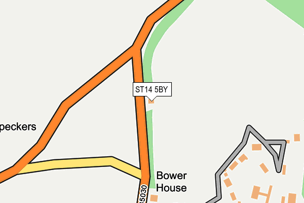
ST14 5BY is in Doveleys, Uttoxeter. ST14 5BY is located in the Stramshall & Weaver electoral ward, within the local authority district of East Staffordshire and the English Parliamentary constituency of Burton. The Sub Integrated Care Board (ICB) Location is NHS Staffordshire and Stoke-on-Trent ICB - 05D and the police force is Staffordshire. This postcode has been in use since January 1980.


GetTheData
Source: OS OpenMap – Local (Ordnance Survey)
Source: OS VectorMap District (Ordnance Survey)
Licence: Open Government Licence (requires attribution)
| Easting | 411033 |
| Northing | 341137 |
| Latitude | 52.967500 |
| Longitude | -1.837172 |
GetTheData
Source: Open Postcode Geo
Licence: Open Government Licence
| Locality | Doveleys |
| Town/City | Uttoxeter |
| Country | England |
| Postcode District | ST14 |
➜ See where ST14 is on a map | |
GetTheData
Source: Land Registry Price Paid Data
Licence: Open Government Licence
Elevation or altitude of ST14 5BY as distance above sea level:
| Metres | Feet | |
|---|---|---|
| Elevation | 120m | 394ft |
Elevation is measured from the approximate centre of the postcode, to the nearest point on an OS contour line from OS Terrain 50, which has contour spacing of ten vertical metres.
➜ How high above sea level am I? Find the elevation of your current position using your device's GPS.
GetTheData
Source: Open Postcode Elevation
Licence: Open Government Licence
| Ward | Stramshall & Weaver |
| Constituency | Burton |
GetTheData
Source: ONS Postcode Database
Licence: Open Government Licence
| Quixhill Lane (Denstone Lane) | Denstone | 934m |
| Hawthorn Close (Main Road) | Denstone | 984m |
| Hawthorn Close (Main Road) | Denstone | 998m |
| Lady Meadow Close (Main Road) | Denstone | 1,071m |
| The Tavern Ph (College Road) | Denstone | 1,081m |
GetTheData
Source: NaPTAN
Licence: Open Government Licence
| Percentage of properties with Next Generation Access | 100.0% |
| Percentage of properties with Superfast Broadband | 0.0% |
| Percentage of properties with Ultrafast Broadband | 0.0% |
| Percentage of properties with Full Fibre Broadband | 0.0% |
Superfast Broadband is between 30Mbps and 300Mbps
Ultrafast Broadband is > 300Mbps
| Percentage of properties unable to receive 2Mbps | 0.0% |
| Percentage of properties unable to receive 5Mbps | 50.0% |
| Percentage of properties unable to receive 10Mbps | 50.0% |
| Percentage of properties unable to receive 30Mbps | 100.0% |
GetTheData
Source: Ofcom
Licence: Ofcom Terms of Use (requires attribution)
GetTheData
Source: ONS Postcode Database
Licence: Open Government Licence


➜ Get more ratings from the Food Standards Agency
GetTheData
Source: Food Standards Agency
Licence: FSA terms & conditions
| Last Collection | |||
|---|---|---|---|
| Location | Mon-Fri | Sat | Distance |
| Ellaston Post Office | 16:45 | 10:00 | 1,724m |
| Norbury | 16:45 | 09:00 | 1,866m |
| Roston | 16:45 | 09:45 | 2,233m |
GetTheData
Source: Dracos
Licence: Creative Commons Attribution-ShareAlike
The below table lists the International Territorial Level (ITL) codes (formerly Nomenclature of Territorial Units for Statistics (NUTS) codes) and Local Administrative Units (LAU) codes for ST14 5BY:
| ITL 1 Code | Name |
|---|---|
| TLG | West Midlands (England) |
| ITL 2 Code | Name |
| TLG2 | Shropshire and Staffordshire |
| ITL 3 Code | Name |
| TLG24 | Staffordshire CC |
| LAU 1 Code | Name |
| E07000193 | East Staffordshire |
GetTheData
Source: ONS Postcode Directory
Licence: Open Government Licence
The below table lists the Census Output Area (OA), Lower Layer Super Output Area (LSOA), and Middle Layer Super Output Area (MSOA) for ST14 5BY:
| Code | Name | |
|---|---|---|
| OA | E00149910 | |
| LSOA | E01029422 | East Staffordshire 001C |
| MSOA | E02006131 | East Staffordshire 001 |
GetTheData
Source: ONS Postcode Directory
Licence: Open Government Licence
| ST14 5BZ | Doveleys Manor Park | 584m |
| ST14 5BX | Barrow Hill | 638m |
| ST14 5DB | Quixhill | 909m |
| ST14 5HD | Elm View | 1004m |
| ST14 5HF | Main Road | 1026m |
| ST14 5HE | 1061m | |
| ST14 5HB | Hawthorn Close | 1069m |
| ST14 5GZ | Frances Close | 1079m |
| ST14 5EZ | Bennion Grove | 1114m |
| ST14 5EY | Lady Meadow Close | 1124m |
GetTheData
Source: Open Postcode Geo; Land Registry Price Paid Data
Licence: Open Government Licence